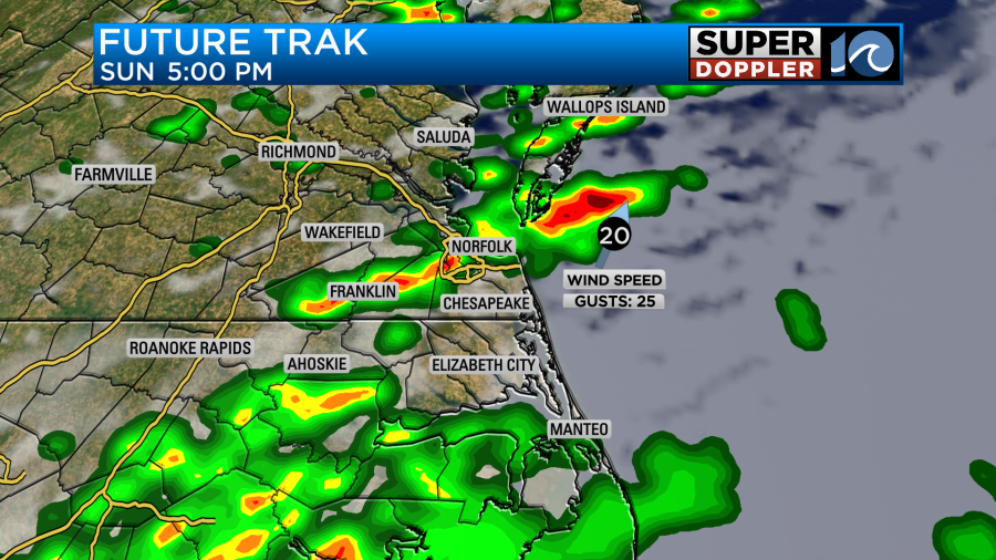
Scattered pop up showers and storms are expected Sunday. Any storm that pops up could produce heavy rainfall, and isolated flooding in spots. We will also expect to see some intense lightning/thunder out of them, so if you hear thunder – it’s time to pack it up and head indoors.
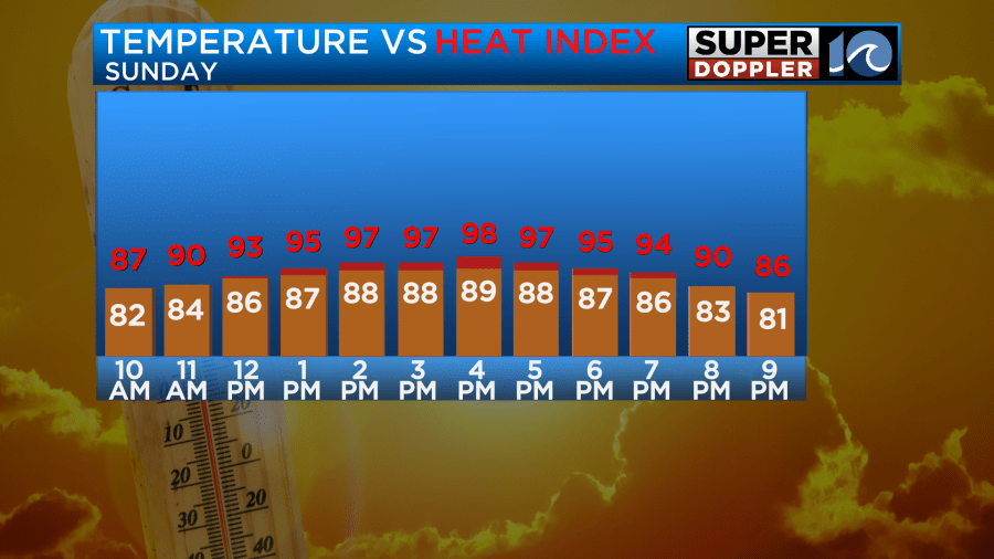
Temperatuers will be in the upper 80s to low 90s, with a heat index around the upper 90s.
Monday features a return to more typical summertime pop up variety rain chances, with partly sunny skies. Highs will once again be near 90, and it’ll feel warmer with heat index values around the upper 90s.
Alright, now to the big topic this week – Debby.
As of Sunday morning, Debby is a tropical storm heading towards the Big Bend area of Florida. The storm is expected to become a hurricane before landfall Monday. From there, things get complicated.
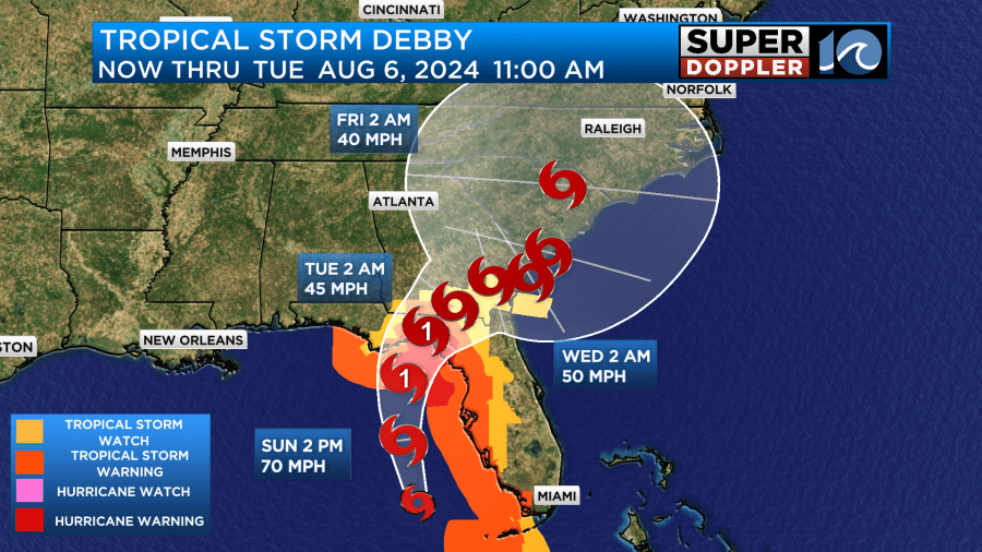
After landfall, the question is will Debby continue north and meander over land, or move back offshore. If it moves back offshore, it could restrengthen. Then, the question is where does it go from there. The general idea is for the system to slow down/stall and then meander back towards the coast through the week. It is likely we will see *some* rain from this system, but the timing of that rain and how much could vary depending on the eventual track.
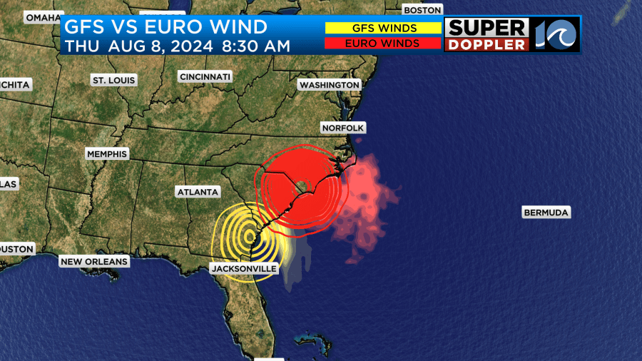
If the system moves back onshore further south, across SC/GA – then rainfall may not reach us until late in the week or even next weekend. If it comes further north, we could see some impacts by late week (Thu/Fri). A bit of moisture from the system could even enhance t-storm chances Wednesday. Notice on the map below, the GFS and the Euro still show some differences, with the Euro further N and the GFS slower and further S.
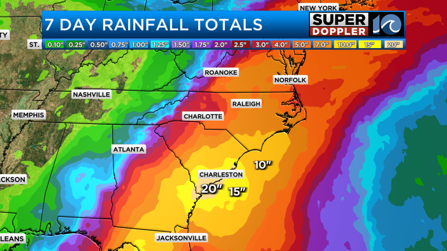
Right now, the bottom line for our region is we just need to keep an eye on it. It doesn’t look like a direct hit, but we could see impacts from rain, and depending on the track – a risk for some spin up tornadoes. These typically happen to the north and east of the center of the storm, so a track west of us would bring that risk. Heavy rain is going to happen with this storm, but the overall amounts and where could change. Here’s the latest 7 day rainfall outlook based on the current NHC track. Yes, that is 15-20″ for parts of SC!
We’ll see how things evolve over the next few days. For now, enjoy your Sunday!
Meteorologist Ricky Matthews
Follow Ricky on Facebook and Twitter


