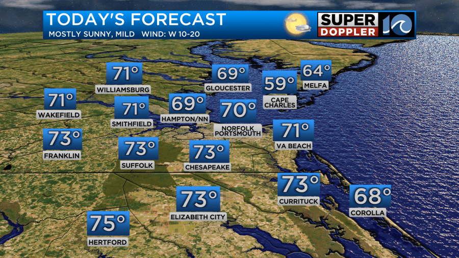
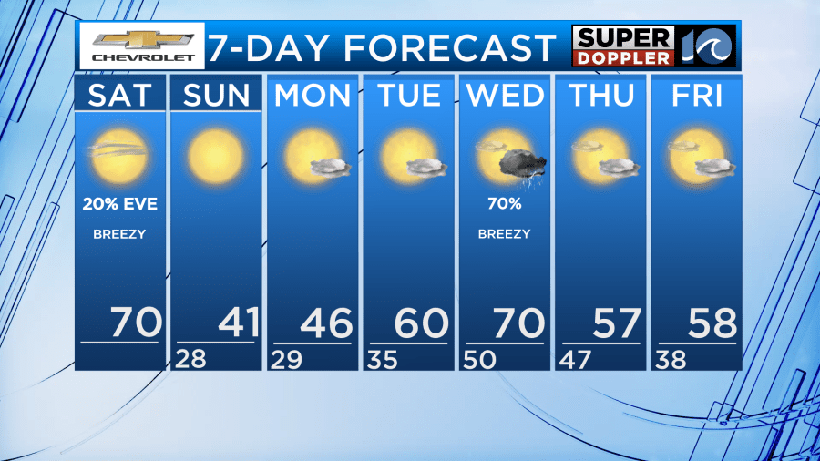
Highs will be in the mid and upper 60s to near 70 on Saturday (cooler on the Eastern Shore) with plenty of sun. Some late-day clouds roll in with an abrupt wind shift around sunset. A shower or two could also pop up.
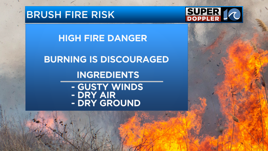
The combination of some breezy SW winds (that’s why it’s warm) and the dry air/low humidity and dry ground will increase the fire danger today. Red Flag Warnings (a forest service alert used to warn of wildfire danger)is in place. Outside burning is discouraged today. Any ember that comes out of a fire may not go out as quickly, or could be carried into dry brush and ignite a new fire. Also, don’t toss your cigarettes out your window today (or any day, really) – as that can also lead to fires in the dry grass along the road.
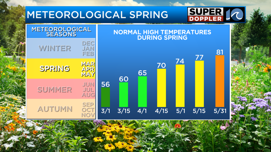
Welcome to meteorological Spring! March 1st begins Meteorological Spring, the time of the year when the temperature starts to rise. The temps of near 70 are more common for mid-April than early March.
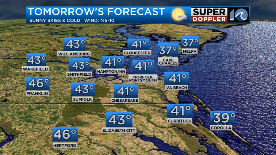
Temperatures will drop quickly through the evening, into the 40s, then plummet into the 20s & 30s overnight as skies clear out overnight. The breeze should continue into early Sunday morning, potentially creating wind chills in the teens to near 20°! Highs on Sunday will struggle to get much higher than the low 40s despite bright sunshine.
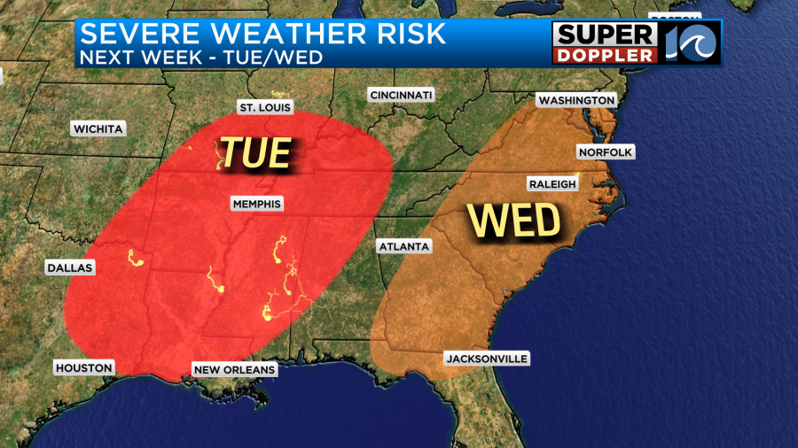
Cold only lasts through Monday, before temperatures climb quickly to near 60° Tuesday, and near 70° Wednesday! We’ll have a chance at some showers and thunderstorms on Wednesday. A few of these storms could be strong/severe, so check back for updates as we get closer. The main question will be how much instability we have on Wednesday. There will be strong winds aloft, so any storm that does manage to get going could tap into those winds aloft and bring strong gusts to the surface.
Hope you have a great weekend!
Meteorologist Ricky Matthews
Follow Ricky on Facebook and Twitter


