There was some good news that was expected this morning, but it was nice to finally arrive… Tropical storm Imelda had finally turned to the northeast as of the 5am update. The models all suggested this would happen as well as the forecast. However, it was a bit unnerving until she finally changed direction. At the same time Imelda had strengthened to a high-end tropical storm. It had then been declared a hurricane by the 8AM update.
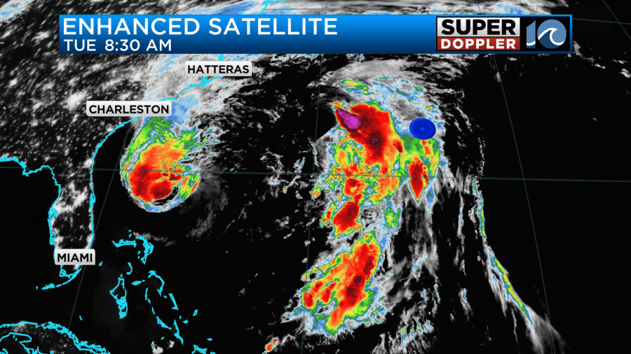
Meanwhile, hurricane Humberto has weakened over the last 24 hours. It definitely degraded on the enhanced satellite.
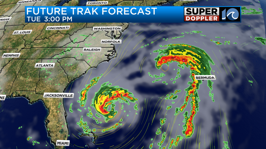
Today Imelda will continue on an east/northeast track. It will definitely move away from the U.S. coast. In a couple of days it could possibly hit Bermuda as a hurricane.

The system will then move over the north Atlantic and become post-tropical. Meanwhile, hurricane Humberto is forecast to dance around the island of Bermuda.
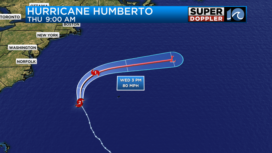
While the worst of the storm will miss the island, they will still have some impacts there from that storm. These include large waves, and some strong winds.
We will have some minor impacts here from these systems, but rain will not be one of them. Today we do have lots of moisture still pushing up into the region. This is pressing north/northwest of a stationary front.
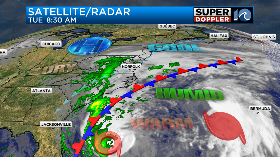
We’ll only have some spotty sprinkles and showers for the first half of the day. In the afternoon we’ll be mostly cloudy.
We’ll have a little drier air move in later today, but some much drier air will slide into the area over the next 2-3 days.
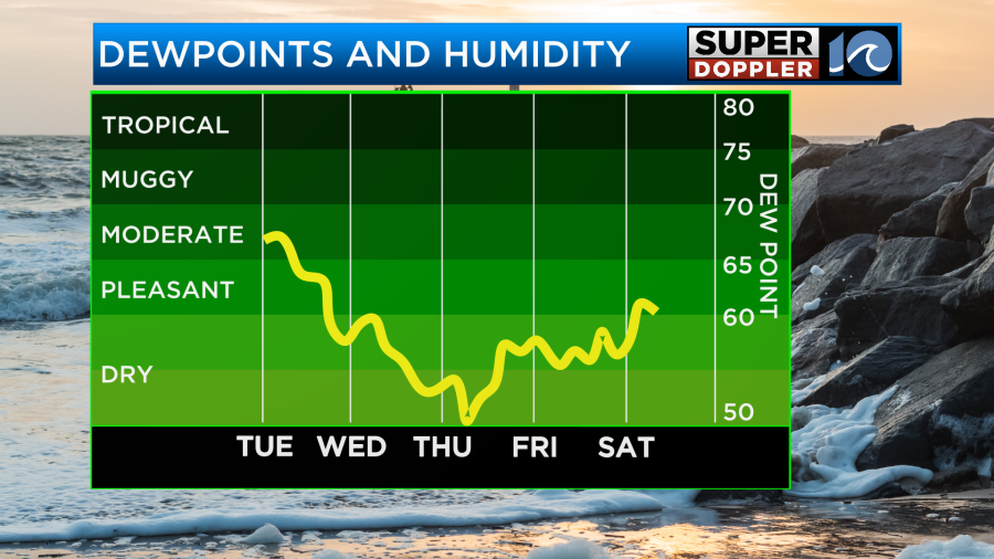
So there won’t be any rain from tomorrow through the weekend. In fact…we’ll have a good amount of sunshine.
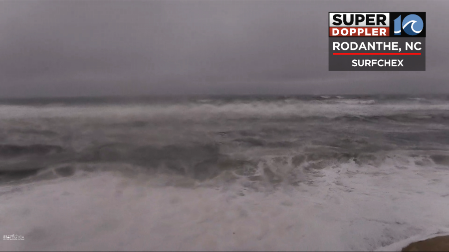
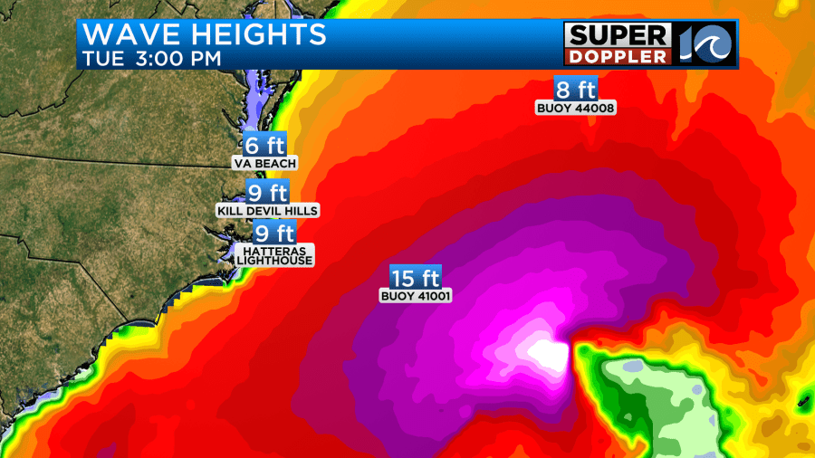
Having said that… (I love ellipses). We are going to have some sizable waves/swells along the oceanfront. This morning the surf was already very rough along the Outer Banks. Check out this camera from Surfchex.com.
The waves will be up to 5-7 feet later today around Virginia Beach. They will be possibly up to 10ft near the shore along the Outer Banks.
These waves will decrease a little over the Outer Banks tomorrow, but they will still be up a bit in Virginia Beach.
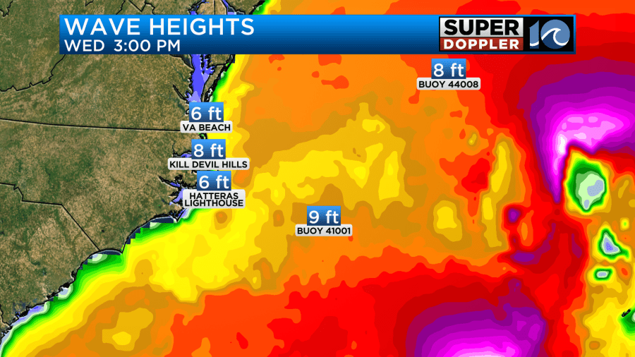
These waves could lead to some ocean overwash along highway 12. It is possible later today. It will be more likely late Wednesday.
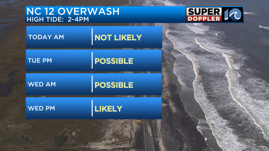
That is because the tide will be highest Wednesday afternoon and evening.
I don’t know why I saved the winds for last. It’s just the way this flowed today. Anyway, winds will gust up to 25mph today with some higher gusts along the shore.
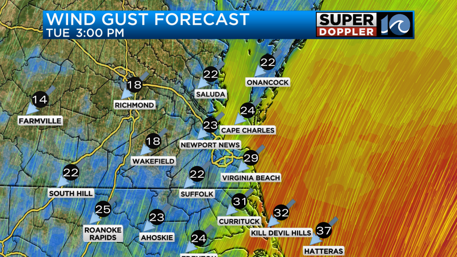
However, by this evening winds will be gusting up to around 30mph with possible gusts to 35mph along the Outer Banks. These types of winds will continue into tomorrow.

They should taper off late in the day. Then it will just be a little breezy on Thursday. Again, the weather should be pretty nice later this week. It will be cool on Thursday and Friday with highs in the upper 60s to near 70 degrees. Lows will be in the 50s. Can’t wait.
Stay tuned for updates.
Meteorologist: Jeremy Wheeler


