Get ready for a mess. This morning we had heavy rain, strong winds, and some tidal flooding. The rain actually started last night, but it became heavy along the coast this morning.
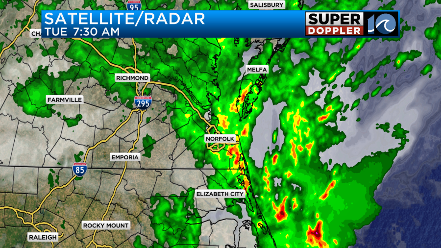
There were also a few thunderstorms coming in off of the ocean as well. As predicted an area of low pressure is coming in off of the ocean, and it is moving to the northwest.
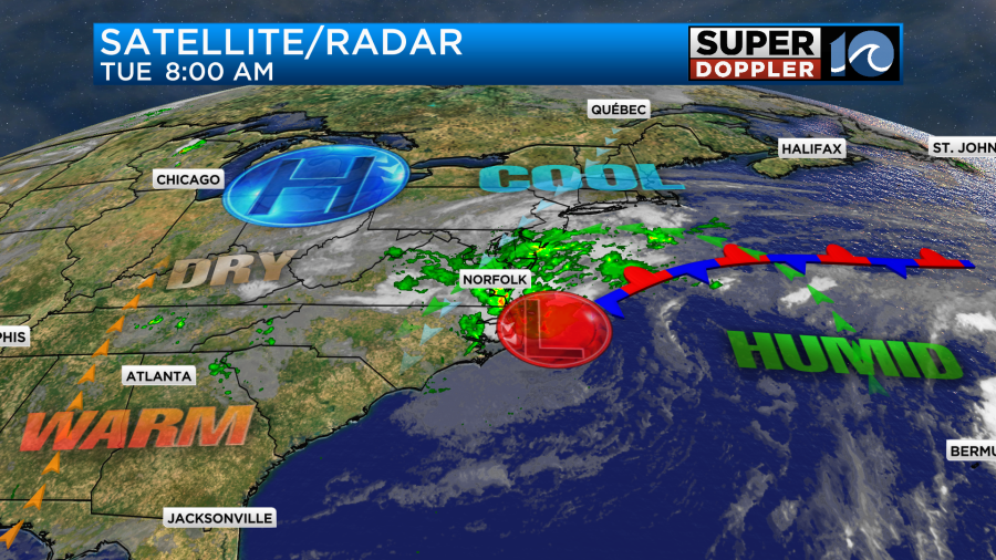
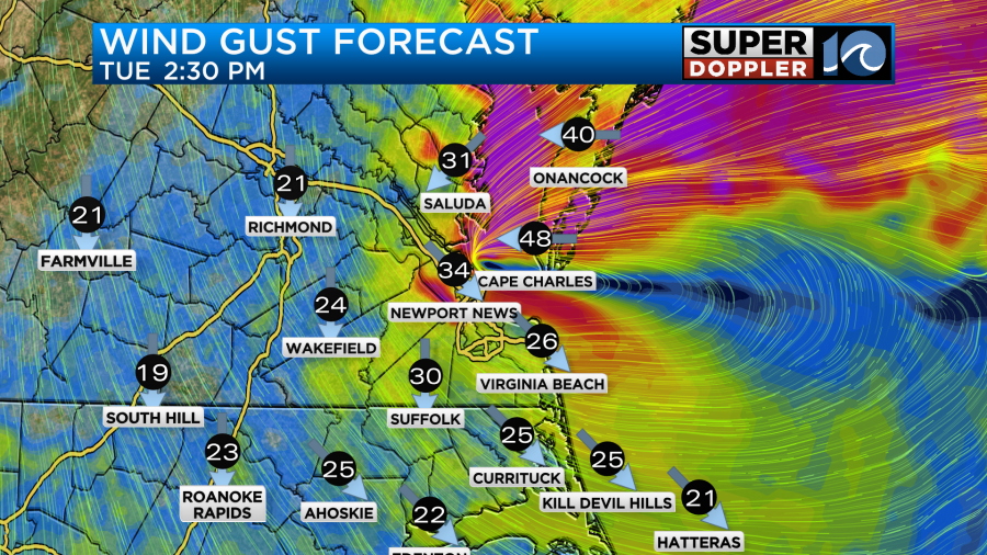
The low is not tropical, but it is wrapped up in a lot of moisture. It’s also interacting with the high pressure to the northwest. Hence the winds are stronger than usual considering the low is fairly weak. Winds this morning were gusting to around 40-45mph near the shore.
We’ll have rain and wind throughout the day. Rain will be heavy at times as the low keeps creeping to the northwest.
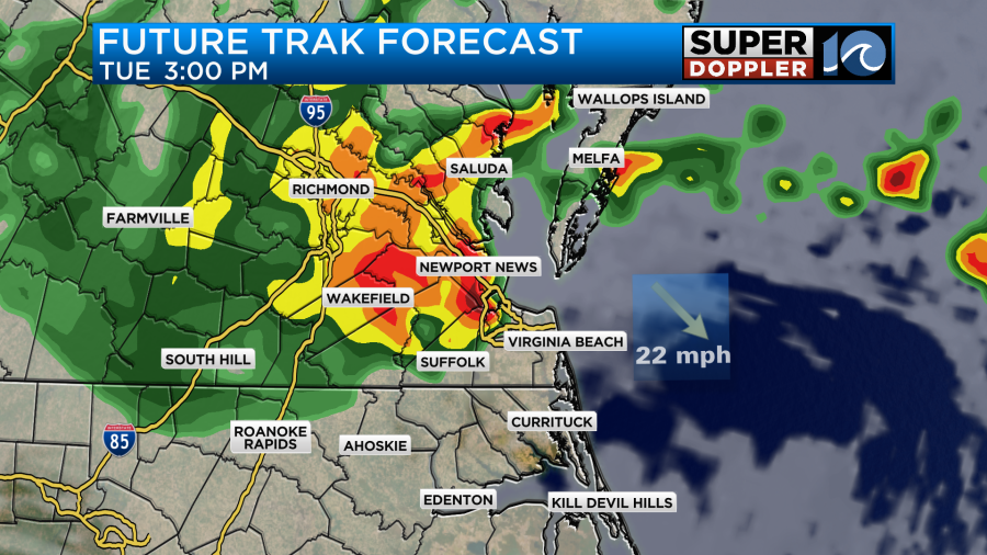
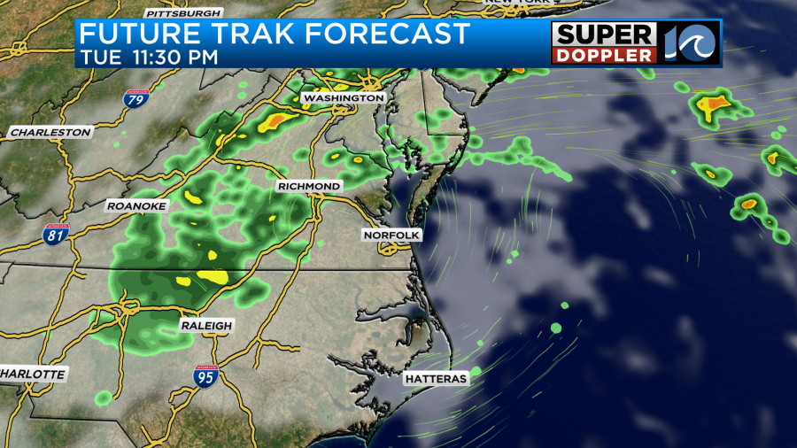
The models are actually having a tough time figuring out exactly where the low is going to go later this afternoon into the evening. The HRRR model has the center still near the coast. However, Future Trak has the center to the west.
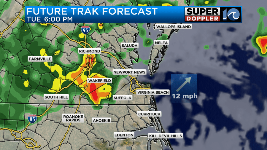
This will make a big difference in where the heaviest rain sets up. That is very important because the next high tide will be around that time, and it will be the highest recent tide. Here is the forecast for Sewell’s Point.
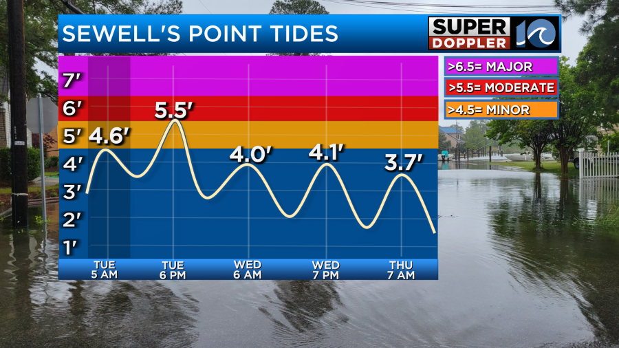
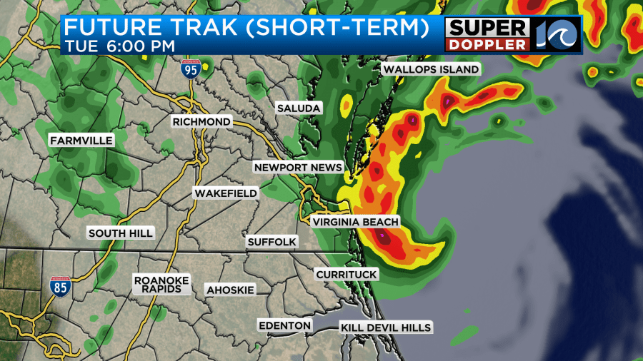
If we get the heavy rain during high tide, then there will be a lot of poor drainage. If our model is right, then hopefully the heaviest rain is more inland. However, I think our model is a little too far to the northwest. In reality the position may be between the two model’s solutions. You can see it’s forecast for the rainfall compared to others.
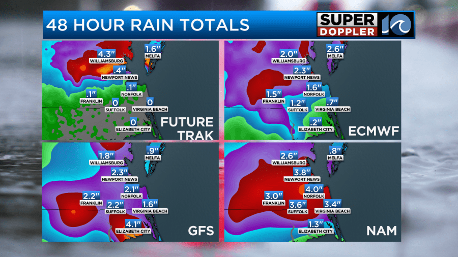
Therefore, I disagree with it’s rainfall forecast. I’m siding with the NAM’s numbers and placement overall. I think we could see a solid 2-5 inches with locally higher amounts in spots. There is a Flood Watch out for most of the region until 2am tonight.
There may be some major tidal flooding up towards Jamestown and Smithfield with moderate tidal flooding in other locations.

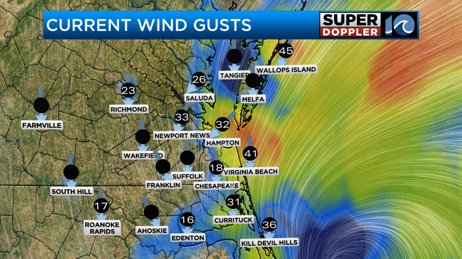
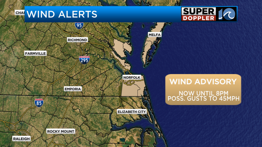
Winds will stay strong though that time. Gusts will be between 35-40mph in the metro. Gusts will be up to 45mph near the shore. They will be about 35-30mph inland.
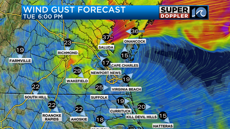
The winds should (theoretically) decrease by the evening as the low moves inland.
Keep in mind if the HRRR is right and the low stays closer to the coast, then the winds may stay up a bit longer.
Either way there is a Wind Advisory out until later this evening.
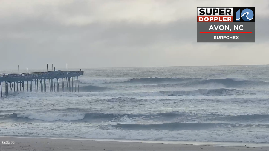
There will probably be some ocean overwash along the Outer Banks this afternoon into the early evening.
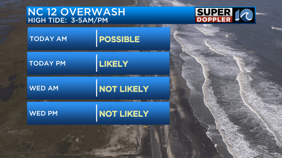
This is due to the higher tide, but also the building waves. They could run up to about 10ft or even a bit higher later today.
High temps will be in the low 70s today.
Overnight the low should move northwest and weaken. Rain showers will taper off, and the winds will drop off.
Then tomorrow the low will become weak and broad. We’ll only have some scattered light showers and drizzle. Winds will be light and out of the west. Highs will be in the low-mid 70s.
We’ll have a mix of sun and clouds on Thursday with only some isolated showers. Highs will be in the upper 70s. We’ll then have nice weather as we go into the weekend. Skies will be partly cloudy. Temps will be in the upper 70s to low 80s.
We are still watching that tropical disturbance in the middle of the Atlantic. It has a high chance of formation as it move to the northwest.
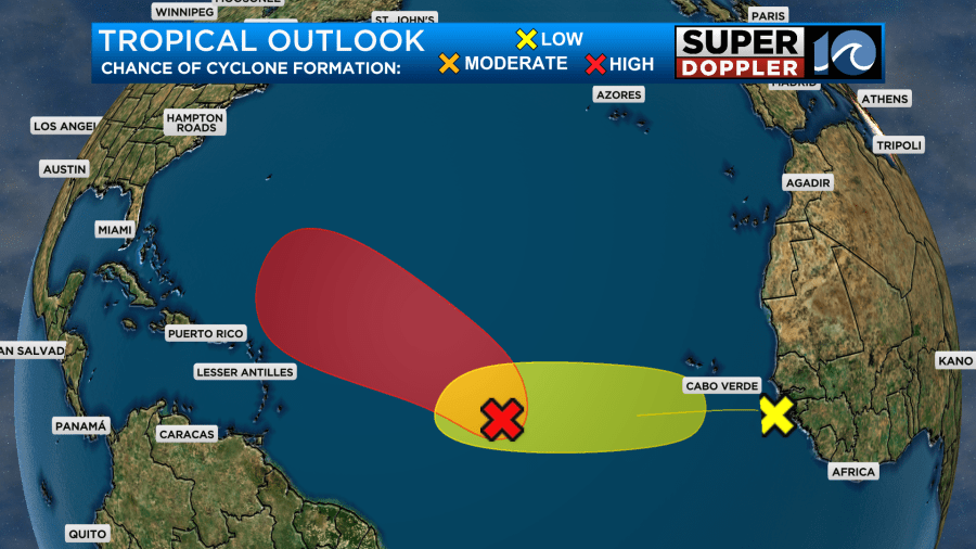
For now the models keep it out to sea. The GFS and Euro have it possibly getting close to Bermuda in about a week. We will still have to watch it over the next couple of days. There is another disturbance in the eastern Atlantic that has a low chance of formation.
The ocean is probably going to stay churned up for a while.
Stay tuned for updates.
Meteorologist: Jeremy Wheeler


