
How about that cool down??? Wow! As expected, we went from a hot couple of days in a row to a longer cool stretch. Take a look at the temps over the last couple of weeks.
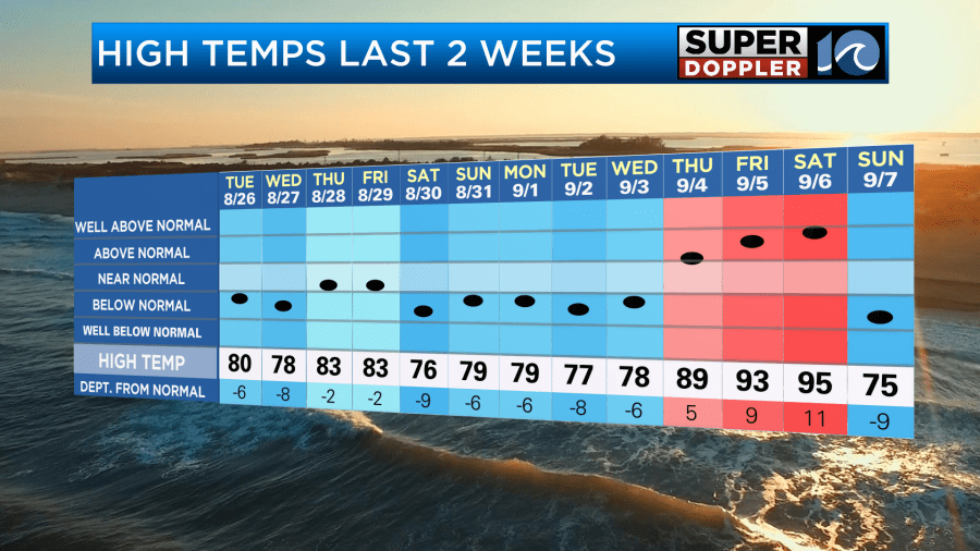
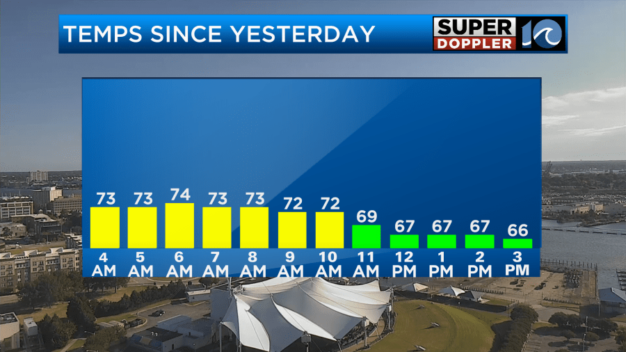
We hit 95 on Saturday which was about 3 degrees shy of the record. However, temps yesterday topped off in the 70s around midnight. Then , we dropped to the 60s yesterday afternoon.
We did get some rain with the cool down. However, some locations just really missed out.
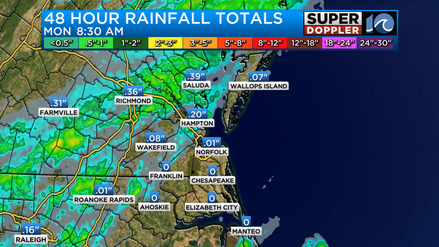
If you go back more than 48 hours, then parts of the Peninsula and Middle Peninsula had some pretty good amounts of rain. I will say that my house on the Southside got totally missed except for a few sprinkles.
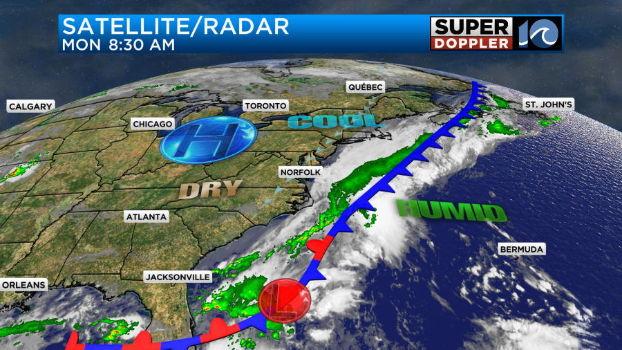
Anyway, now we are in a cooler pattern, and we will stay in that pattern for a while. The cool front is stalling out to our east/southeast. High pressure is building to our northwest.
With this setup we are going to have a cool northeast breeze for a few days. Today the wind will blow out of the northeast at 10-15mph with gusts up to 25mph.
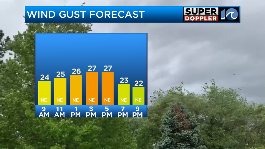
We’ll have a mix of sun and clouds with possibly some more clouds building in by the afternoon. Other than a stray shower or sprinkle we will have a dry day. High temps will be in the mid 70s with some upper 70s inland.
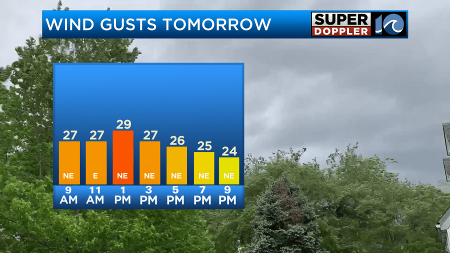
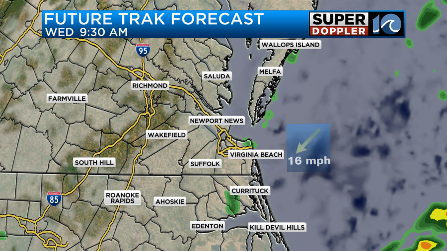
We’ll continue with the northeast breeze tomorrow. A weak area of low pressure will creep northeast along the front (offshore). This will probably enhance the northeast winds, or it will at least keep the breeze as strong as today.
We’ll have increasing clouds with a few spotty showers. Especially to the south.
High temps will be in the mid 70s, but possibly in the low-mid 70s near the shore.
The humidity will be down today and tomorrow, but the offshore low will allow for some more moisture to slide west between late Tuesday and Wednesday night.
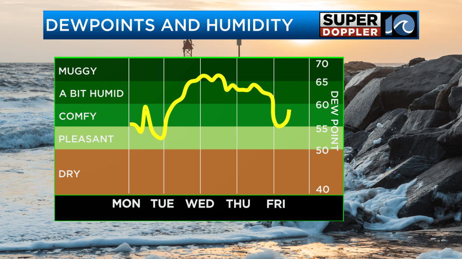
The low will stay offshore the entire time, but it will begin to push away from our area by Wednesday afternoon. There may be a few showers for the first half of Wednesday, but they are expected to move out by the late afternoon.
Any rain that we get should be very light and not add up much in the rain gauge.
High temps will be in the mid 70s on Wednesday.
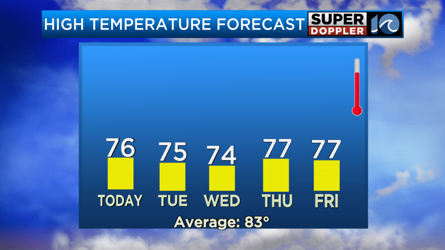
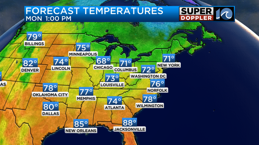
High temps will stay in the 70s until next weekend. We may start to warm up a little on Sunday. We’ll have drier weather later this week into the weekend as well.
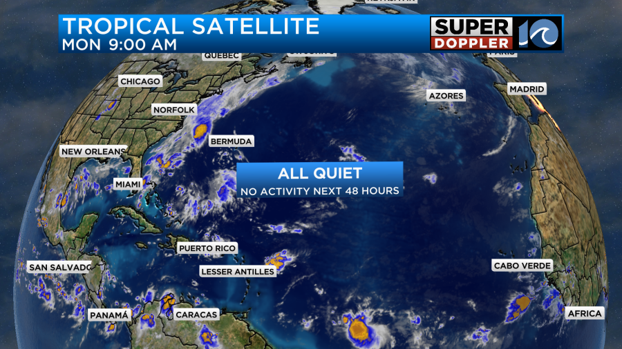
The tropics are….Interesting! But not in the way that you think. The big monster/menacing tropical disturbance that was supposed to eventually wipe out the east coast (big-time sarcasm) is now just a small batch of thunderstorms. Over the weekend the National Hurricane Center quickly downgraded the system as the models severely downshifted. So now there are no tropical systems forecast for the next 48 hours.
Meanwhile, there is also some good news in the Pacific. Hurricane Kiko is tracking west towards the Hawaiian islands. However, the latest forecasts have it turning into a tropical storm and passing north of the island chain.
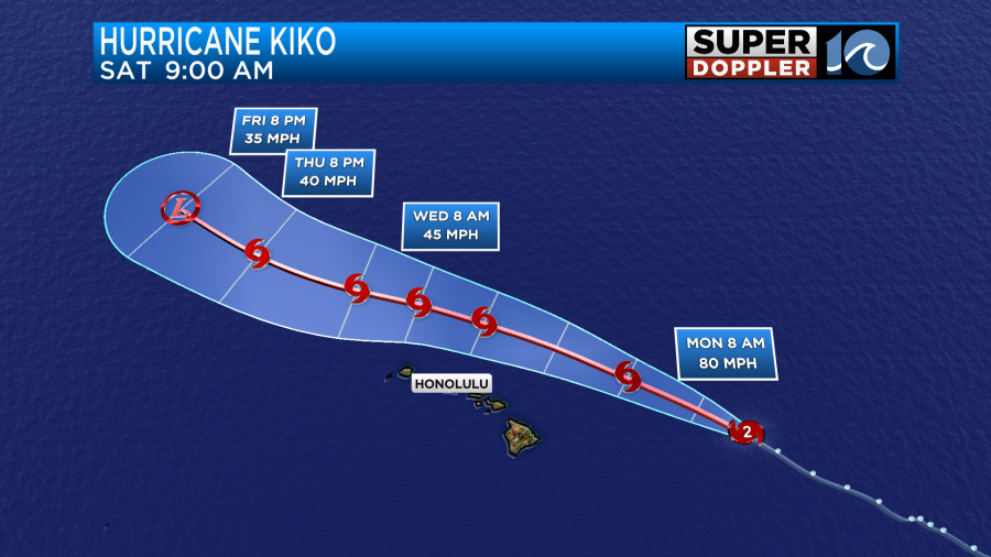
Hence it looks like Hawaii will be spared the worst of the storm. They will have some waves and a little wind, but overall they should fare well.
Meteorologist: Jeremy Wheeler


