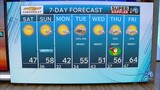
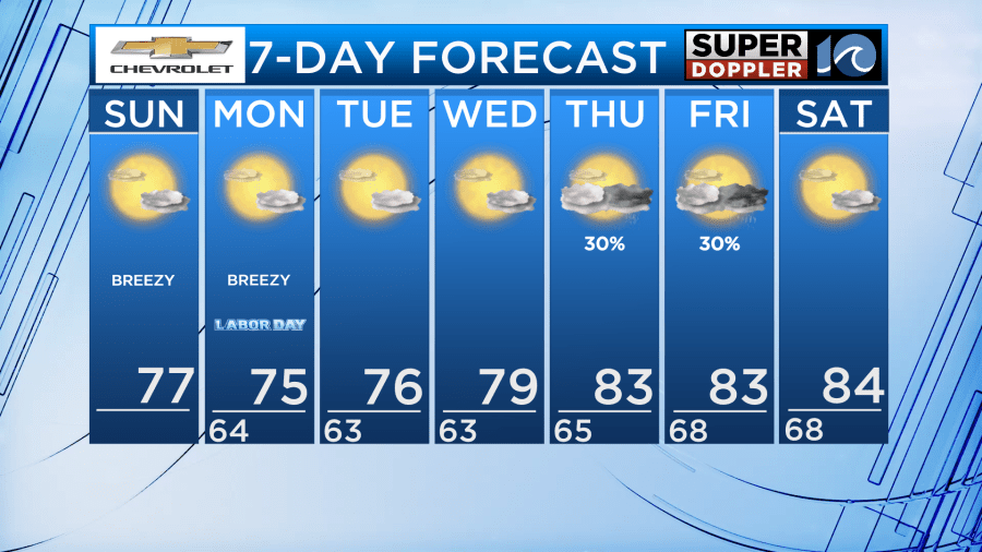
Happy Sunday! Our gorgeous Labor Day weekend weather continues beyond just the next couple days. Later in the week, an unsettled weather pattern will bring us some changes.
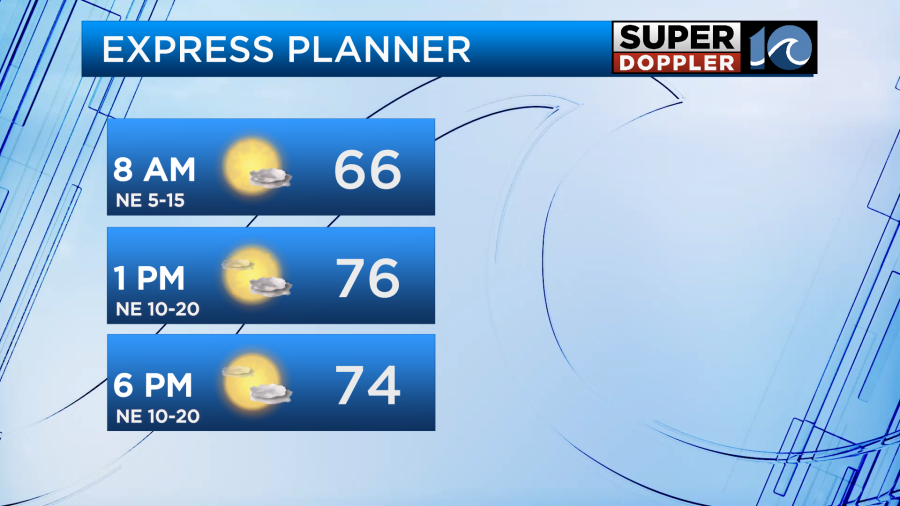
If you enjoyed yesterday’s weather, you’ll love the weather we have in store for today and tomorrow. Very similar conditions with high temperatures in the mid to upper 70s and passing clouds. We will be breezier with northeast winds 10-20 MPH.
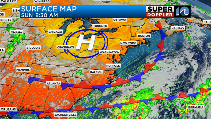
The cold front that was trying to pass through yesterday has stalled just to the south of the Outer Banks. Because of this, the Outer Banks will see isolated showers today and potentially into Labor Day. However, everywhere else will get to remain dry both days.
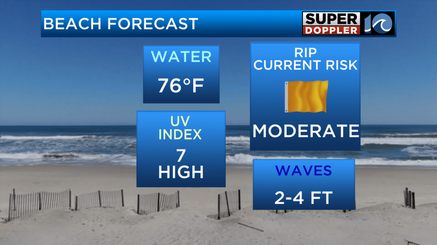
If you’re going to the beach, we have a moderate rip current risk Sunday and high rip current risk Monday.
We stay dry with a mix of sun and clouds and high temps in the mid to upper 70s Tuesday and Wednesday.
Thursday and Friday, a couple fronts will be in the vicinity bringing us an unsettled pattern. Temperatures will rise into the low to mid 80s and humidity will increase. Our rain chances also increase. Not a washout, but isolated to scattered showers are possible to end the workweek.
Have a great rest of your holiday weekend!
– Meteorologist Kristy Steward