Yesterday we did get some scattered thunderstorms over the area. Luckily, my house did get some rain this time.
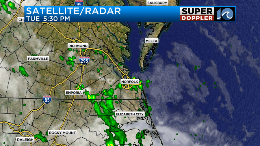
However, I have several folks north of the metro that say they really need some rain. We’ll have a chance at some more scattered showers and storms later today. There’s no big weather systems nearby, but we have a lot of deep moisture over the region. High pressure is offshore. There is a cool front developing over the Midwest.
We’ll have lots of clouds today with some sun peeking out at times. There will be some spotty showers for the first half of the day, but some scattered thunderstorms will form later today.
High temps will be in the mid-upper 80s, but the heat indices will be in the lower 90s. We’ll have a light west wind.
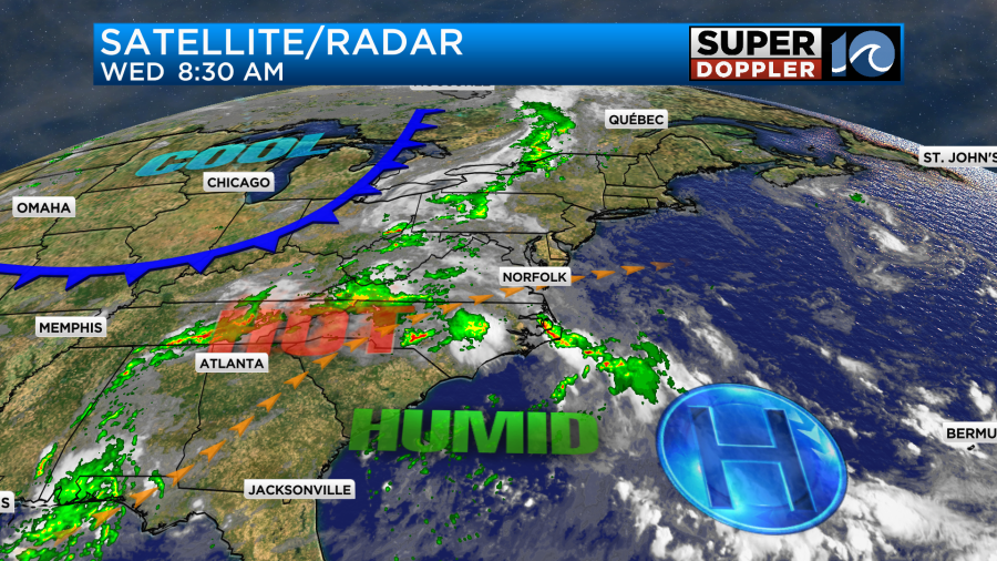
Tomorrow we’ll be south of the cool front, but it will be approaching from the northwest. We’ll have a mix of sun and clouds with a light west wind. There will be a few showers and storms in the afternoon. High temps will be in the upper 80s to near 90.
There may be a better chance of rain in the evening as a cluster of showers and storms may try and come down from northern Virginia. We’ll see.
The cool front will slowly slide south through the day on Friday. There will be a few showers and storms possible. We’ll develop a light north wind as long as the front doesn’t stall out early. Temps will still be in the upper 80s, and it will still be fairly muggy.
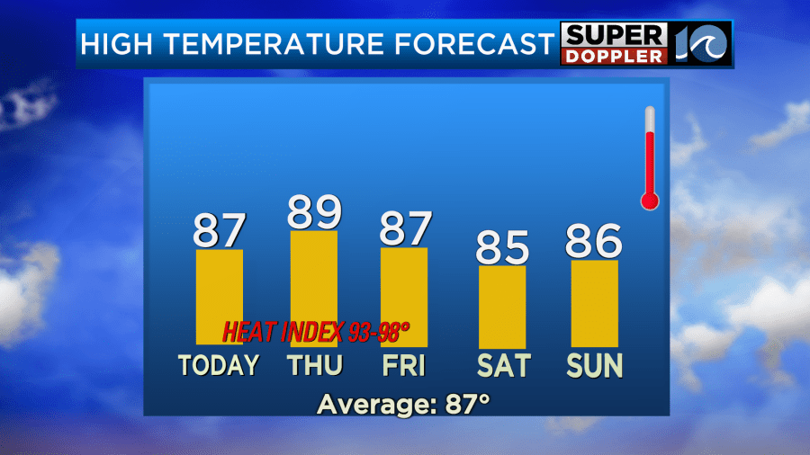
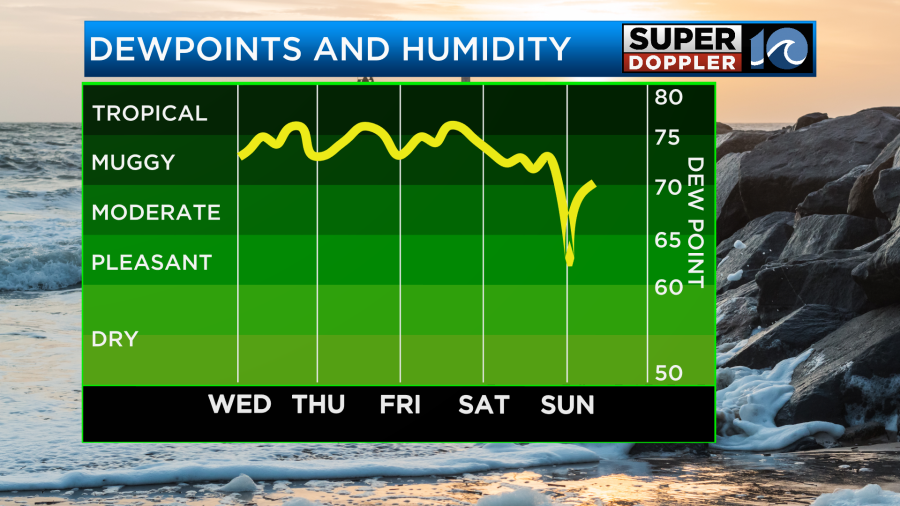
The front should sink to our south over the weekend. Hopefully, that will dry us out and cool us down slightly. If the forecast pans out, then it should be a nice weekend.
Meanwhile we are tracking tropical storm Erin in the central Atlantic. It has been on a steady westward track since yesterday.
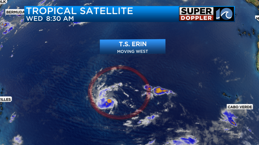
The latest satellite representation of Erin looks pretty ragged. It’s over some mild water, but not too warm. It’s also encountered some dry air and a little wind shear lately. This should all change over the next 24 to 48 hours. It should also slow down a bit. That will allow for strengthening. It will probably become a hurricane within the next 1-2 days.
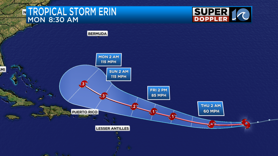
After that point it will start to track a little more to the north. It is also forecast to become a major hurricane by Sunday.
The models are still all in good agreement in the track up through Sunday. They send it north/northeast of Puerto Rico. After that point there is more uncertainty in the track. Here are some of of the models.
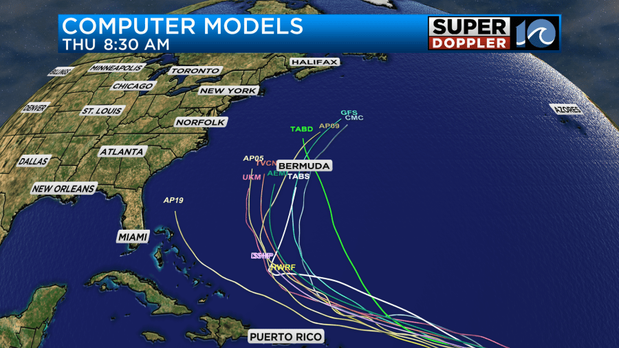
While there is a spread, there is some consensus on a track towards or just west of Bermuda. The GFS Ensembles are starting to focus more on a track towards Bermuda.
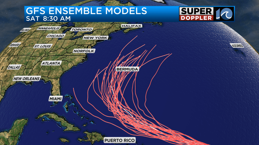
An ensemble model is basically a model that gets tweaked just a little differently many times. That tweaked-version of the model is then run and shown. When the models cluster together, then there is more confidence in the path. If there is a big spread, then there is much less confidence.
We also use the European model for long-range forecasting. Here is the GFS and European models about a week out.
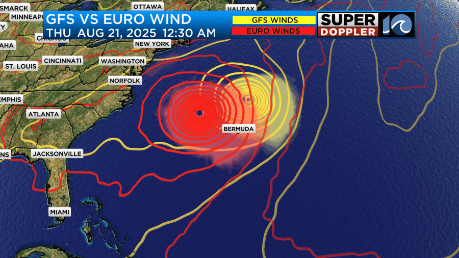
The Euro has tracked east in the long term, but it is still west of Bermuda. With those tracks and strengths we will still expect some high waves and rip currents at our beaches. There could also be some beach erosion. At least there will be some nice surf for the ECSC competition next week.
In national news… There has been a lot of flooding over parts of the country…AGAIN. There was some really bad flooding up in Milwaukee, Wisconsin lately. Wisconsin flooding. It made major headlines in the news.
Then just yesterday there was some flash flooding around Chattanooga Tennessee. Tennessee flooding. Several roads were shut down.
Meteorologist: Jeremy Wheeler


