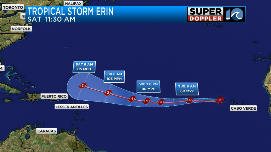
Update: Tropical Storm Erin has formed in the Atlantic. See update below.
This last weekend we had some pretty nice weather. It felt great on Friday and Saturday for sure. Especially when the breeze blew. Yesterday, the humidity came back, and there were a few rain showers, but at least it still wasn’t too hot.
Today still won’t be too hot, but the humidity is still climbing. We have high pressure to the northeast with a stationary front to our south.
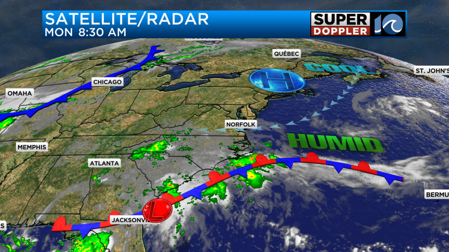
We’ll be mostly cloudy today with a few spotty showers this morning. Then we’ll develop some scattered showers and storms this afternoon.
We’ll only have a light wind out of the east today. It will only run at 5-10mph. High temps will be in the low 80s with some mid 80s inland and south.
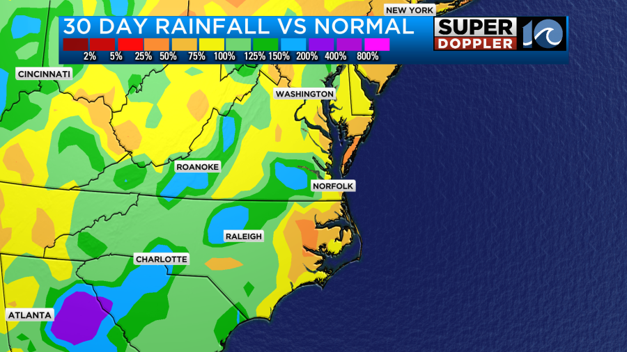
We do need some rainfall. We don’t just need the Summertime scattered thunderstorms (which is forecast). We need a good soaking rain. A lot of the region is well behind on rainfall compared to average.
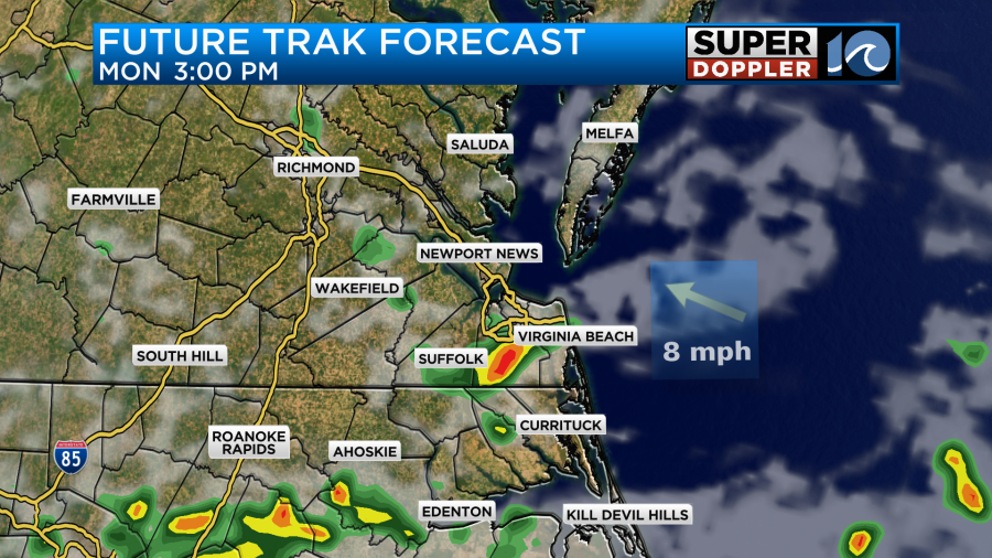
Tomorrow we’ll have a few showers and storms in the area, but the chance isn’t too big. I have about a 30% chance for the afternoon and early evening.
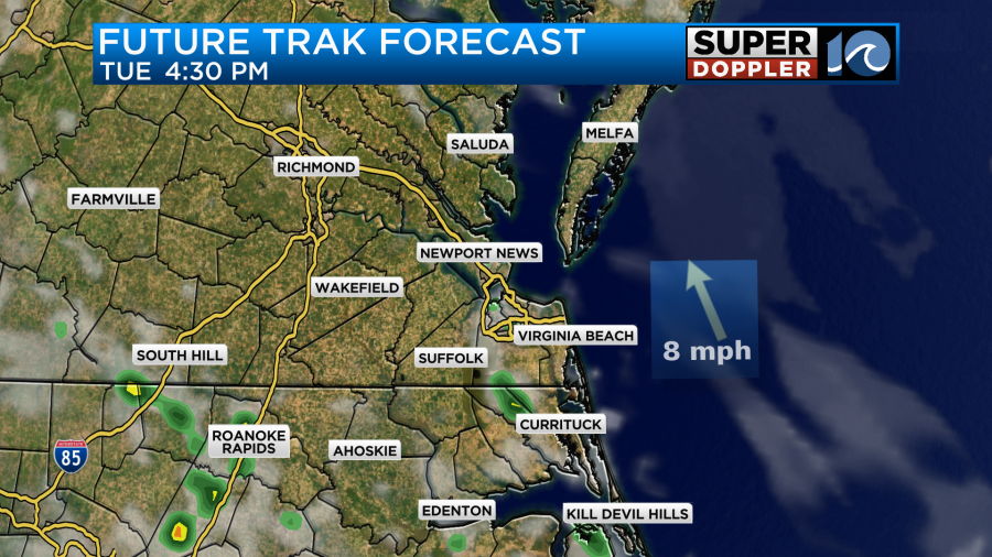
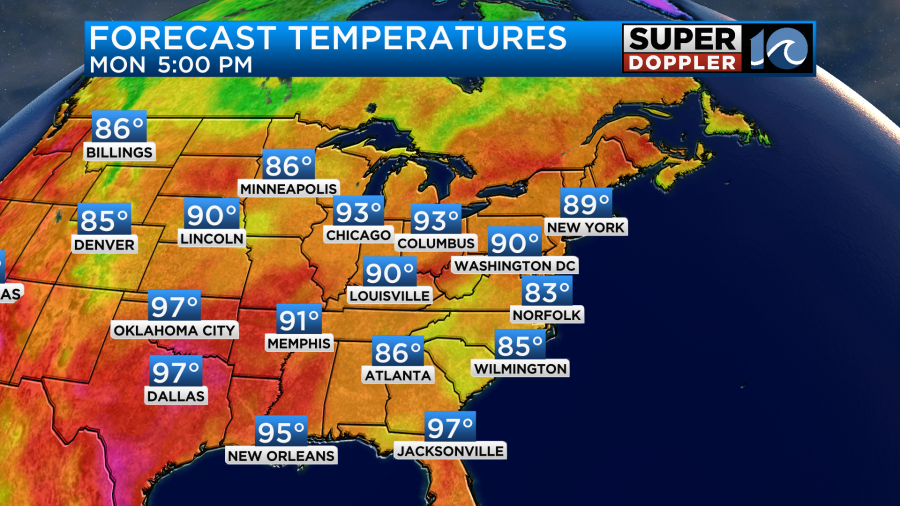
We should have a little more sunshine tomorrow with partly cloudy skies expected. The front should fall apart, and that should in-turn allow for more sunshine. Also, the wind will turn more out of the south as high pressure sinks southward (offshore). That will allow the high temps to heat up into the upper 80s with a couple of 90s possible inland and south.

We will heat up some more by Wednesday and Thursday. High temps will reach up to near 90 degrees.
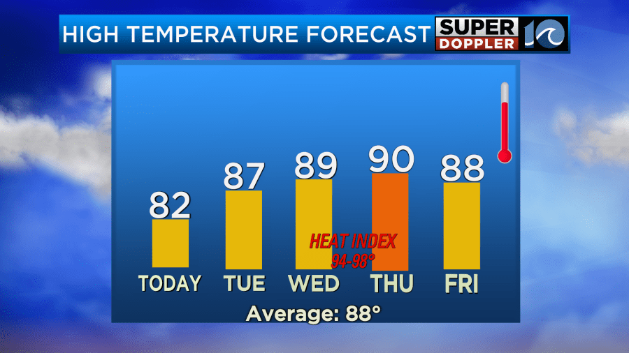
The heat index on those days will be in the mid-upper 90s. There may be some (slight) drying and cooling by next weekend. I’ll talk more about that in tomorrow’s weather blog.
But wait there’s more…. A LOT more!
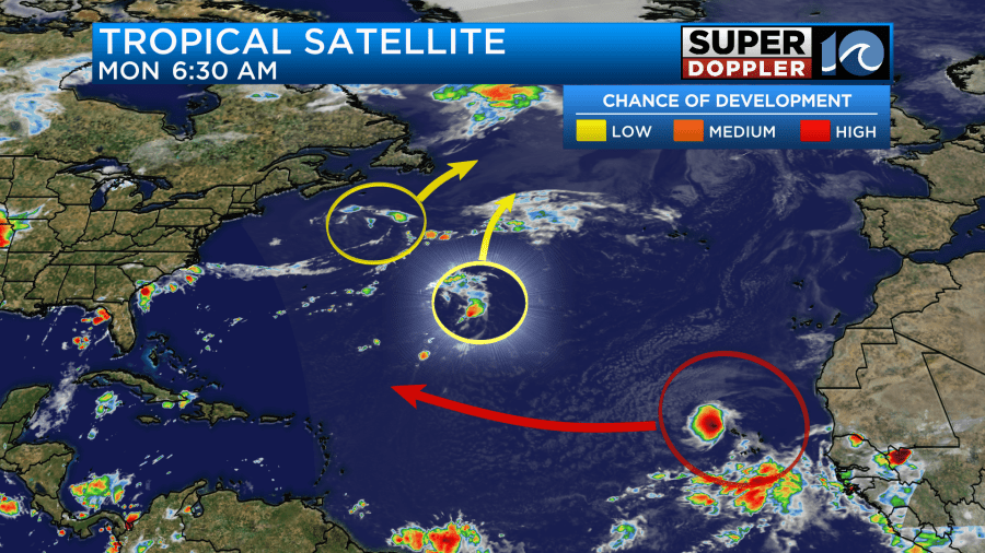
I didn’t start the blog with the tropics because as I was writing this there wasn’t a named system in the tropics. However… by the time you read this there may be a system in the eastern Atlantic.
Update: Tropical storm Erin has formed. Here is the latest track:
There is definitely a high chance of formation over in that zone.
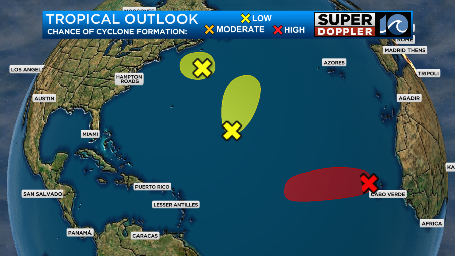
The feature already has a decent cloud deck overhead with what looks like some decent outflow aloft.
This system (tropical storm Erin?) will roll west for a while. The models are in good agreement in sending it to the west/northwest for a few days. Then they have it bending more to the north either around Bermuda or near that region.
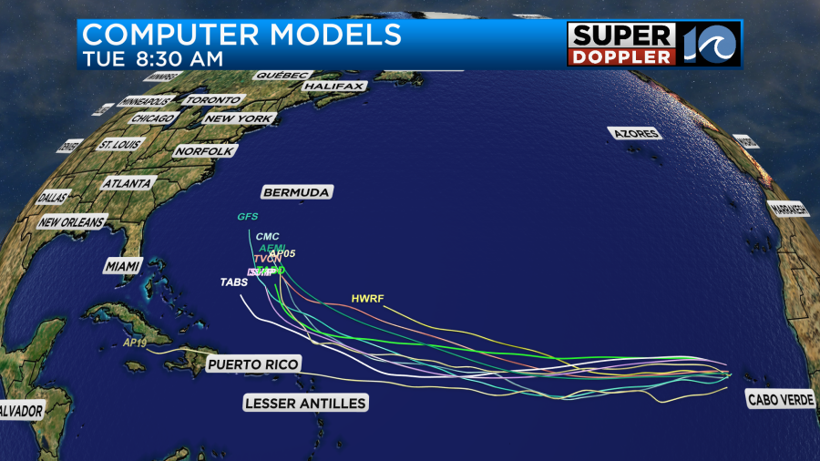
The European model and the GFS model are in fairly good agreement for once (at least for now) on the track through day 8 and 9.
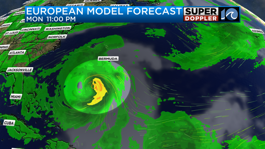
They have a strong hurricane running a little west of Bermuda and then to the north. The thing is that it is still very early in the game. There are a few models which still bring it closer to the U.S.
We have a lot of time to get updates on this thing. It could be a great scenario for surfers, but if it gets too close, then we could have some bigger/badder impacts. Stay tuned for updates.
Meteorologist: Jeremy Wheeler