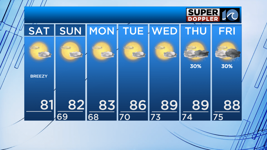
Good Saturday morning! We continue to stay with below-normal temperatures and low humidity this weekend before changes arrive later in the week.
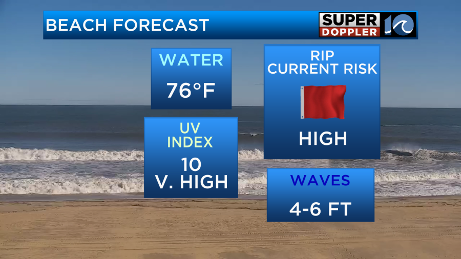
Both Saturday and Sunday will be very similar. Highs in the low 80s, lows in the mid to upper 60s, low humidity, more sun than clouds, and remaining dry. Saturday will be a little breezier with 10-15 MPH northeast winds. This will bring a rough surf and high rip current risk. 4-6′ breaking waves in the Atlantic.
High pressure largely influences our weather much of the workweek. This will keep us mostly dry and partly cloudy most of the week. High pressure slides south later in the week and opens the door for a disturbance to impact us. Muggy air returns. Temperatures will gradually rise into the upper 80s by Wednesday. Isolated to scattered showers and storms could impact us Thursday and Friday, but that depends on if the disturbance will be able to develop over us or not, so there’s still a fair amount of uncertainty with those rain chances.
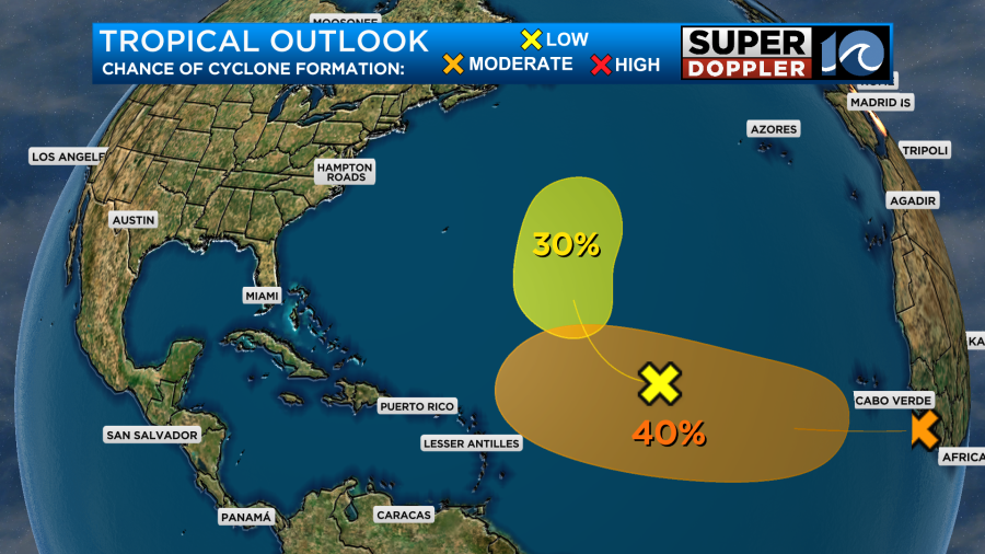
We are continuing to monitor the tropics. There are currently two areas being watched in the Atlantic. One in the middle of the ocean that has a 30% chance of development in the next 5 days and one off the coast of Africa that has a 40% chance. No local impacts anytime soon from either area.
Enjoy the beautiful weather we have outside the next few days!
– Meteorologist Kristy Steward