
This morning we had a good amount of rain showers to kick off the workday.
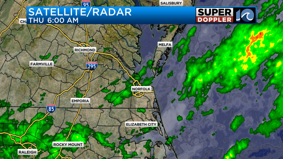
Over the last 24 hours there has been some heavy rain over a few inland locations.
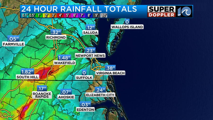
The bulk of the area only had about a tenth of an inch up to a half an inch. The recent rainfall was caused by a weak upper-level disturbance that will roll to the east and fall apart today. Otherwise, high pressure is to our north with a weak area of low pressure forming along a stalled-out front to the south.
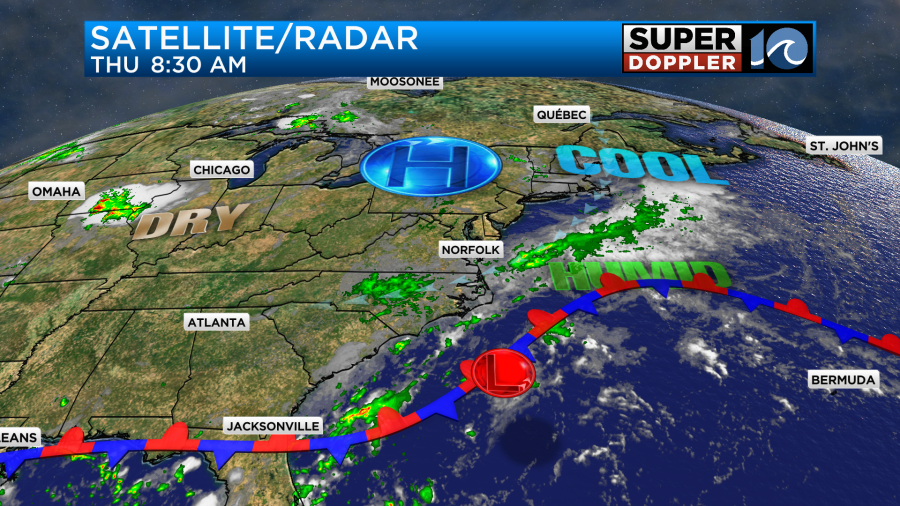
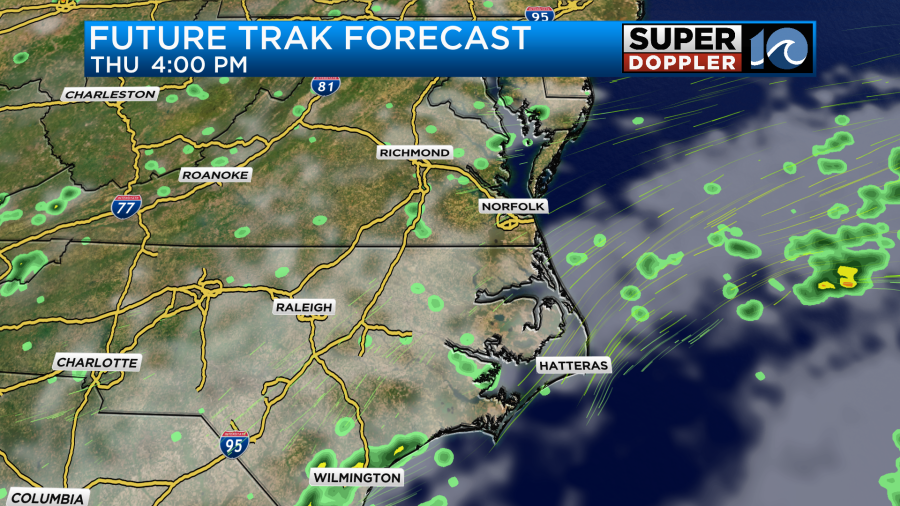
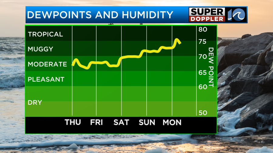
We definitely have a lot of moisture in the region. We’ll have a lot of clouds today with a few scattered showers from time to time, but it won’t be a washout.
We’ll have a northeast breeze running at 10-15mph with occasional gusts between 20 and 25mph.
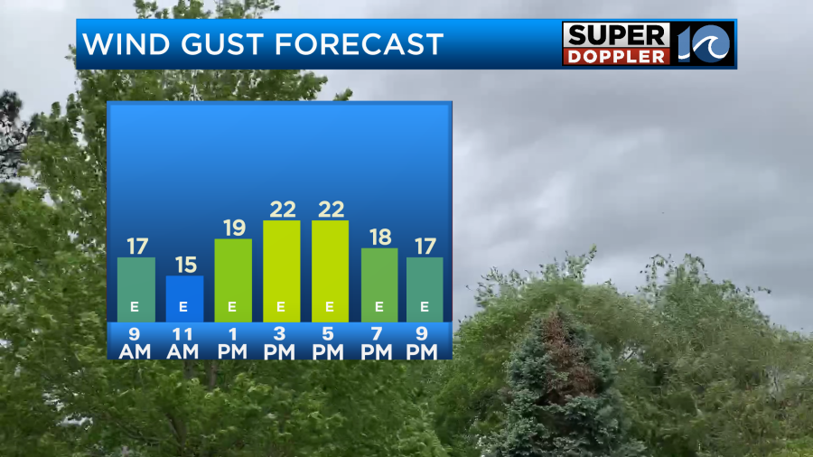
The persistent breeze may create a little bit of nuisance tidal flooding this evening.
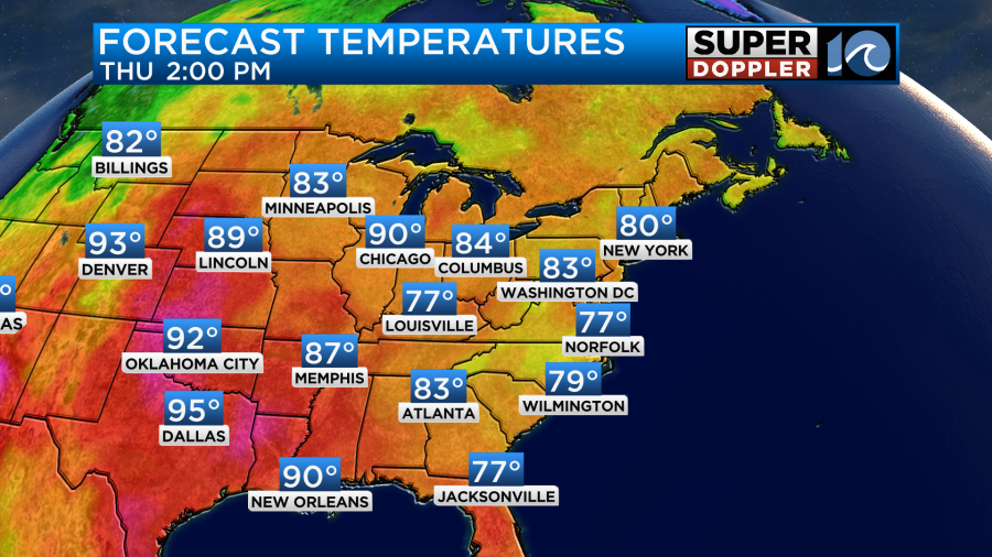
Temps will be held down today in the upper 70s. Which is about 10 degrees below average.
Any rainfall going forward should be fairly light and won’t add up to much in the rain gauge.
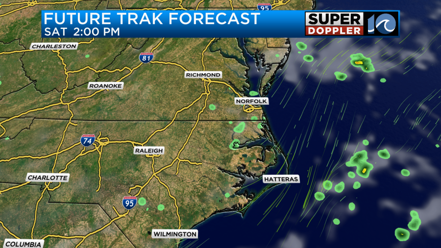
Tomorrow the area of low pressure will stay offshore, but it will be to our east/southeast.
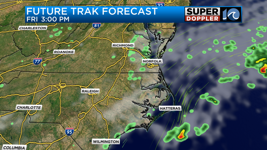
It will throw a few showers back our way through the day. Otherwise we’ll have mostly cloudy skies. With the combination of the weak offshore low and the high to the north we’ll continue with the northeast breeze. Gusts will be up to 25mph.
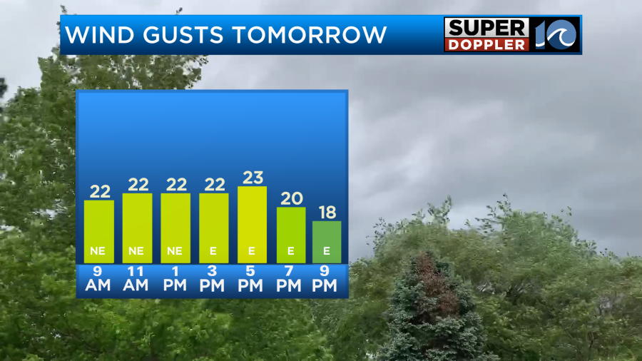
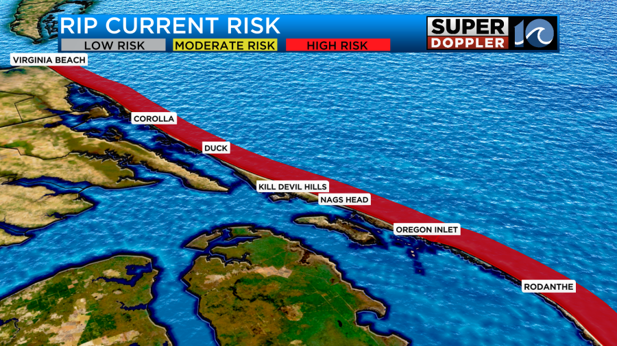
Unfortunately, this is going to keep the high risk for rip currents going for the next 2 days.
By Saturday the low will be pushing farther to the northeast. We’ll still have a northeast breeze behind it, but the wind should be less than today and tomorrow. Still, it could pull down an isolated shower or two.
High temps will be near 80 degrees, and we should have more of a mix of sun and clouds. I’d say it should be a pretty decent day overall. Then on Sunday it should be very nice. High temps will be in the mid 80s with partly cloudy skies.
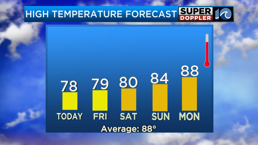
Keep in mind that the humidity will still be up a bit. So it won’t be a dry 84.
Temps will warm up next week. Highs will probably return to near 90 by Tuesday.
The area of low pressure that I’ve talked about up to this point now only has a low chance at becoming tropical. There are 2 other features that we have to talk about.
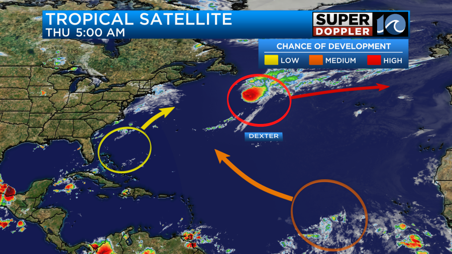
Tropical storm Dexter is transitioning into a post-tropical storm. It is actually strengthening as it expands and starts wrapping in some cooler air.
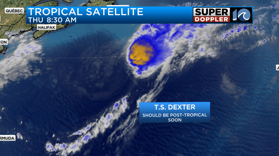
The system is forecast to obtain hurricane-forced winds after it finishes the transition.
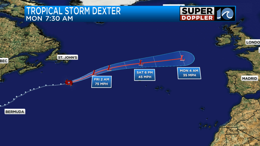
It will keep moving east over the next few days. Luckily it should weaken before it heads towards Europe.
The other feature is that tropical disturbance over the central Atlantic. It has a medium chance for formation within the next few days. Here’s some of the latest mode’s forecast track.
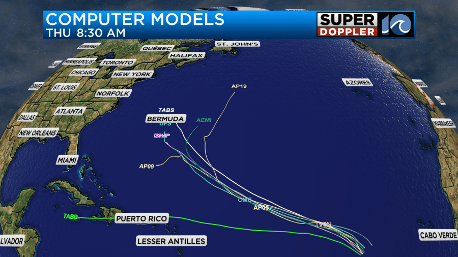
I’d say the bulk of the models take it fairly close to Bermuda, but it is still early. Whatever the track it will probably strengthen quite a bit. We’ll watch this area closely, but it is pretty far out there. Stay tuned for updates.
Meteorologist: Jeremy Wheeler


