
We have one more hot day until a big cool down arrives. Today, the big game-changing cool front is developing to our north over the Ohio River Valley.
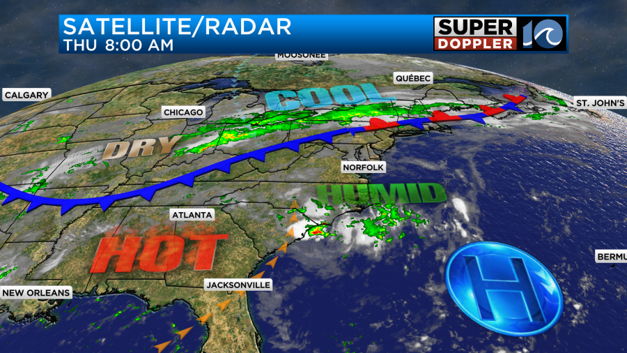
High pressure is to our southeast.
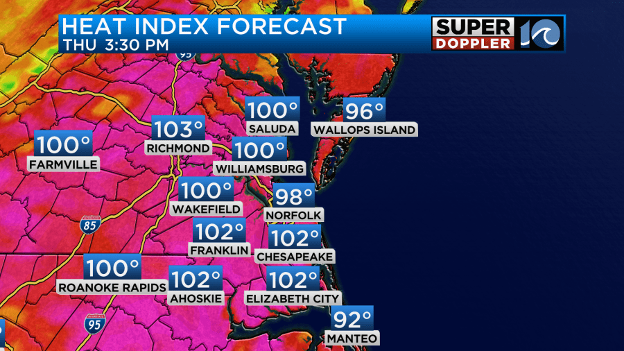
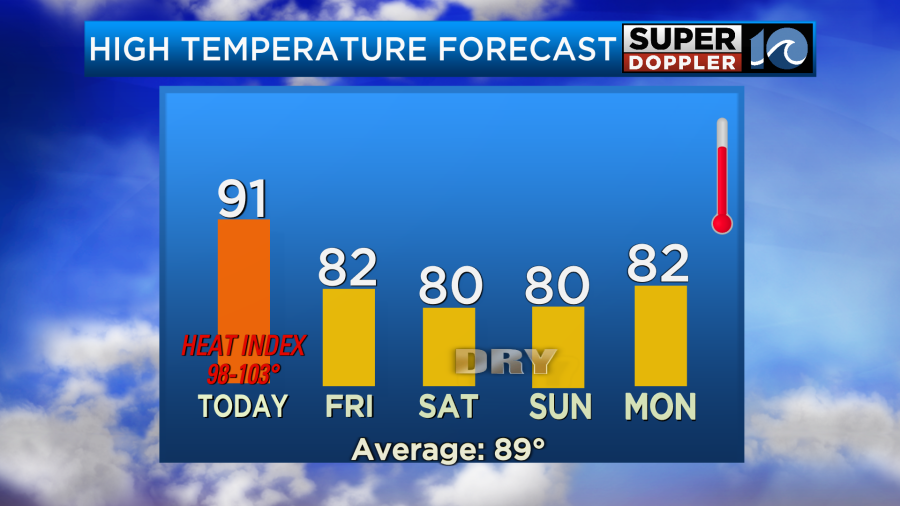
We are still in the hot/humid zone. So high temps will aim for the low 90s this afternoon with some mid 90s inland/south.
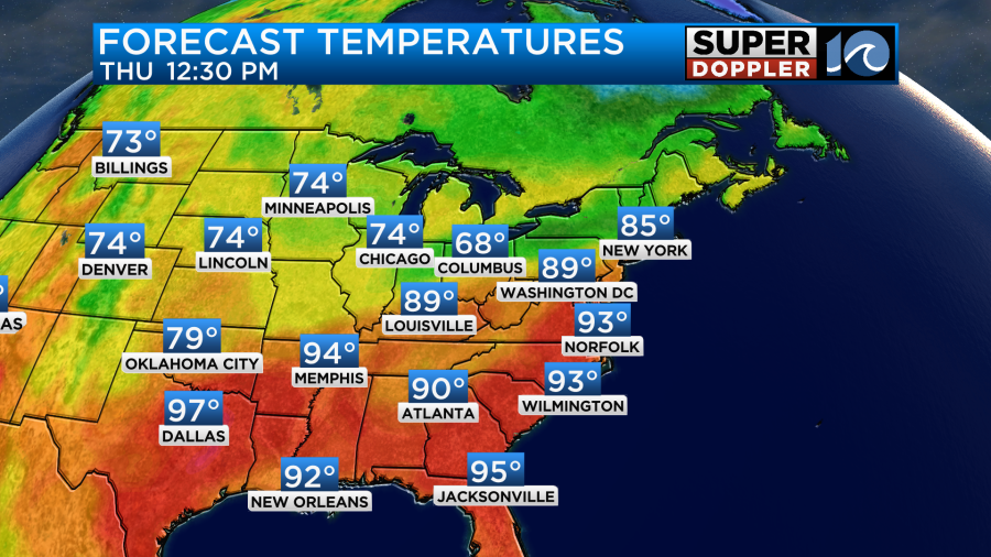
The cool down will reach the D.C. area today, but it will really cool down over the Great Lakes and Midwest. Locally our heat index will be around 100 degrees.
We’ll be partly cloudy through the day. There will be some isolated showers and storms this afternoon. There won’t be too many storms, but there will be a couple more than the last 2 days. Later this evening there will be a big cluster of showers and storms moving in from the northwest.
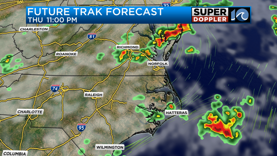
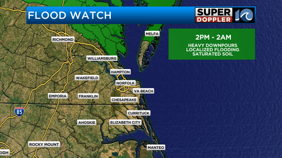
Heavy rain will be possible. That will be more likely north/northwest of the metro. There is a Flood Watch in effect for those areas for later this evening.
The storms should weaken overnight. Then tomorrow the front will slowly slide to the south. We’ll have lots of clouds over the region Friday. There probably won’t be any thunderstorms. However, there will be some scattered rain showers with on-and-off drizzle.
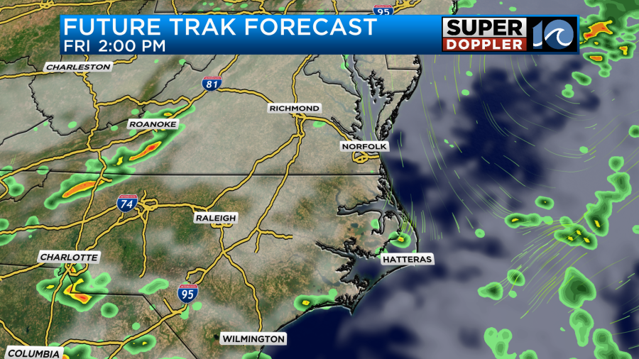
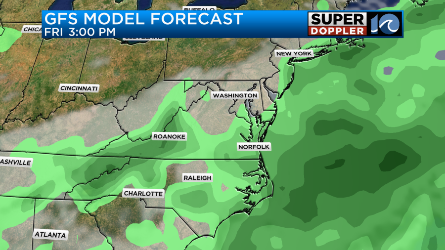
Keep in mind that our Future Trak model doesn’t do well with light and low-level precip (like drizzle). So I think that’s why you don’t see much green on the map. Here is the GFS model. It’s probably more representative of tomorrow’s weather.
High temps will be knocked down to the lower 80s. That will be awesome!
However, the humidity won’t drop right away. It will only slowly sink.
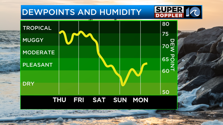
However, it will drop much more as we go into Saturday and Sunday. The dry air will get a push from a stronger northeast breeze. Tomorrow it will run at 10-15mph out of the northeast with gusts to 20mph.
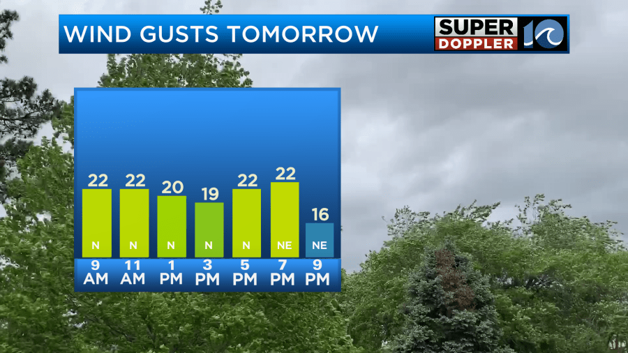
The breeze will probably stay that strong on Saturday. So high temps over the weekend will drop to near 80 degrees.
After some spotty showers Saturday morning, we should dry out and clear out for the rest of the weekend. It should feel very nice. Keep in mind that it will be a little cool at the beaches. There could be an increase in rip currents as well.
It may be a bit cool both Sunday and Monday mornings. Low temps will be in the 60s and 70s. We may even get close to 60 in some inland spots. Upper 50s??? We’ll see. The cool air looks like it will continue into early next week with high temps in the 80s through at least Wednesday. Can’t wait!
Meteorologist: Jeremy Wheeler


