
I was doing the daily dog walk yesterday and just tried to make it through another hot and humid day. There was a little breeze out of the north. It was nice when that blew, but most of the time it was just feeling hot and muggy. High temps were in the upper 80s to near 90 in Norfolk. That is probably due to the location being fairly close to the bay. However, many inland temps hit the low 90s.
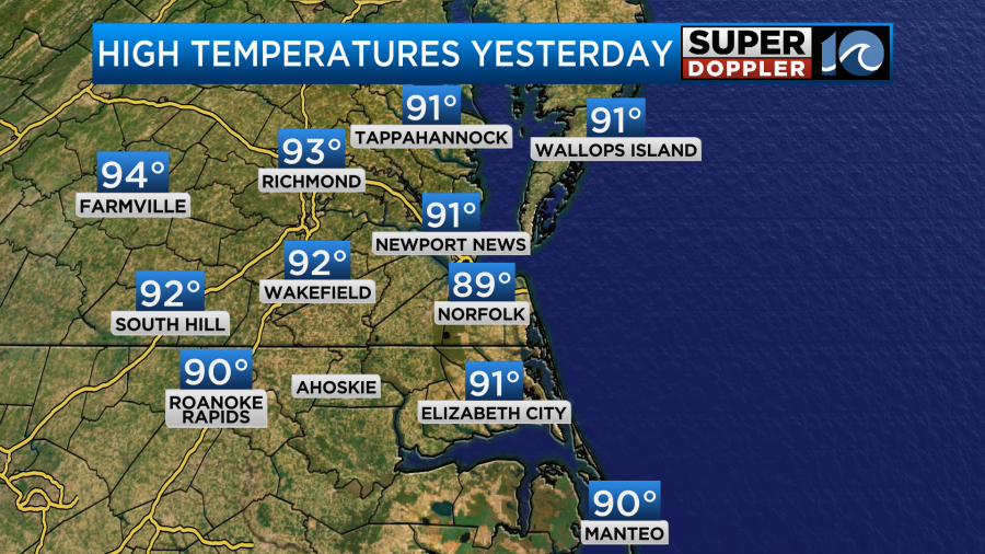
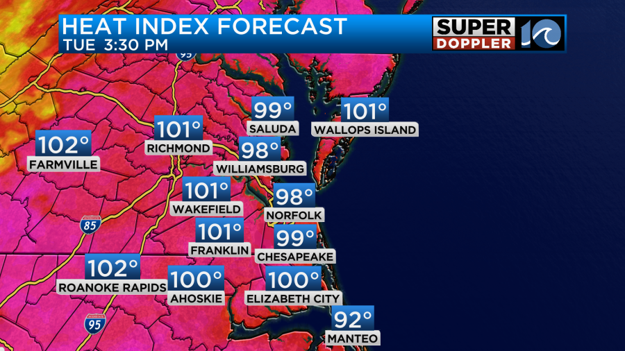
Keep in mind that many inland temperatures were in the low 90s, and the heat indices were in the lower 100s.
One viewer asked about if we had broken a record for 90 degree days lately. Interestingly enough, we have actually and technically been below average for most of the last 2 weeks.
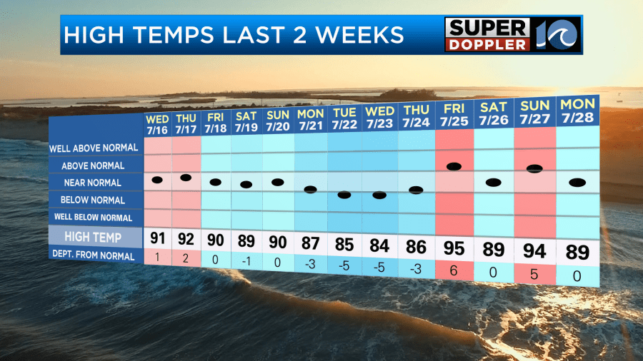
Again, I think part of the reason for that is that there has been an onshore breeze for a good bit of the time (which is rare this time of year). Norfolk is located fairly close to the water. So a breeze off of the bay will affect that site and keep it cooler than inland areas. Also, we have had a lot of very muggy days. This has produced a good amount of clouds on some days with rain on some others. So that is also a factor. It’s really been the heat index that has made it feel so miserable for so long. (We’ve been pretty humid since May!).
Having said that, there is a large area of the U.S. covered in heat alerts.
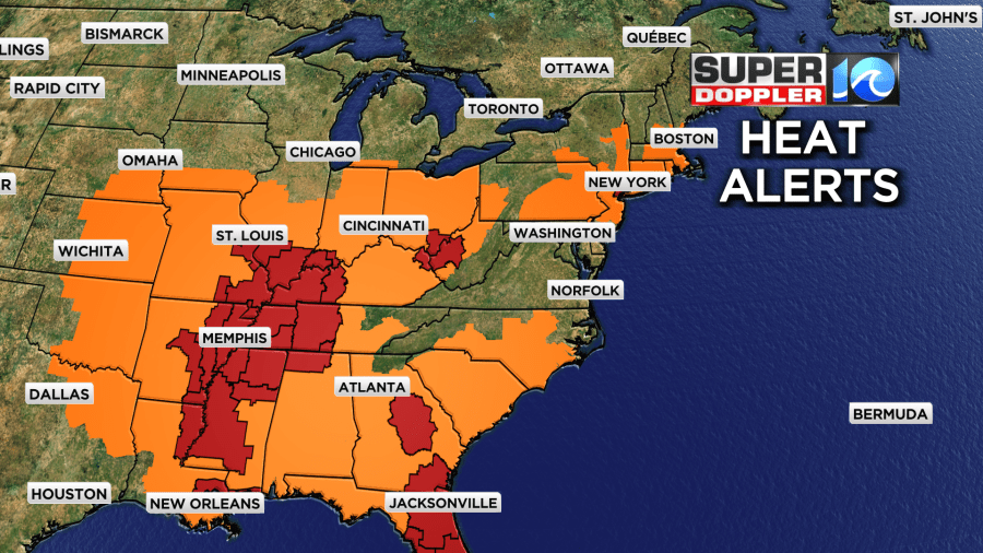
There are also some large areas in the “Extreme Heat Warnings”. You’ll notice that we are not in a heat alert today. We should be just below Heat Advisory criteria. (Heat index 105-109).
The National Weather Service this morning mentioned in their discussion that there could be some slight drying as drier air mixes down from the mid-levels today. This also showed up in the short-term humidity forecast.

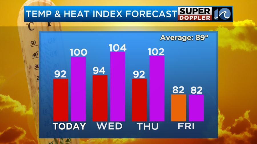
Don’t get me wrong… It will still be pretty hot and humid this afternoon. High temps will aim for the low 90s with a few mid 90s inland.
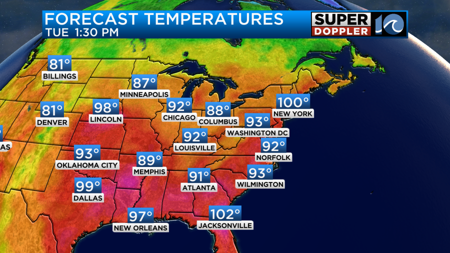
The heat index will be in the upper 90s to lower 100s.
We’ll be mostly to partly sunny with only a stray shower or storm. There will be a light breeze out of the northeast. Perhaps that will help with the slight drying. However, it will not be a strong breeze.
Tomorrow the setup will be about the same. High pressure will be to our south with a stationary front to the north. However, tomorrow the wind will be light and out of the southeast. I expect our temps to rise a little with some extra humidity. I’m calling for highs in the low-mid 90s with a heat index over 100. (Maybe up to 105).
There may be an isolated shower or storm. Otherwise, we’ll be partly cloudy. By Thursday the cold front will be approaching form the north. It won’t be here during the day. So we’ll still be pretty hot and humid. However, there will be some scattered showers and storms forming between the afternoon and evening.
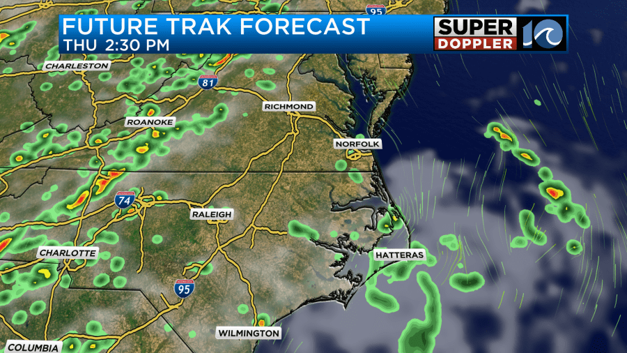
There may be a lot of rain between Thursday night and Friday. During that time the cool front will be slowly sinking into that humid air mass. Heavy rain will even be possible.
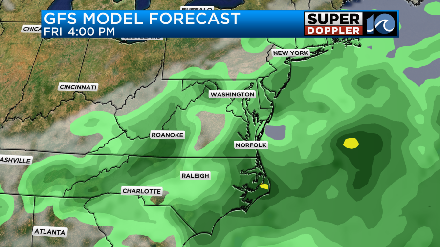
At least the temps will finally drop to the 80s on Friday. Over the weekend the front is forecast to stall out to our south. It may stall out just to our south. That’s why I have small rain chances for Saturday, and isolated showers on Sunday. At least our high temps will be near 80s degrees. Plus, the humidity should drop quite a bit. It should stay cooler into early next week. I’ll have even more detail about the big cool down for the weekend in tomorrow’s weather blog.
Meteorologist: Jeremy Wheeler


