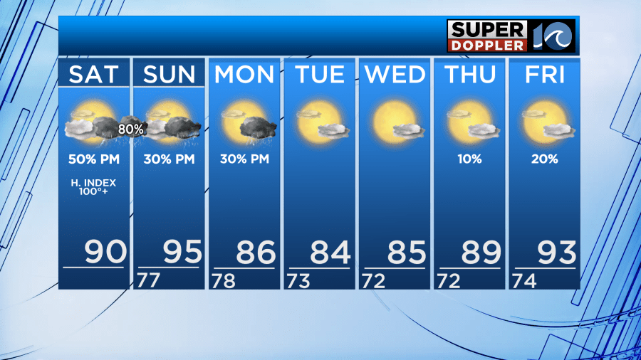
Good Saturday morning! It was an active night last night with scattered storms bringing heavy rainfall and lots of thunder and lightning. Much of the same is on the way this evening into tonight again. The good news: We do finally have a dry, cooler break in sight.
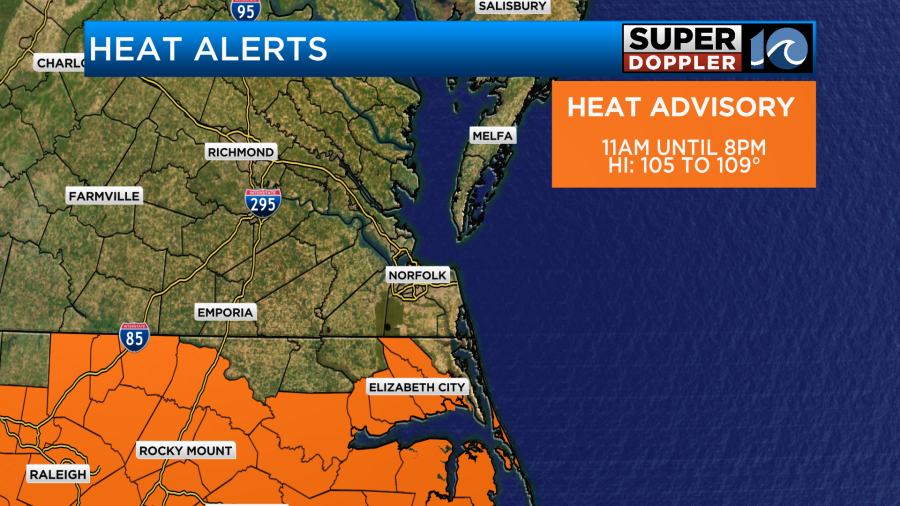
We will have a mix of sun and clouds throughout the day. High temperatures will reach around 90°, feeling like the triple digits. There is a Heat Advisory in effect for Bertie, Camden, Chowan, Pasquotank, Perquimans, and Dare counties until 8 PM Saturday. Heat index values will be 105-109°. Stay in the shade and hydrated while outdoors.
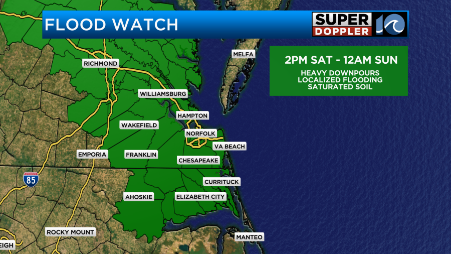
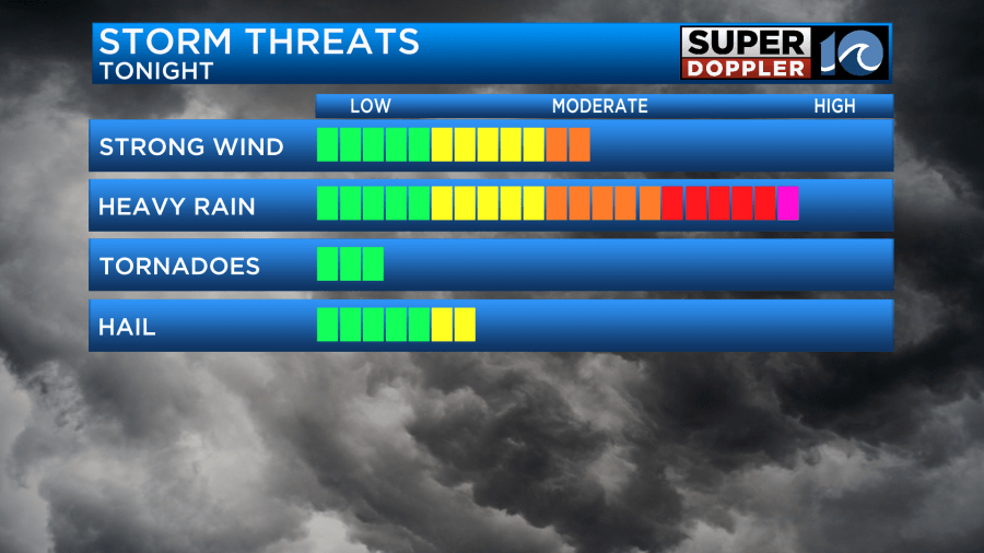
This evening, scattered to widespread thunderstorms develop after 5 PM. These storms will produce a lot of rain. An additional 2-4″ of rain could fall. That’s why majority of the region is under a Flood Watch from 2 PM Saturday – 12 AM Sunday. However, the rain doesn’t look to completely stop until the middle of the night around 3-4 AM Sunday.
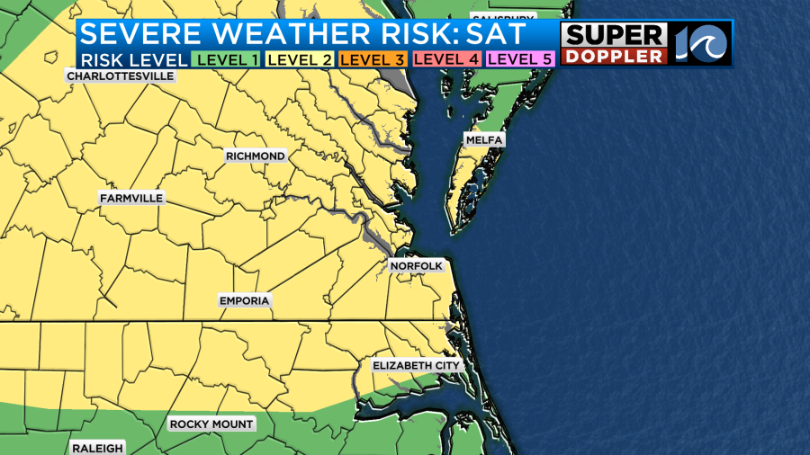
Some storms this evening/tonight could become severe. We are under a level 2 of 5 severe risk. Heavy rainfall leading to localized flash flooding, damaging wind gusts, small hail, and frequent lightning are the concerns.
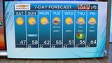
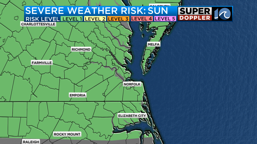
We should wake up to dry conditions Sunday. Much of Sunday looks decently dry with a mix of sun and clouds, but it will be sweltering outside. High temperatures in the mid 90s will feel like the triple digits. In the afternoon, isolated to widely scattered storms could develop. We are under a level 1 of 5 risk for severe storms Sunday PM. Then, the cold front arrives!
Behind a cold front Sunday night, we will get a much needed break from the storms, humidity, and heat. The first half of the workweek will have high temperatures in the mid 80s and dew points in the mid 60s. Temperatures begin to climb closer to the 90s on Thursday and return to the lower 90s by Friday. However, aside from a few spotty showers possible on Monday, the week ahead is looking nice and dry with plenty of sunshine.
Enjoy your weekend, keep cool, and watch for the storms this weekend!
-Meteorologist Kristy Steward