There has pretty bad weather over parts of the U.S. this weekend. The biggest problem by-far has been over central Texas. Heavy rain and flash flooding has led to widespread damage and multiple deaths over that region. It has become a very sad story. Here’s a link with some of the latest information: Texas flooding.
Closer to home there was also some flooding (though not quite as bad) over parts of North and South Carolina. As of this writing this event was not deadly. However, at one point, thousands of people were without power. This was from tropical depression Chantal. Near the center there was a zone where about 10″ of rainfall fell.
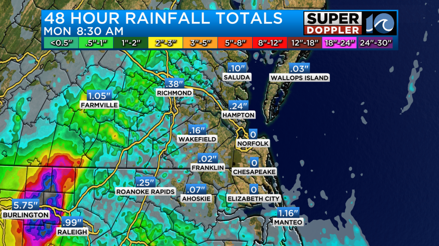
At one point some of the interstates were closed down towards the Burlington and Chapel Hill area.
Locally, we did have some scattered showers and storms yesterday, but they didn’t add up to too much in the rain gauges. The center of Chantal will pass just to our north/northwest today.
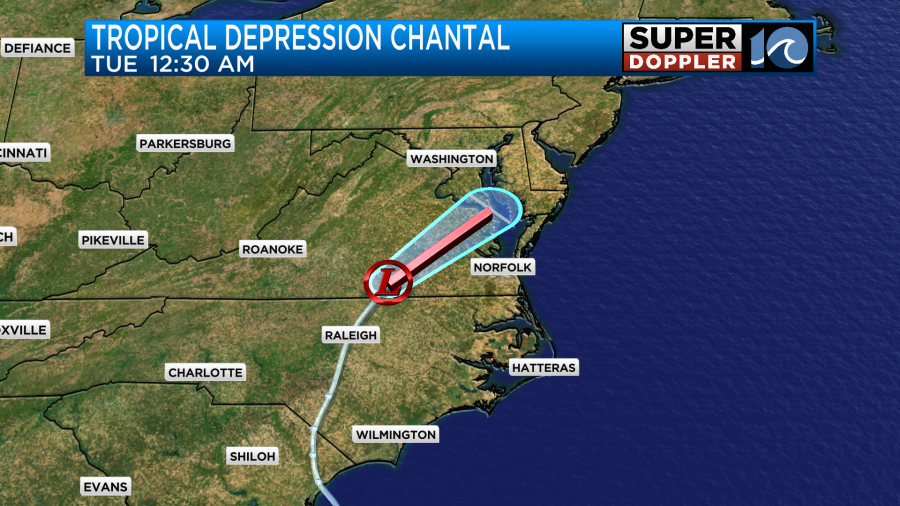
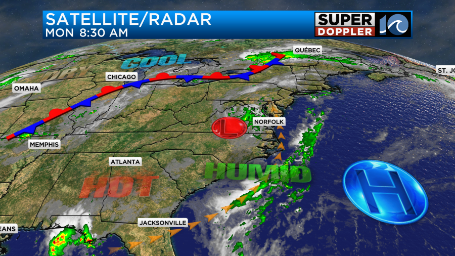
This morning it looked like it was already becoming disorganized. Regardless it is now mainly a rainmaker. Meanwhile there was a stationary front far to the north with high pressure offshore.
Through the day there will be a large cluster of rain showers and thunderstorms closer to the center of Chantal’s path.
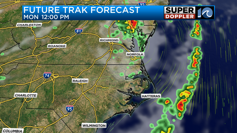
That will be regardless of whether it is a tropical depression or a remnant low. Locally we will have some scattered rain showers and thunderstorms.

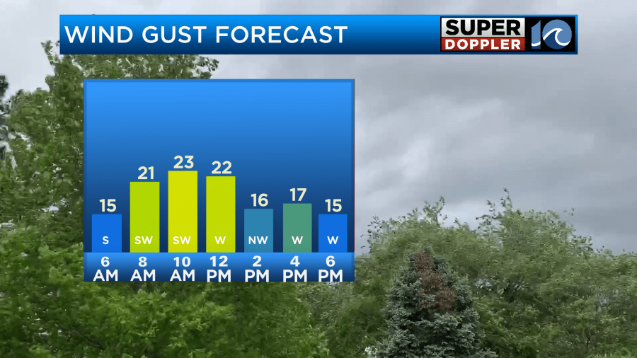
There could be some isolated downpours in the area due to the high humidity and lower pressure. There will be some breezy winds, but I don’t expect severe weather. Wind gusts will be out of the south then west at 10-15mph with gusts to a little over 20mph.
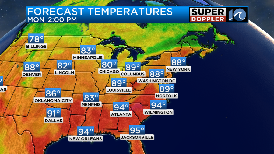
We’ll have a mix of sun and clouds today. High temps will reach up to near 90 degrees.
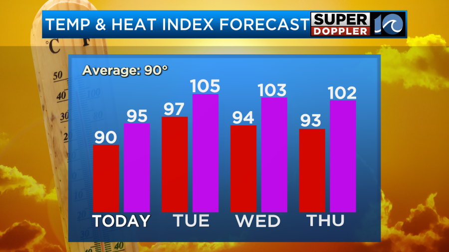
The heat index will be in the mid 90s.
Tomorrow as the remnants of Chantal move north of our area, we’ll start to focus on the heat. High temps will aim for the mid-upper 90s.
However, the index will be around 105 degrees. There may be some heat alerts issued for our area. Stay tuned for updates on that. We’ll be partly cloudy with a few showers and storms in the afternoon.

Winds will be out of the southwest at 10mph.
The rest of the week will be hot and humid with scattered showers and storms. Mainly in the afternoons and evening. High temps will be in the 90s.
No day looks like a washout, but a few strong storms with heavy rain will be possible.
The rip current risk is moderate today along our beaches.
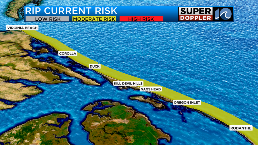
Be extra careful if you try to get in some beach time today.
One last thing…We have been very lucky with the tropics so far. There was Chantal, but in previous years we have had much stronger storms in the Atlantic by now. However, Taiwan just got hit by a major typhoon. It was one of the strongest storms on record to hit the (west) coast. Unfortunately, there were a few hundred injuries and a couple of deaths. Here is an article with more information: Typhoon Danas hits Taiwan.
Meteorologist: Jeremy Wheeler


