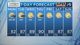
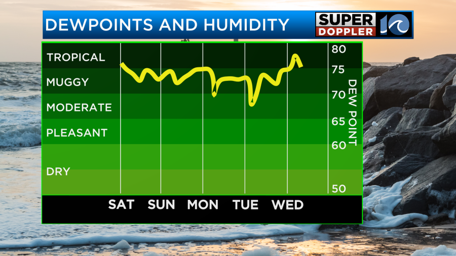
Summer has been off to a HOT start across Hampton Roads with temperatures well into the 90s this past week. Not only have the temperatures been up but the dew points have also been high as well making it feel sticky and uncomfortable outside.
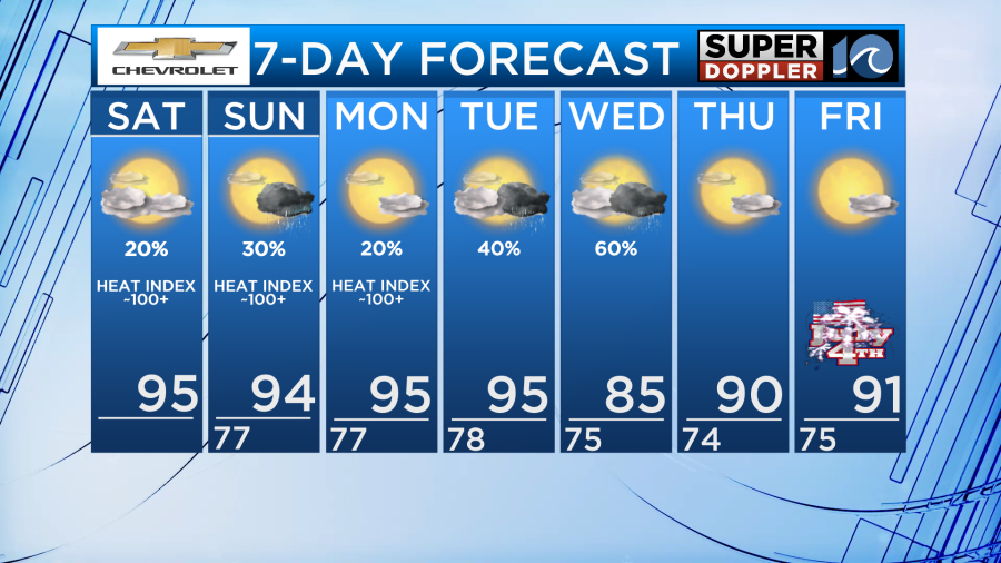
Unfortunately, as we head through the next few days, the high humidity is going to stick around as our wind remains generally out of the south due to an area of high pressure circulating near Bermuda.
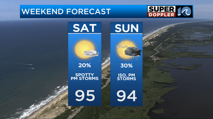
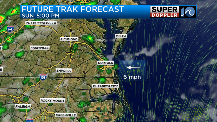
There could be a little bit of relief in store this weekend in the form of afternoon showers and thunderstorms, but it certainly will not be for all of us.
Rain chances will be slim and any storm that does form will likely not hang around for very long, however, it could hang around just long enough to provide temporary heat relief.
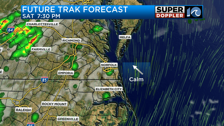
The biggest threat with these thunderstorms will be the brief periods of heavy rain. A slow moving downpour could disrupt weekend traffic on some of our major roadways especially if storms form near the beaches which will likely be busy this week. The threat for stronger storms with gusty winds and hail will be for inland areas near Richmond and west of I-95.
Despite the slight rain chance, do not let that ruin your beach plans for today. There is a low rip current risk with some small surf in the two foot range. This will be a great day for swimmers and longboard surfers especially since water temperatures have reached the 80 degree mark.

If you plan on heading to the beach, sunscreen is a MUST! The UV is very high today and without sunscreen you will likely start to burn in just 20 minutes!
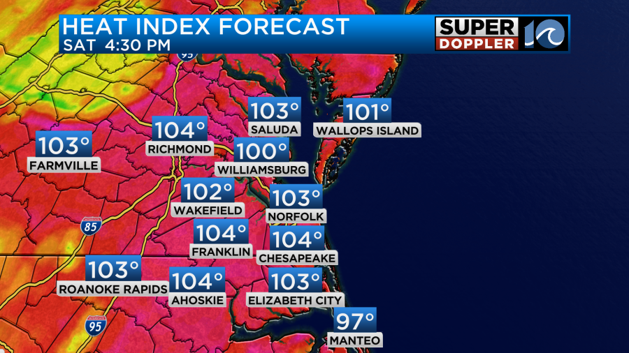
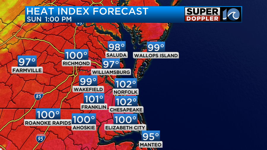
If you are not headed to the beach but want to enjoy some time outside make sure you stay hydrated as heat indices will be back in the triple digits today. It is also another day to make sure to check in on those who are vulnerable to dangerous heat like the elderly as well as young children.
Overall, rain chances remain steady for the next few days before a front moves through during the middle of this upcoming work week. This front will briefly cool us into the 80s on Wednesday before we are back into the 90s with plenty of sunshine by the 4th of July!
-Meteorologist Brian Michigan 🤙