
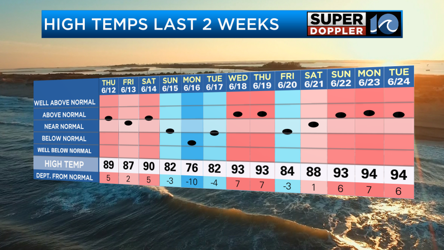
We are in the middle of a pretty rough heat wave. During the last 3 days we have had high temps well into the 90s.
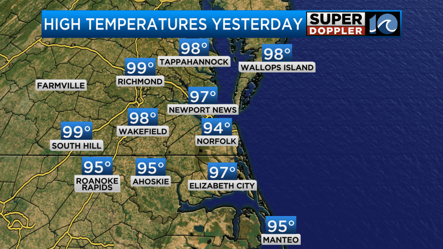
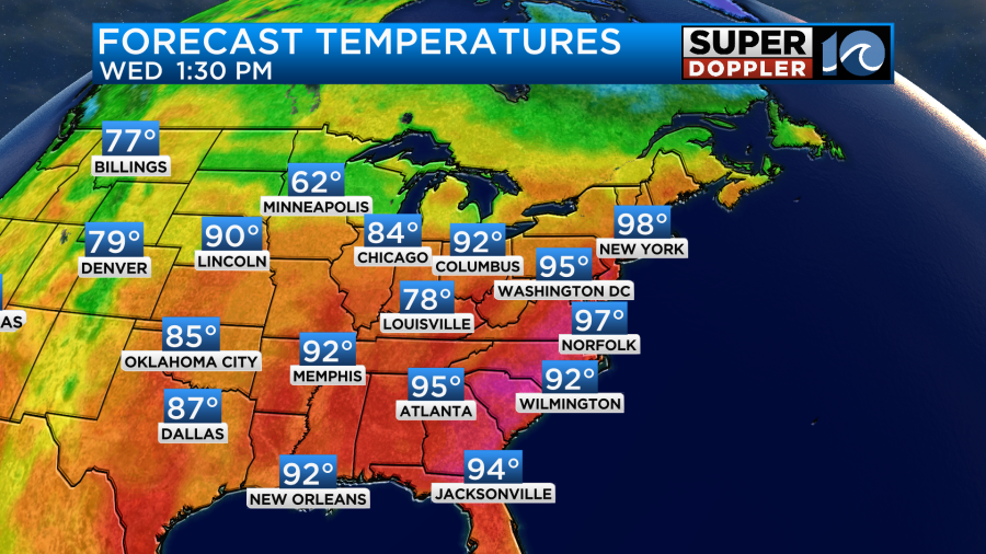
These temperatures are for Norfolk which normally does a good job representing the area. However, we’ve also had a light northeast wind over the last 3 days. So the high temperature in Norfolk has actually been about 2-4 degrees less than many other locations. Look at the map with yesterday’s high temps.
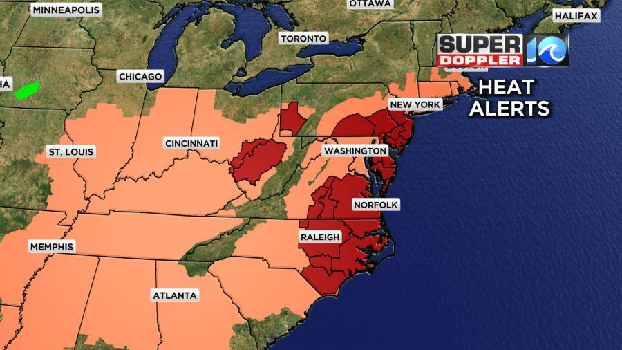
Regardless, the heat index has been up to 105-110 degrees. We’ll have similar weather in the region today. There are many more heat alerts for the eastern third of the country.
We still have the Extreme Heat Warning here until this evening. However, there are some small differences that might help a bit with the heat. The large/strong area of high pressure that has dominated the eastern U.S. weather for the past few days has started to weak just a liiitle bit.
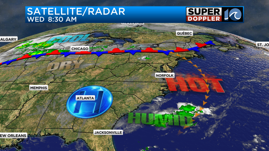
Lately this has suppressed the clouds, and it has created a lot of sinking air (which tends to heat up this time of year). However, today that weakening could be enough to give us a little more clouds along with a few PM showers and storms.
I don’t think we’ll have a lot of rain in terms of coverage, but if you do get one of those showers or storms, then it could contain some heavy downpours. While the chance for getting one of those storms is not huge, it could potentially cool you down for a bit. Keeping that in mind…The forecast temperatures are still going for the mid-upper 90s this afternoon.
The heat index will be over 105 degrees, but I don’t think we’ll have as many readings around 110 degrees this afternoon.

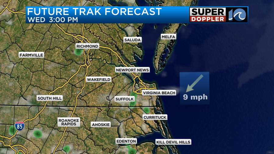
There is also that low chance that a sea breeze will develop today. That could cool down a few spots near the shore, but don’t bank on that to happen. Be sure to stay hydrated. Take lots of breaks in the shade or the A.C. if you have to work outside.
Tomorrow we’ll have similar weather. High temps will be more in the mid 90s. The heat index will be around 105 degrees or higher.
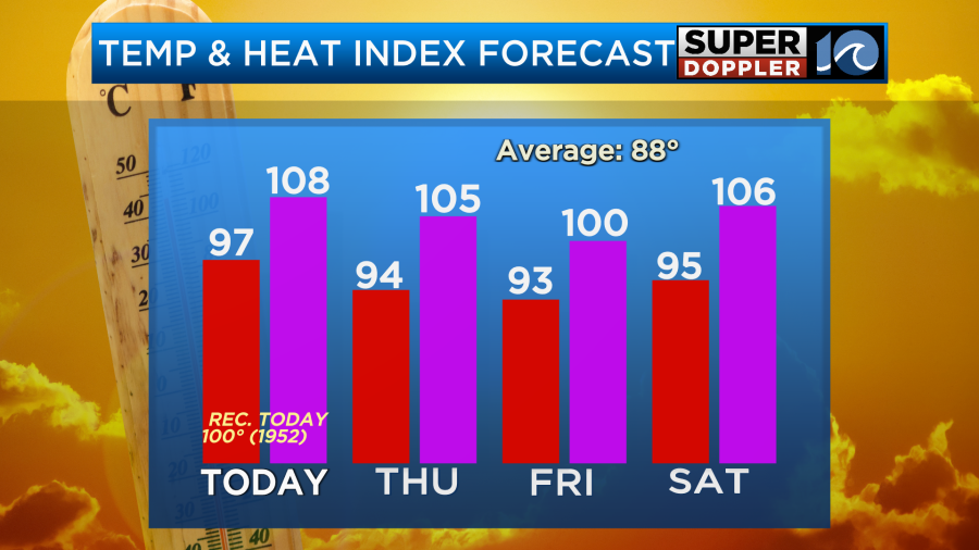
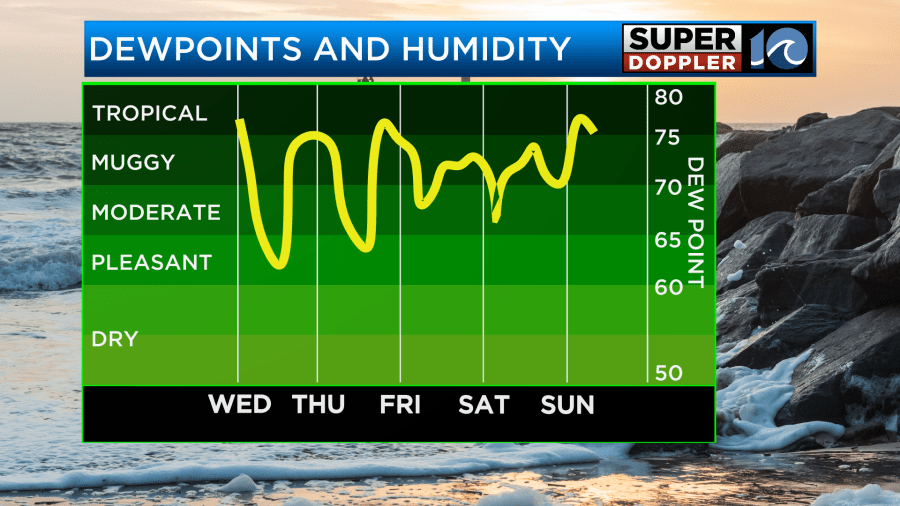
We’ll be partly cloudy with isolated showers or storms. Hopefully, the temps come down a little more on Friday, but the heat index will still be near or over 100. Then we’re back up to the mid 90s on Saturday. I don’t see much rain between Friday and Saturday. However, there may be some scattered showers and storms late Sunday. That could potentially take the temps down some more. We’ll see. There’s no doubt that the humidity will stay up for the next few days.
Finally, there was a tropical storm in the Atlantic yesterday. This was the first one of the Atlantic season. As expected, it was very short-lived. Andrea formed late yesterday morning. By early this morning it had already become post-tropical. In fact it barely showed up on the satellite.
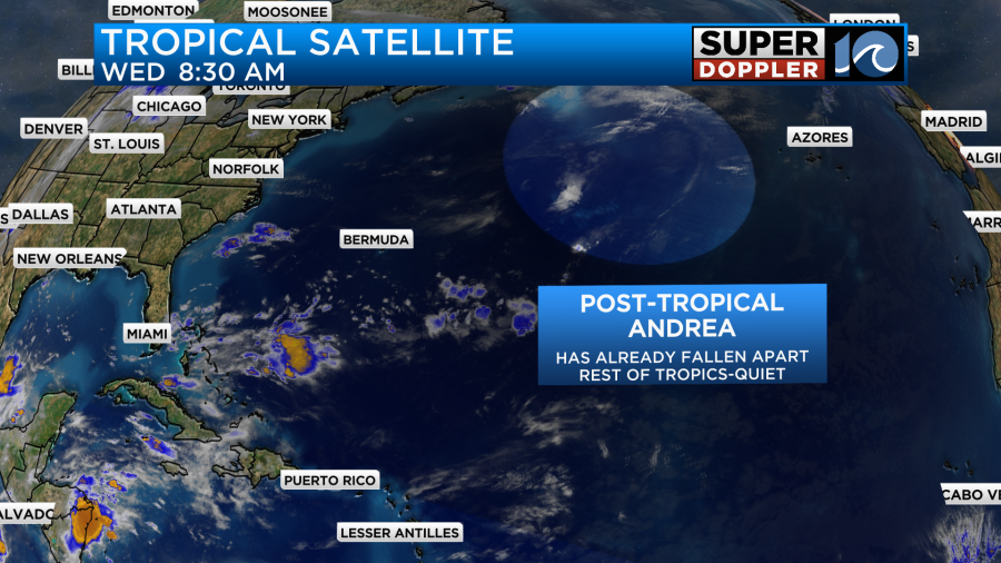
Things are quiet over the rest of the Atlantic for now.
Meteorologist: Jeremy Wheeler


