
The weather lately feels like we are already in the dog days of Summer. However, Summer doesn’t officially start until June 20th, and the dog days of Summer are usually more towards August. Having said that… Yesterday there was a lot of heat and humidity. However, my temperature forecast miffed a bit. That was due to a neat little quirk in the weather. The area of low pressure that was supposed to keep moving northeast instead lingered just offshore. So that pulled the stationary front back south a bit.
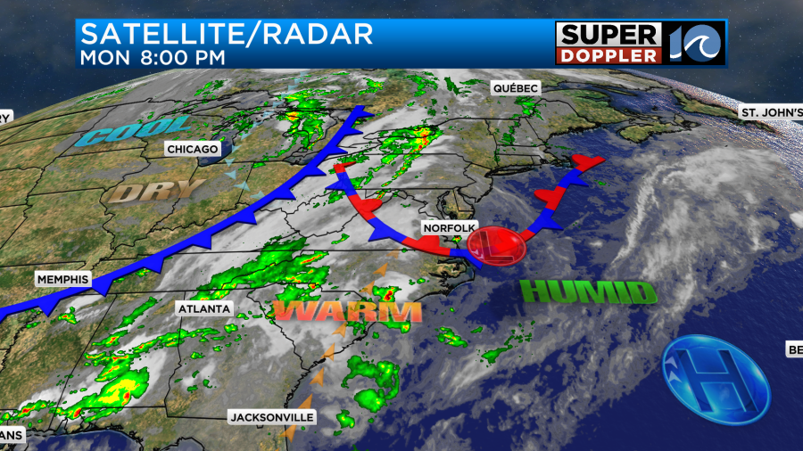
This cooled down the metro area, but it also helped to create a few strong storms in the evening. One in particular over the Southside became severe.
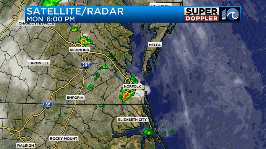
There was some heavy downpours for a time. Norfolk picked up about three quarters of an inch of rainfall.
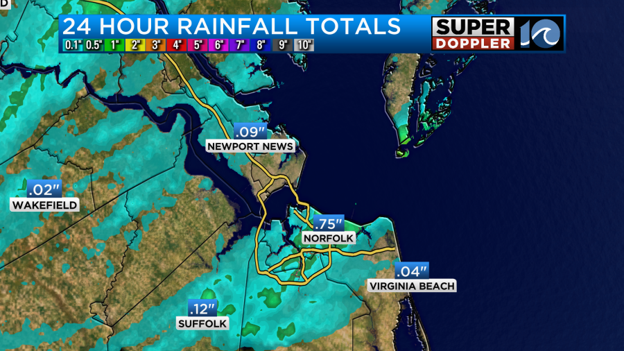
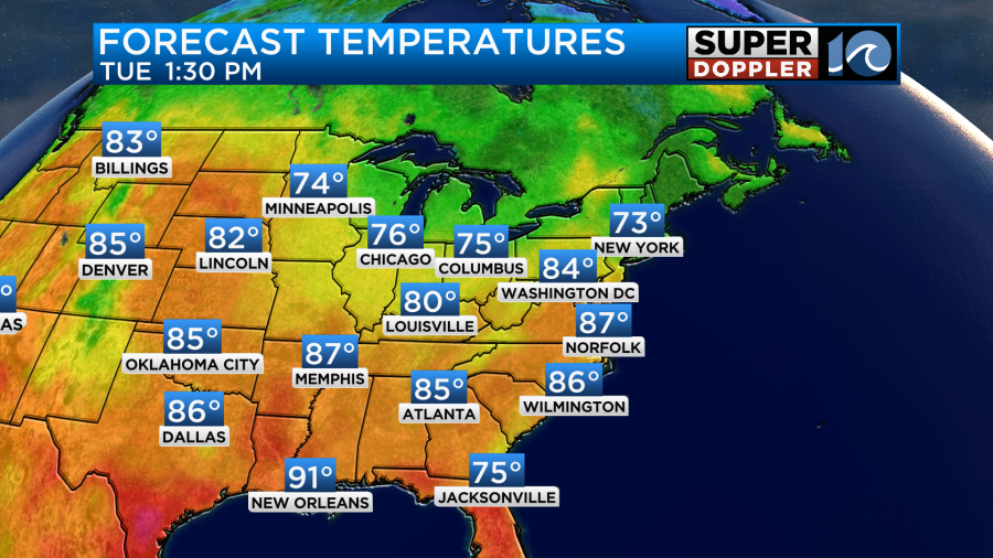
We ended up in the low-mid 80s in the metro by the way, but we did hit 90 in Elizabeth City and a few inland spots.
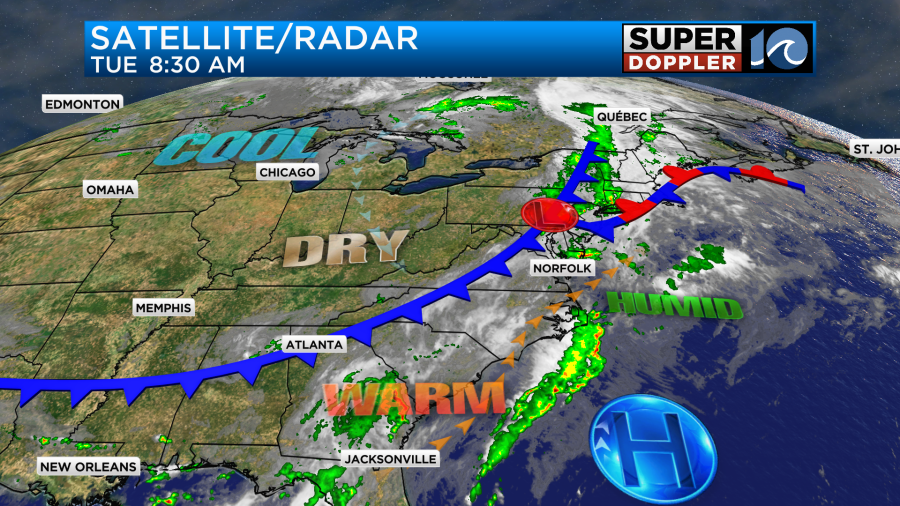
Today the low is moving away from us, but the cool front to the northwest is creeping closer to the region.
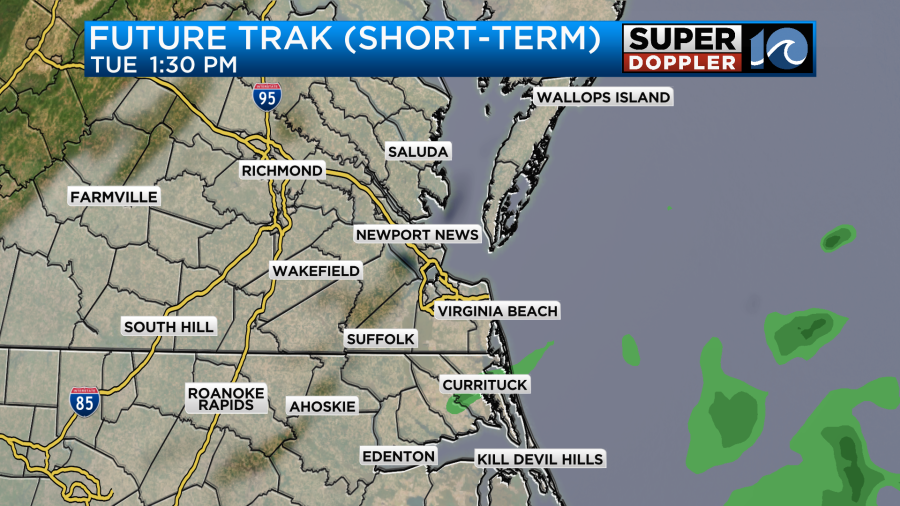
We’ll be on the warm side of the front all day. Winds will be out of the southwest at 10-15mph with some gusts to 20mph. This will keep feeding the deep moisture in the area. We’ll be mostly cloudy for the bulk of the day. We had some scattered showers this morning up until around 8:30am. Going forward we’ll have some quiet weather for a while. The models don’t show much rain between the late morning and mid-afternoon. Our model is even pretty quiet through 5pm.
However, some of the other models have at least a few showers and storms popping up between 1 and 5pm.
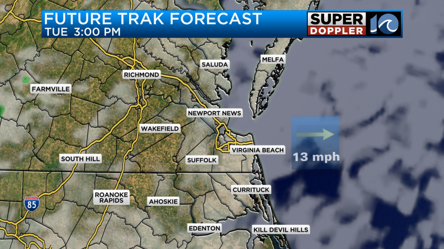
I’m just a little leery about having no rain this afternoon as we’ll be pretty warm and humid with that boundary fairly close by. Having said that, the focus on the models is more towards the evening. They bring in some scattered showers and storms in from the west.
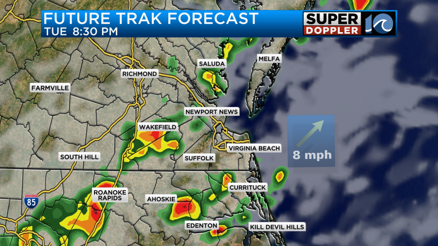
This is when there could be some strong to severe storms. The main threat would be strong gusty winds with some brief downpours possible.
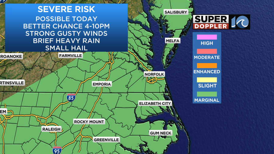
They should end by about 10-11pm. Then we’ll have quiet weather overnight. High temps will be in the mid-upper 80s today, but it will be very humid.
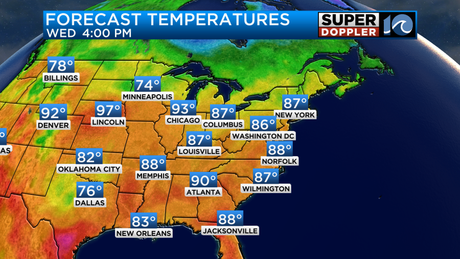
Tomorrow the front will stall out over the region, but we should have some (slightly)y drier air move in at the surface. There will probably be a little more dry air moving in at the mid-levels. So other than some isolated showers in the morning. We should have a mostly rain-free day. High temps will warm to the upper 80s.
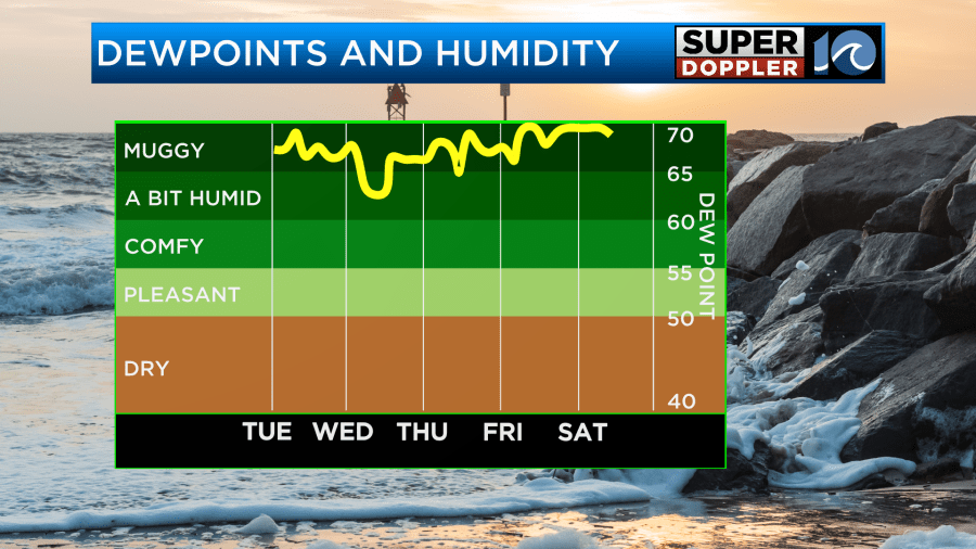
Dew points will still be in the 60s. Maybe they will drop a few degrees, but our model has backed off of the slight drying recently.
For now Thursday looks quiet and hot. High temps will aim for 90 degrees.
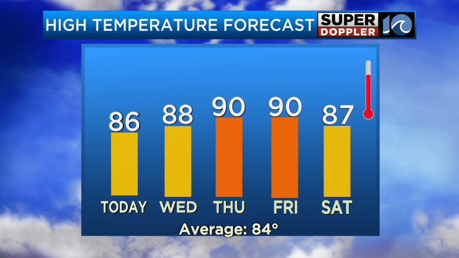
The heat index will probably be in the low-mid 90s. We’ll have similar weather on Friday, but there will be a few PM storms on Friday. Then on Saturday we’ll have an increased chance for scattered showers and storms between the afternoon and evening. This will be as a cool front to the north sinks south. IF the front stalls out sooner, then maybe we’ll be able to drop the rain chance. We’ll see. It will be warm and very humid regardless. I’ll talk more about that in tomorrow’s weather blog.
Meteorologist: Jerem Wheeler


