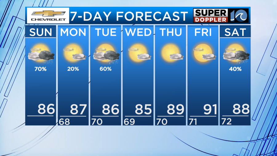
We lucked out for Harborfest yesterday as storms moved out of the area just in time for the fireworks show! Today could be a bit of a different story though as storm chances look to be a bit more widespread.
A slow moving cold front will continue to allow for the increased storm chances along with plenty of heat and humidity. Highs will be in the mid to upper 80s but it will feel closer to 90 since dew points are still high. While it may not be a total washout, be sure to keep an eye to the sky if you plan on doing anything outdoors or going back out to Harborfest.
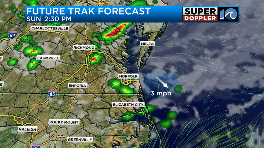
After some heavy rain and thunderstorms this morning, short range guidance suggests we could see a short break in the storms for the midday and early afternoon. Then, around 2-3pm scattered showers may begin to develop.
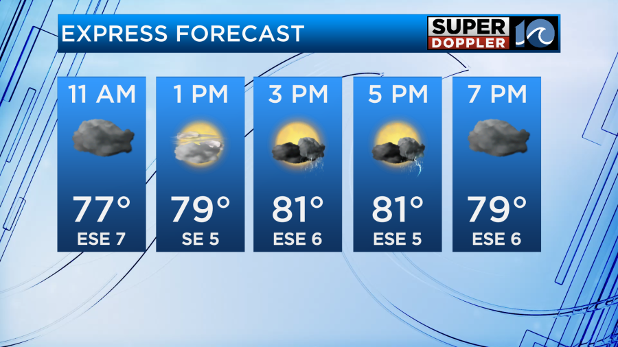
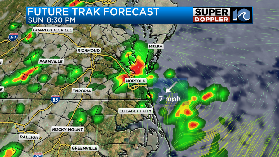
As we head into the early evening, it is possible that the coverage becomes more numerous and some stronger storms may develop.
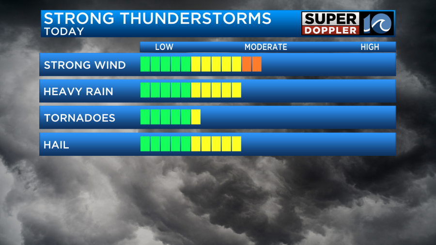
The storm prediction center has our entire area in a level 2 out of 5 risk with the main concerns being gusty winds and the potential for large hail of over an inch in diameter. We also cannot rule out an isolated tornado so stay weather aware.
As we head into tomorrow morning, we will be dry with just a few clouds around. Winds will be out of the southwest allowing for continued warmth and humid conditions.
As the afternoon comes around, a sea breeze may develop and push onshore. As it does so, it is possible for a stray shower or storm to form along the boundary but coverage will be very slim.
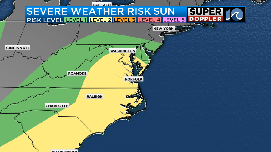
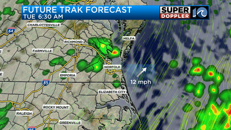
During the day on Tuesday, another front looks to enter the region and bring another round of showers and thunderstorms. Rain may be a bit more widespread but models are still coming to agreement on that. It is also possible for another round of severe storms. The storm prediction center currently gives us a level 1 out of 5 but that may also change as we get closer.
Besides from the rainfall, the heat will be our next big weather storm as temperatures remain above average heading into the week ahead.
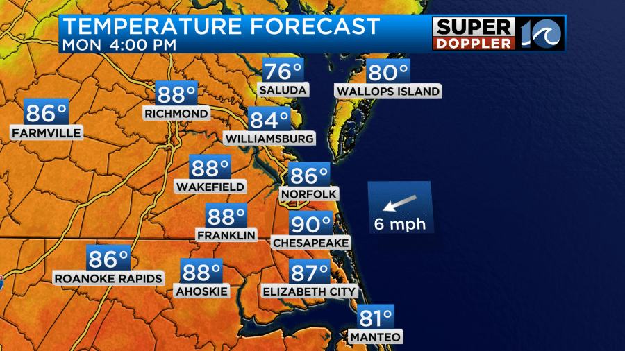
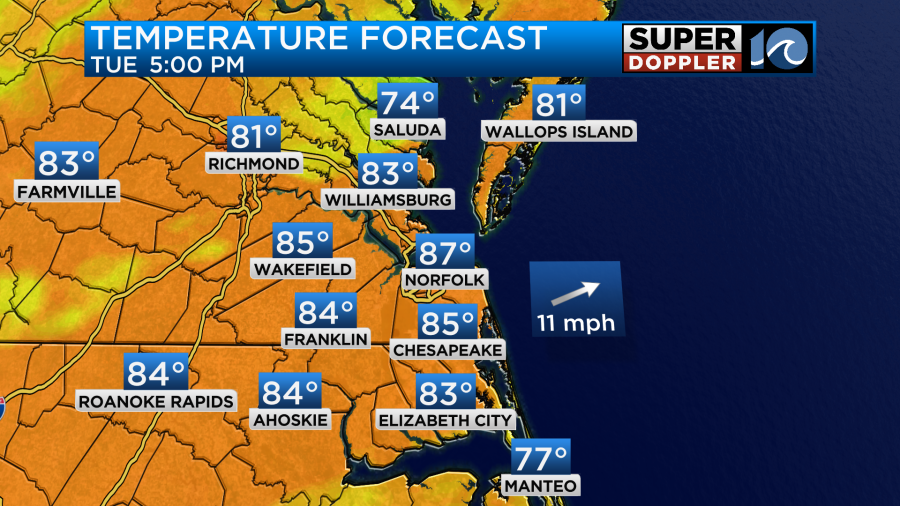
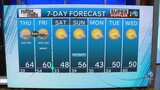
Highs will be in the upper 80s to near 90 degrees both Monday and Tuesday and with the humidity remaining high, it could feel closer to the mid 90s! After Tuesdays storms, humidity will fall down a tad, but the temperatures remain abnormally warm for the rest of the week.
Have a great day!
-Meteorologist Brian Michigan 🤙