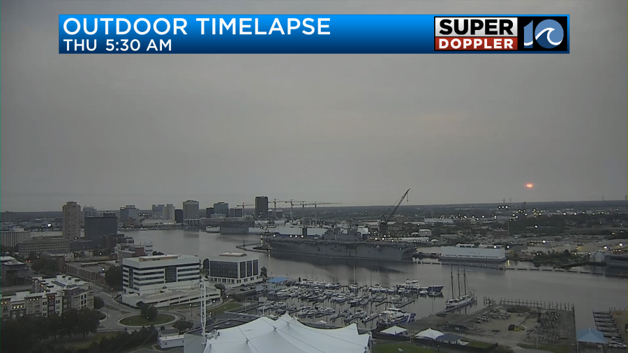
Over the last couple of mornings we had the sun briefly blocked out by the overhead haze from the Canadian wildfire smoke. However, this morning it was blocked by a little haze and a lot of clouds.
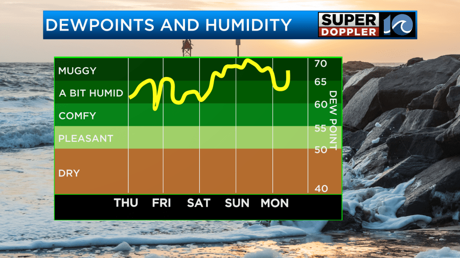
Moisture has increased over the region over the last 24 hours. The nice dry air that we had for a few days is now gone. The haze won’t really be much of a factor in today’s weather. However, an area of low pressure to our south will. The low is weak, but it is getting closer from the south.

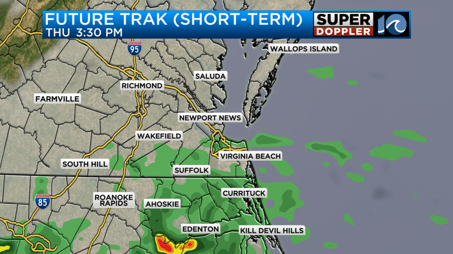
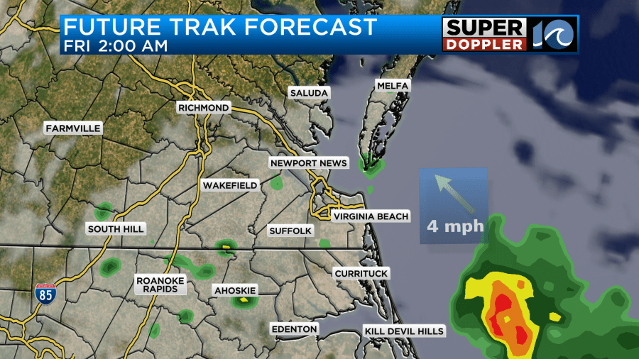
Meanwhile, high pressure is moving offshore. Moisture is increasing at all levels. There will be a southeast wind today at 8-12mph with some higher gusts near the shore. Despite the increasing moisture we won’t have much rain through midday in our area. That’s probably due to the slow motion of the low. However, we will have some scattered rain showers moving in during the afternoon. Here is our Future Trak model during that time:
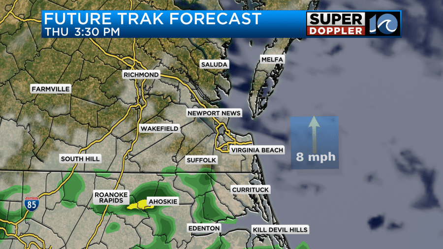
The models handle the rain coverage differently. Our model is fairly lean with the rain now between the afternoon and evening, but it does have some scattered/light showers. The theme is higher rain chances south with less rain to the north.
However, the HRRR model and the hi-res NAM have a good amount of rain showers, and they have them a little farther to the north.
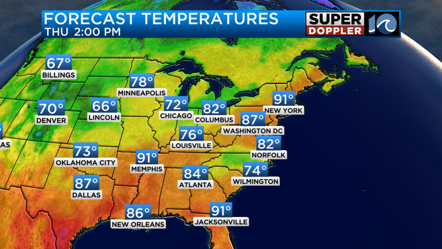
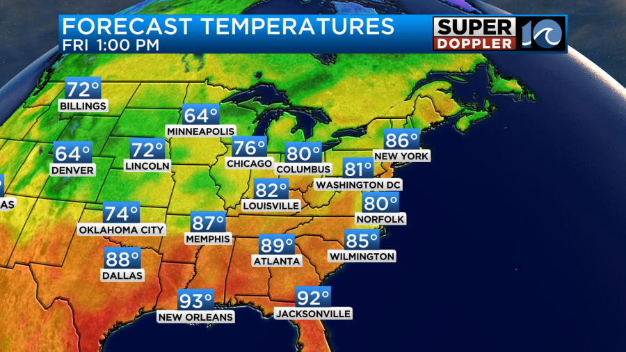
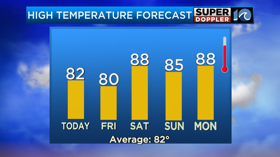
I will say that our model doesn’t usually pick up on very light precip very well. So that could be one reason why. At least the models are only showing light showers now,,, for the most part. yesterday, Future Trak had some heavy rain over parts of North Carolina (for today). Either way, high temps today will probably make it into the low 80s this afternoon.
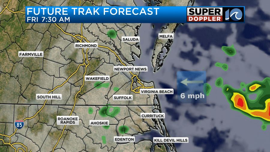
The scattered showers will push a little more to the north tonight. This will be as the area of low pressure skirts our region.
There will probably be some pockets of drizzle in-between the rain showers overnight. Tomorrow morning the low will begin to push out to sea. However, there will be a few wrap-around showers behind it.
The good news is that the showers will probably push out by midday. Then we’ll have some drying and clearing during the afternoon. That’s good news for the parade of sail and Harborfest. However, the wind may gust up a little behind the low. It will be out of the northeast. Some of the gusts will be between 20 and 25mph.
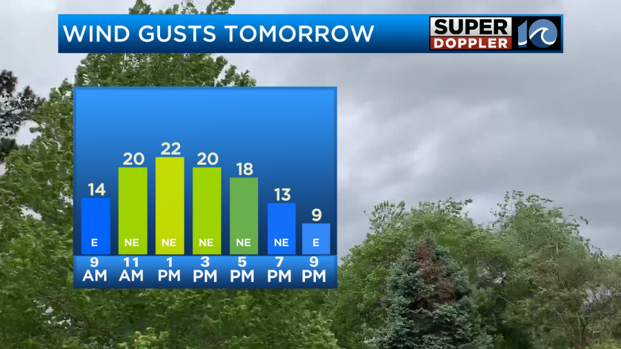
Despite the clearing that wind will probably keep the high temps down a bit. We’ll likely top off in the upper 70s to low 80s.
The low will be long-gone by the weekend, but unfortunately a cool front will move in and stall out over the region. This will bring us some scattered rain showers and thunderstorms. As of this time it looks like there will be a few showers Saturday morning with a few more storms possible in the afternoon.
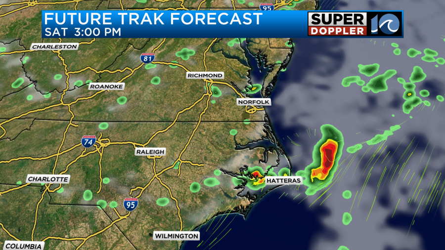
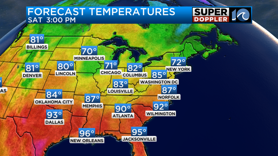
I will say that this morning’s model runs did back off the rain a little on Saturday. Either way it won’t be a washout. Otherwise, we’ll have a mix of sun and clouds with high temps in the upper 80s.
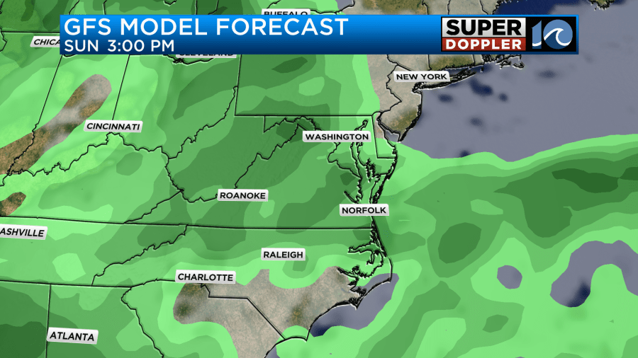
As mentioned, the front will stall out over the weekend. So there may be some more scattered showers and storms on Sunday. Again… NOT a washout.
High temps will be in the 80s.
We’ll stay warm and humid going through most of next week.
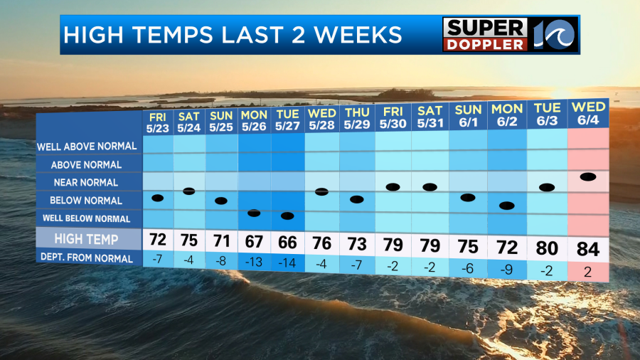
This is in contrast to the last couple of weeks which have been mostly below average.
One more thing before I go. The models really backed off the rainfall forecast since yesterday. Especially our model. (The Euro actually got wetter since it had nothing before). I think we are looking at a quarter to a half an inch for those that do get the rain.
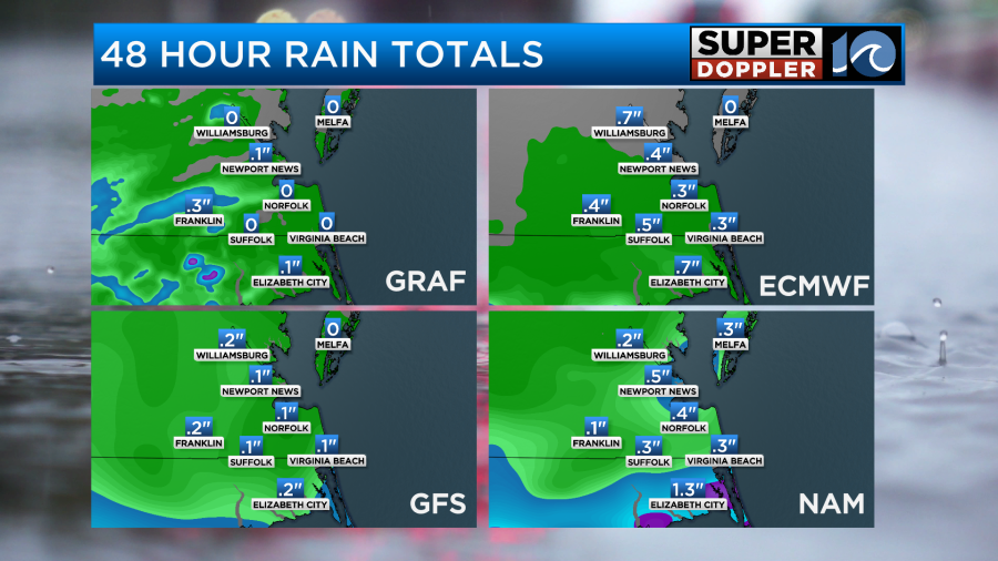
There may be some higher amounts over North Carolina.
Meteorologist: Jeremy Wheeler


