
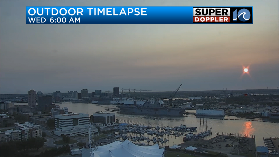
This morning we had quiet weather again. We had lots of sunshine again. But we also had that overhead haze as well.
As I mentioned yesterday, this haze is from the long-travelled wildfire smoke coming out of the numerous wildfires in Canada. The smoke dropped down to the south. Then the smoke rolled east. Today is seems that a wig waft of smoke will come back in off of the ocean.
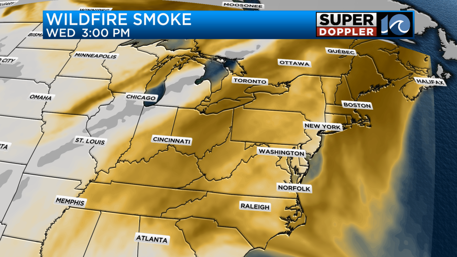
The problem today is that the smoke and haze may drop down a little lower. Our Future Trak model shows higher concentrations at the surface compared to yesterday.
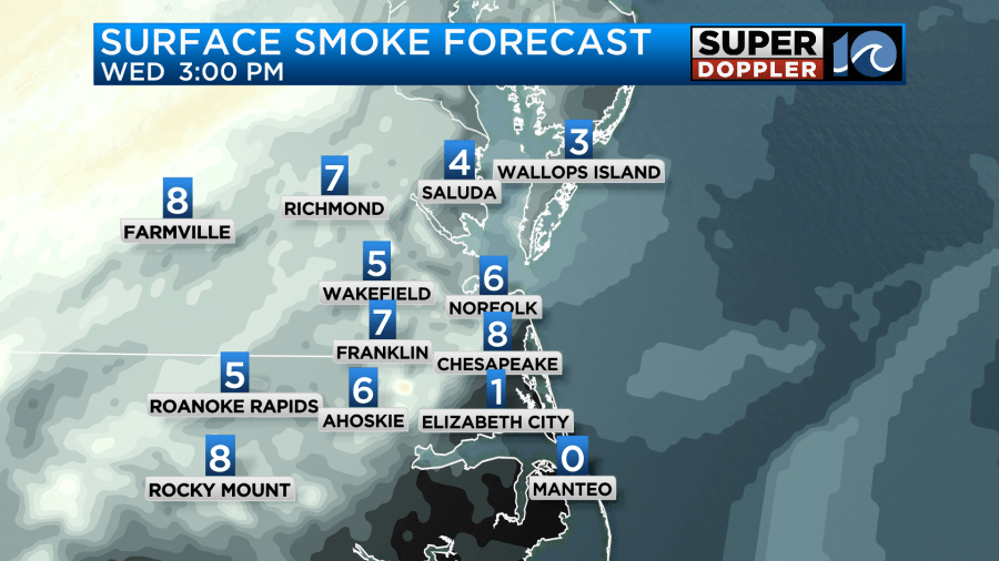
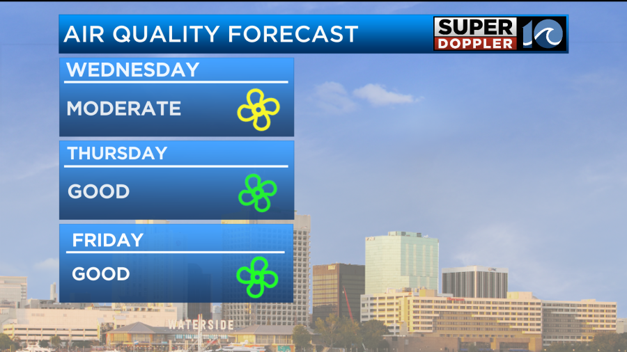
This suggests that our air quality could be up to moderate levels for some people.
That could affect folks that have asthma or other health issues. I will say that one other source I look at keeps the levels just below moderate levels for air quality.
The good news is that this will be temporary. Tomorrow the air quality should clear up. However, that is due to the wind increasing from an approaching low. More on that in a moment.
Aside from the haze today we should have some nice weather. High pressure is overhead.
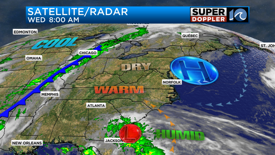
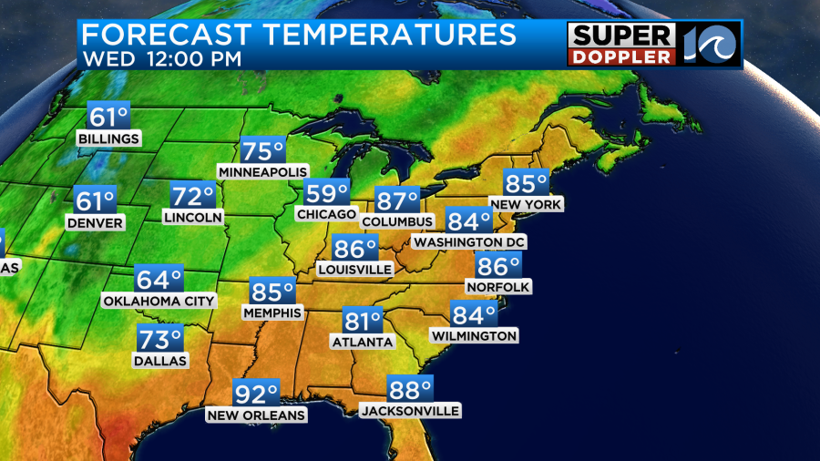
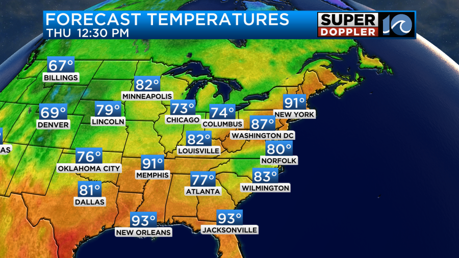
We’ll have lots of sunshine today, and it will be dry. Dew points are increasing a bit, but they are still in the 50s. Winds will be out of the southeast at 8-12mph. High temps will rise to the mid-upper 80s.
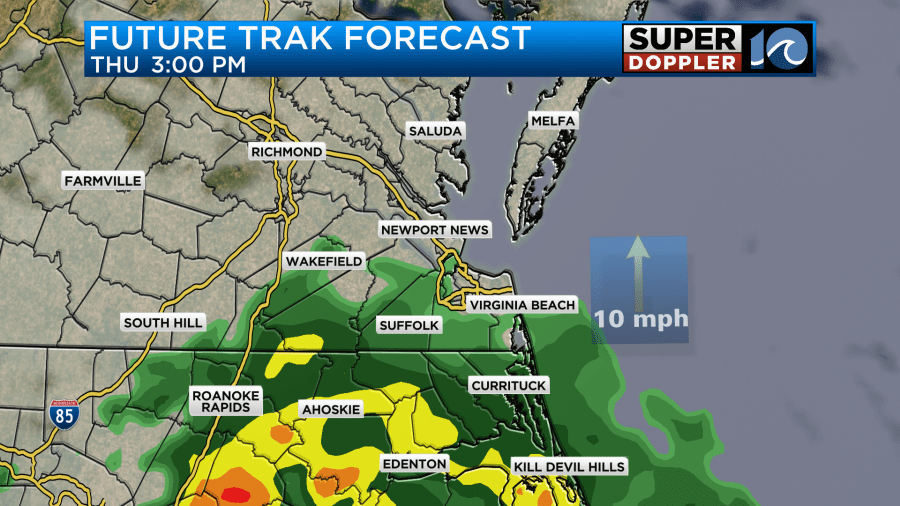
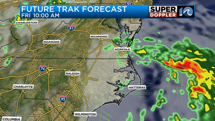
By tomorrow the low will creep up into the Carolinas. Rain will slowly push up into our region through the morning.
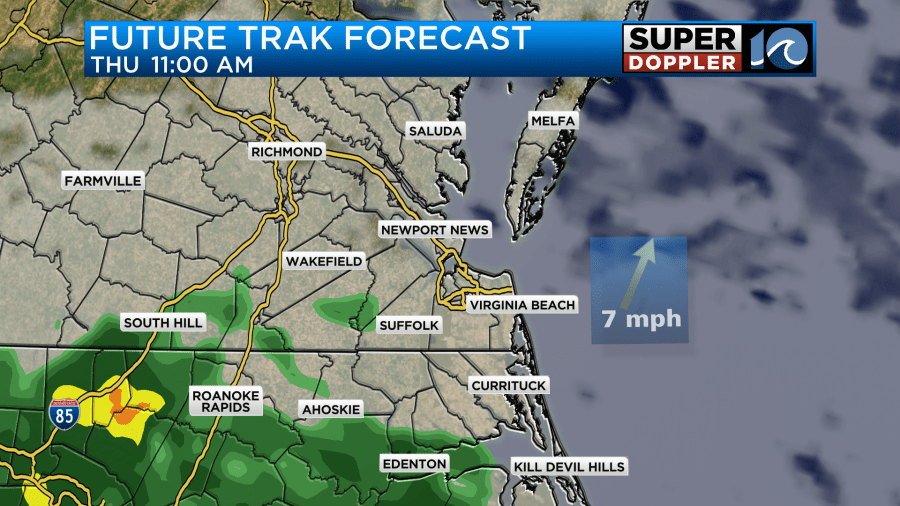
We’ll have lots of clouds through the day. There will likely be lots of rain over northeast North Carolina as that area will be closer to the low. A few showers will also push north up into southeast Virginia.
The models are mostly in agreement with this scenario. However, the European model still keeps the low (and most of the rain) farther to our south. I don’t tend to use it in short-term forecasting much, but it does do a great job at long-range forecasts. With the extra cloud cover and rain chances our high temps will be down a bit. They will be closer to 80 degrees.
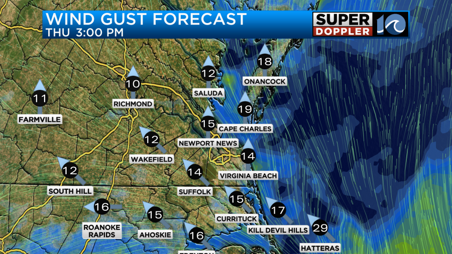
The wind will be out of the southeast at 10-15mph with a few higher gusts. Especially down towards Hatteras.
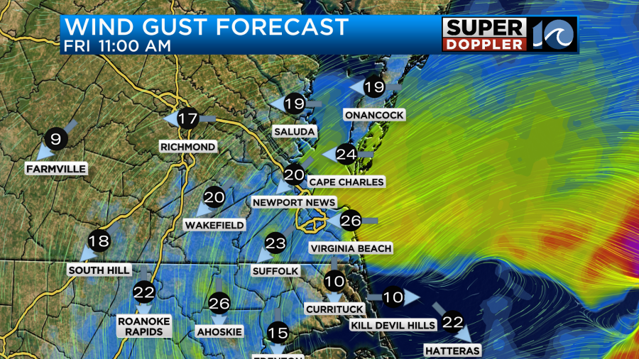
The low will roll offshore Thursday night into Friday morning. We’ll have some scattered rain showers on the back side of the low.
The wind will pick up behind the system as it pushes offshore. We may have some gusts, briefly, between 25 and 35mph coming in out of the east/northeast.
The rain though should steadily push offshore as we go into the afternoon. Then we’ll dry out by the evening.
Due to the difference in how the models are handling this system we have wildly different rainfall forecasts from the 4 models.
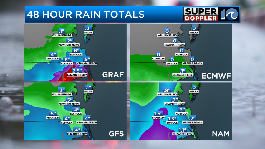
I’m leaning on the wetter forecasts, but I’m not going quite as high as the GRAF model over North Carolina.
The onshore breeze and extra clouds should keep the temps down on Friday. Highs are now aiming for the upper 70s.
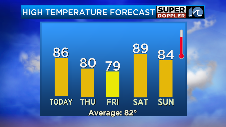
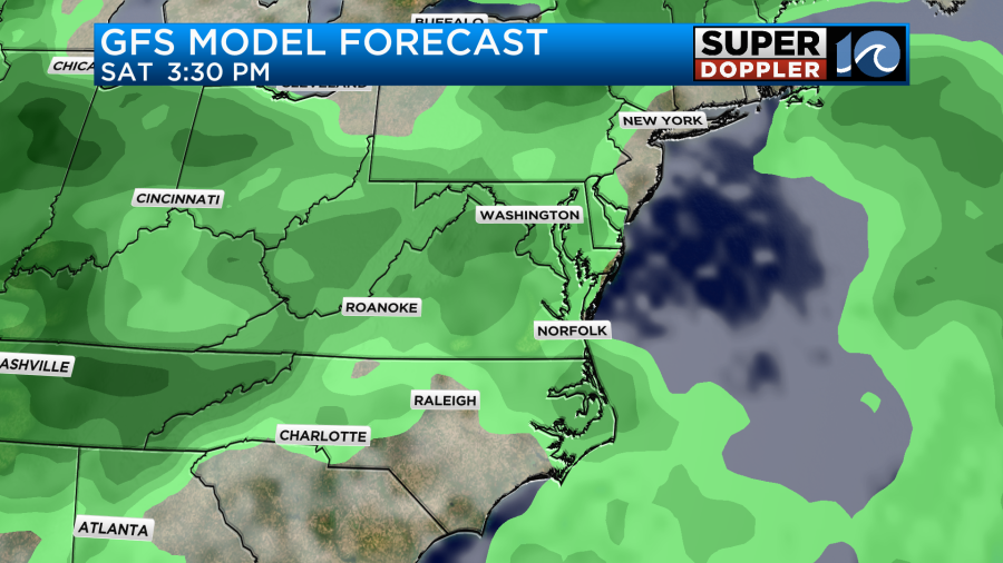
We will probably warm up on Saturday with partly cloudy skies for a long while. High temps will be in the upper 80s to near 90. However, a cold front will be approaching from the west. So we’ll probably develop some scattered showers and storms later in the day.
The front will drop in on Sunday, but now there’s some indications that it will stall out. That could bring us a few more showers and storms between the afternoon and evening. High temps will be in the low-mid 80s.
I’ll have more details on the weather between tomorrow and Sunday in tomorrow’s weather blog.
Meteorologist: Jeremy Wheeler


