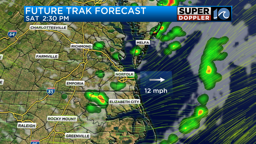
A low pressure system now centered across the Tri-state area of New Jersey, New York, and Pennsylvania brought some pretty strong storms through parts of the area yesterday. That same system will bring us another chance for storms this afternoon but it will not be as intense.

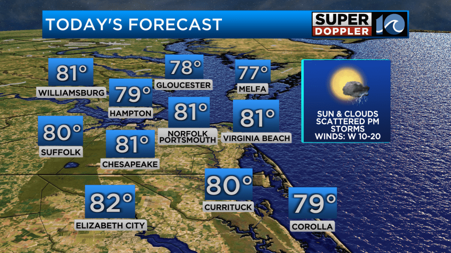
Most of the day should remain dry with a mix of clouds and sunshine. That sunshine will help warm us up to near 80 degrees for most areas during the afternoon. Dew points will be lower today as well, only in the mid-50s, so it will feel more comfortable.
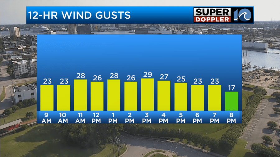
Other than the chance for rain this afternoon, our day will also feature strong wind gusts upwards of 30mph from time to time so hang onto your hats.
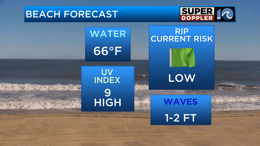
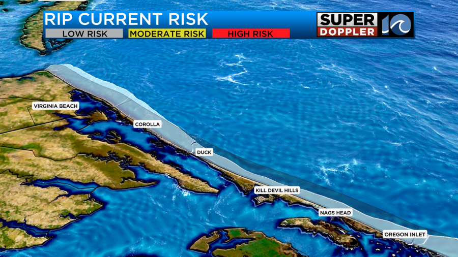
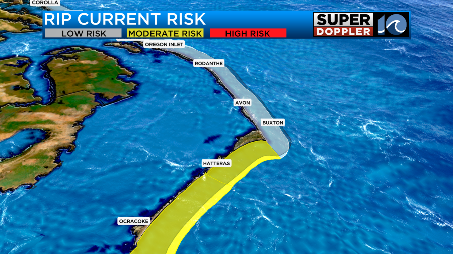
Strong winds like this may also cause problems on the beaches since the sand may blow around a little bit. If you do plan on making today a beach day, make sure your umbrellas screw into the ground deep to prevent them from blowing away. Otherwise, the beach should be nice with warm air and a low rip current risk.
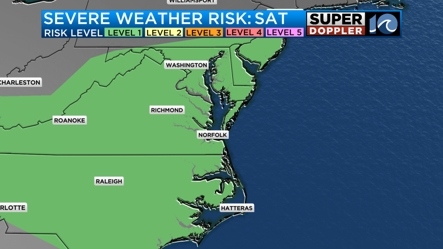
However, a boundary rotating around that same area of low pressure that brought storms yesterday will push through this afternoon. Showers will be a bit more scattered in nature due to the air not being as moist but still the chance is there for a downpour or two. Some storms may even become severe with the main threats being hail and gusty winds. The storm prediction center has a low risk of this occurring, only a level 1 out of 5.
After this boundary moves through this evening, conditions will clear out overnight and set the stage for a beautiful Sunday! Expect sunshine from start to finish with high temperatures in the middle and upper 70s. Low humidity will also be around to make the air feel refreshing so outdoor plans are looking good!

Our next rain chance across the area won’t come until later next week so enjoy the bright sunshine and summer-like heat as temperatures return to the upper 80s to near 90 degrees by Friday!

-Meteorologist Brian Michigan 🤙