Rain, rain go away… I think we’re all ready for some dry time for a while. It’s coming. But we have to get through a few more rounds of showers and thunderstorms before we dry out. This morning there was a soaking rain over much of the region.
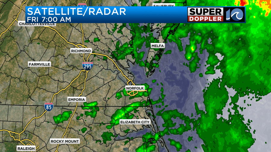
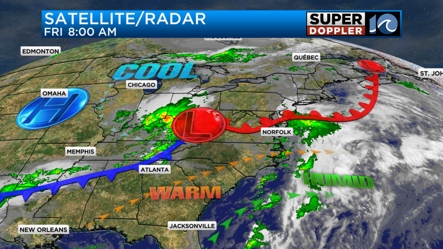
It caused a lot of problems on the roads this morning during the commute. The morning showers will push out as a warm front rises to our north. The front will keep moving north today with an area of low pressure and a cool front approaching from the west.
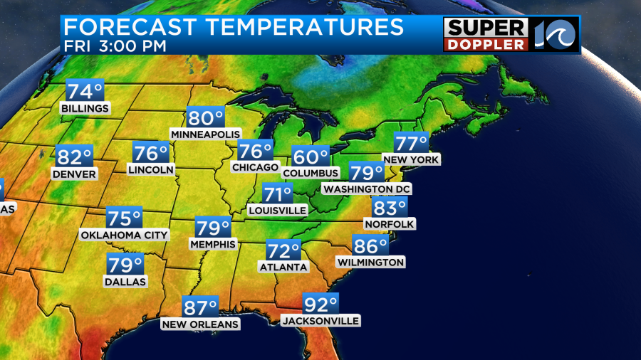
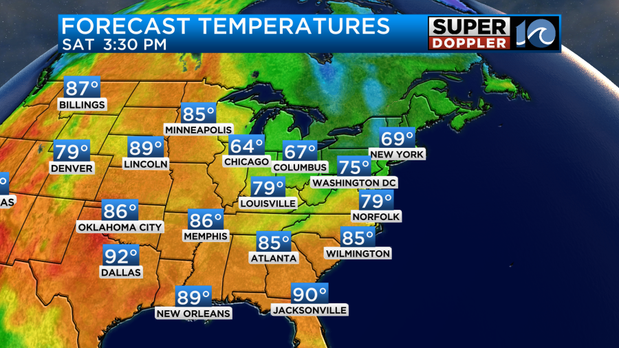
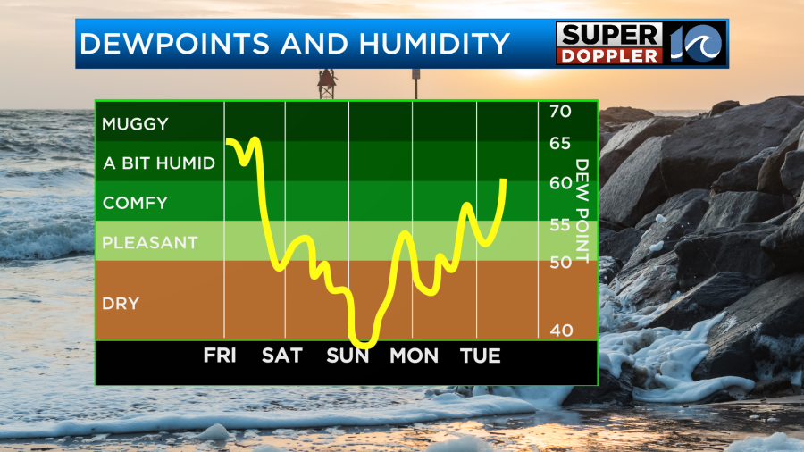
We’ll clear things out for a while between the mid-morning and the early afternoon. It should be fairly nice out, but it will be humid. Dew points are in the mid 60s. As we get into the mid-afternoon a few showers and storms could pop-up. There shouldn’t be too much though. I have a 30% chance for rain between about 2pm and 5pm. Winds will be out of the southwest at 8-12mph. However, winds will gust up to 20-25mph as we head towards the evening. High temps will be in the low-mid 80s today.
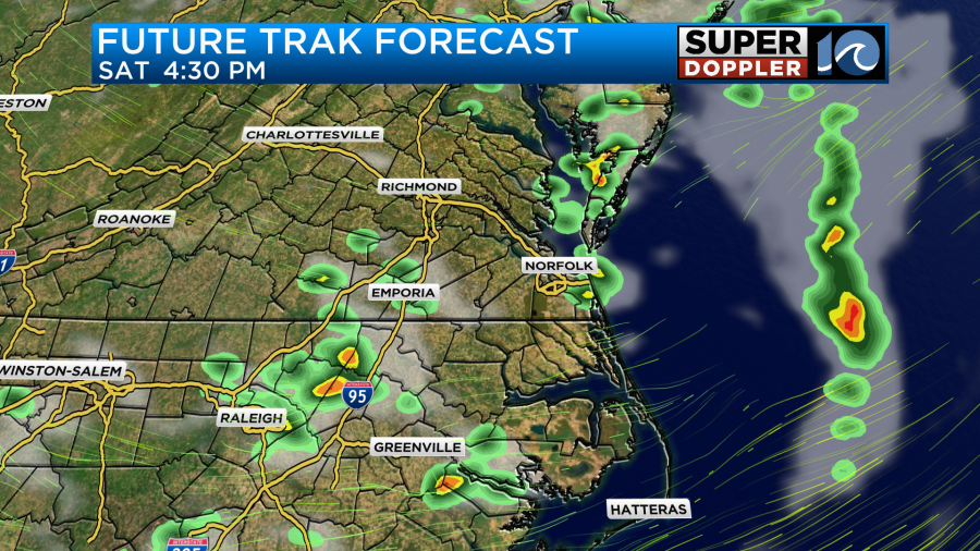
As we go into the evening commute starting up around 5pm we’ll be tracking a line of showers and storms moving in from the west. This line could produce brief heavy rain and possibly some strong-damaging winds. The models differ a bit on the timing, but the window is basically between 5 and 9pm with more of an emphasis between 6 and 8pm.
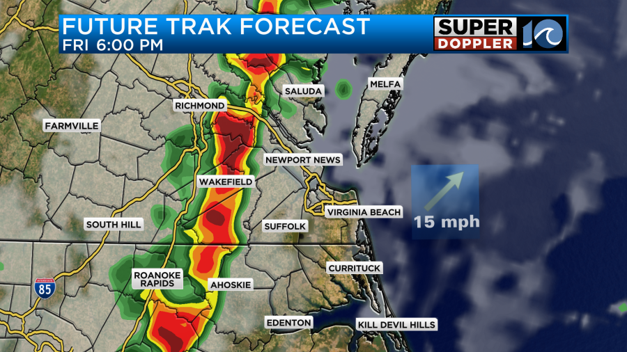
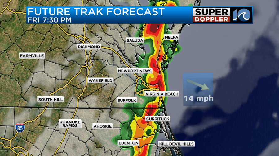
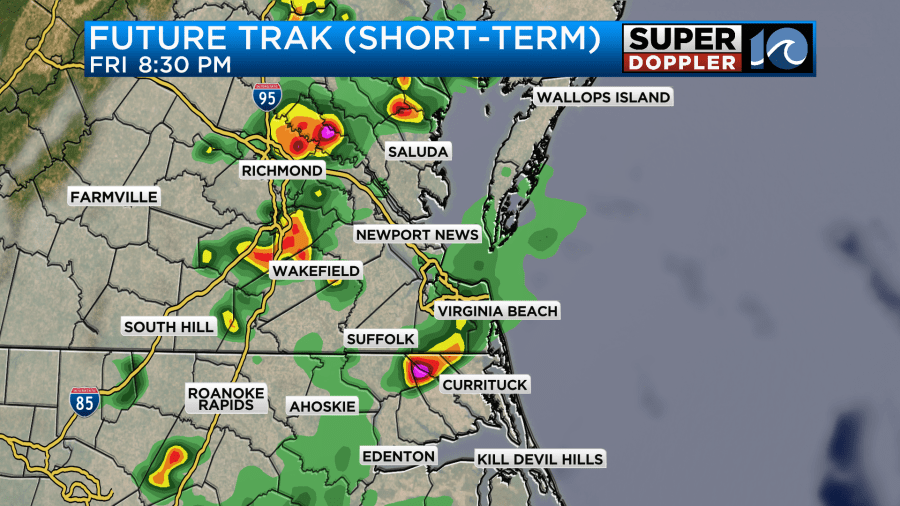
There is a risk for severe weather during this time.
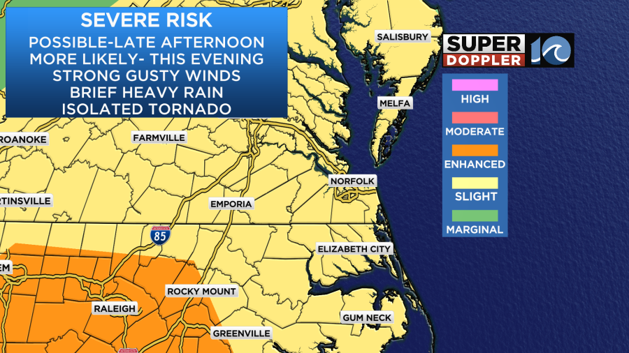
The main threat will be strong-possibly damaging winds. There will be some brief heavy rain as well, but I don’t expect much flooding due to the fast nature of the storms. There could be some isolated tornadoes, but that threat is lower than the straight-lined winds. Keep an eye to the sky and on the wavy weather app this evening if you are out and about.
The storms will kick out then later tonight. Then we’ll have quiet weather behind the front overnight. Lows will be in the 60s.
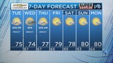
Tomorrow we’ll start off with quiet weather. We’ll be partly cloudy for a while and a bit drier. However, a second cold front will be headed for the area later in the day. So we may have a stray shower or two by midday. Then in the afternoon we’ll have a few scattered showers and storms develop.
These might not be severe, but a couple of strong storms will be possible. High temps will rise to near 80 degrees.
However, we may only rise to the mid-upper 70s if the rain starts up a little sooner. We’ll FINALLY dry out Saturday night into Sunday.
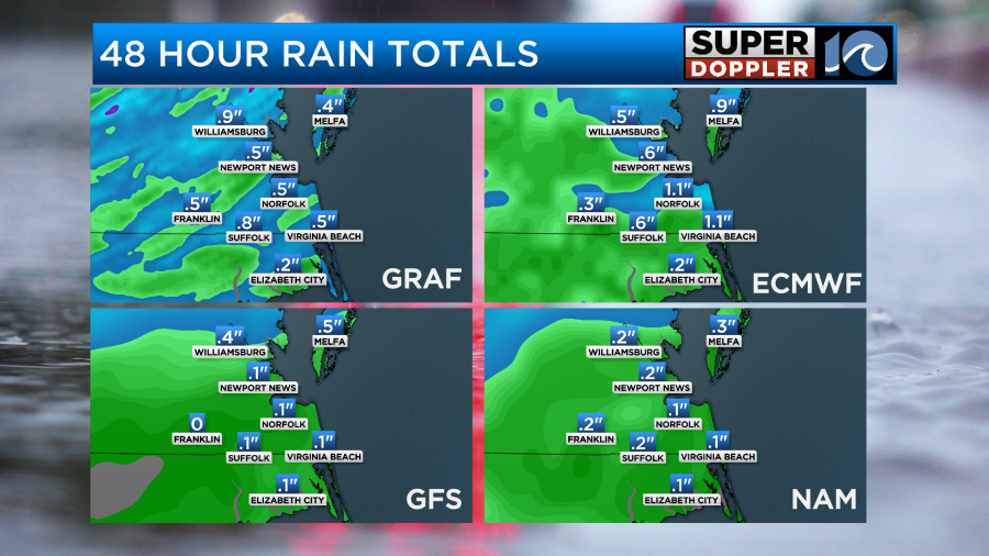
Before the rain ends we could get about a quarter to a half an inch of rainfall. Some locations could get about three quarters of an inch up to an inch.
The much drier air arrives on Sunday. Dew points will drop to the 40s.
High temps will be in the upper 70s Sunday.
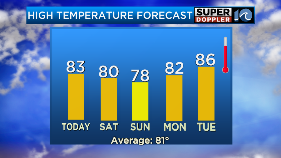
We’ll have quiet weather for the first half of next week, but temperatures will definitely warm. High temps may be near 90 by Wednesday.
Some folks are talking about tropical storm Alvin over in the eastern Pacific. Luckily it doesn’t look like it will be too strong. It will move north and affect northern/western Mexico over the weekend.
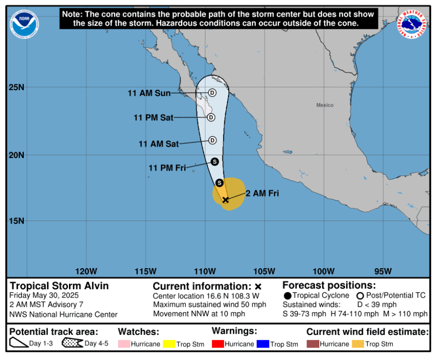
Heavy rain and flooding could be a a problem for that region though. Stay tuned for updates.
Meteorologist: Jeremy Wheeler