
A Severe Thunderstorm Watch has been issued until 11pm for the Hampton Roads area, as well as northeast North Carolina for the threat of fast moving thunderstorms capable of producing damaging wind gusts and hail.
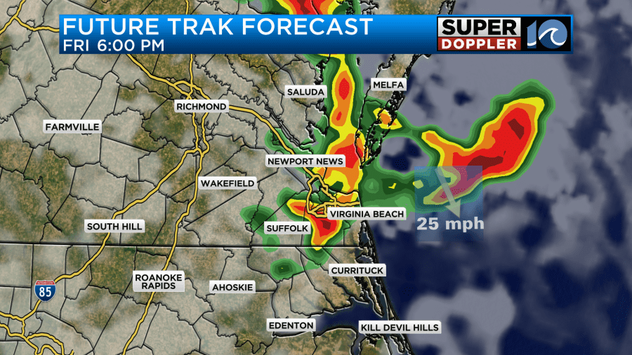
While we sit pretty until the hot, sizzlin’ sunshine, humidity levels making it feel like the mid 90s will fuel up a batch of fast moving thunderstorms approaching from our west. These should blast into the region sometime between 5 & 8 pm Friday — moving at around 50-55mph, they will be capable of producing significant wind gusts, potentially damaging. Stay weather aware through this evening.
Fortunately, these will be racing through the region, so on either side of sunset they’ll be offshore and we should be able to enjoy the remainder of our Friday night.
More details on the remainder of the weekend forecast from Meteorologist Jeremy Wheeler in the rest of his blog below:
———————————————————————————————————-
I’ll say it…. I’m tired of these storms. It’s been a long week. On the up-side we did get a lot of much-needed rainfall lately. However, we’ve had a chance for strong to severe storms, I think, every day this week.
While there was a threat for severe weather for the entire area yesterday, most of the storms formed over North Carolina.
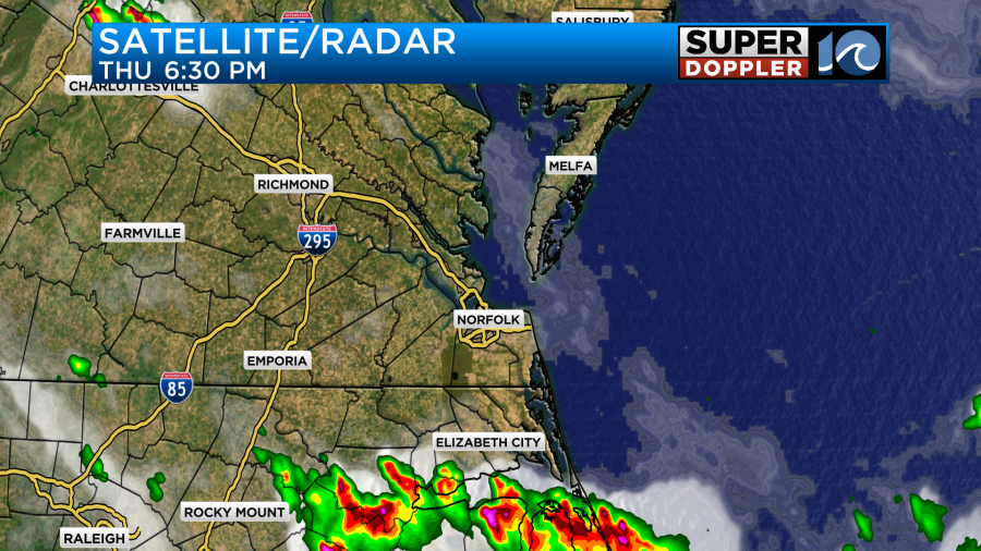
There were heavy downpours, large hail, some flooding, and even an unverified report of a tornado or water spout near Manteo.
Today we are still going to have a threat for strong to severe storms. However, things have changed. The surface low has moved out and weakened. The upper-level low has weakened and moved out to sea.
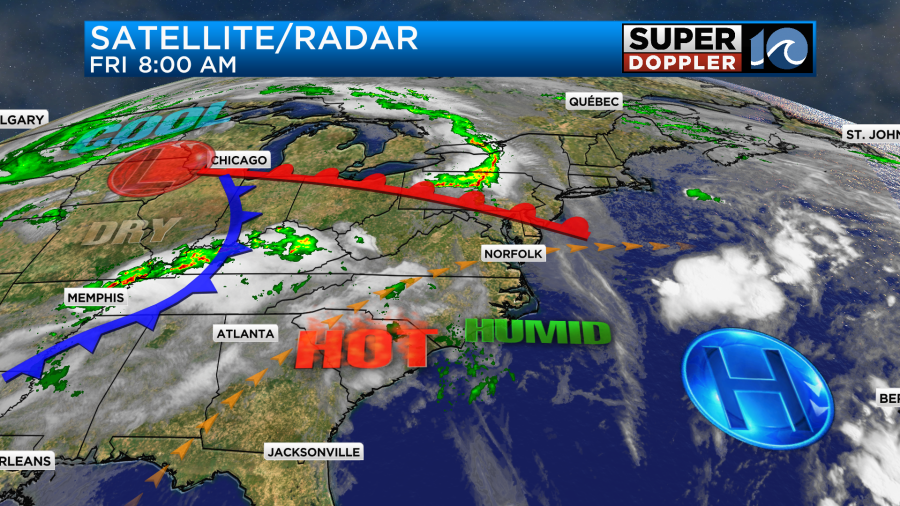
The mid-upper-level winds are fast and going from west/southwest to east/northeast. This will allow any storms to move quickly today. This morning there were some storms forming well to our west, but we had fair skies.
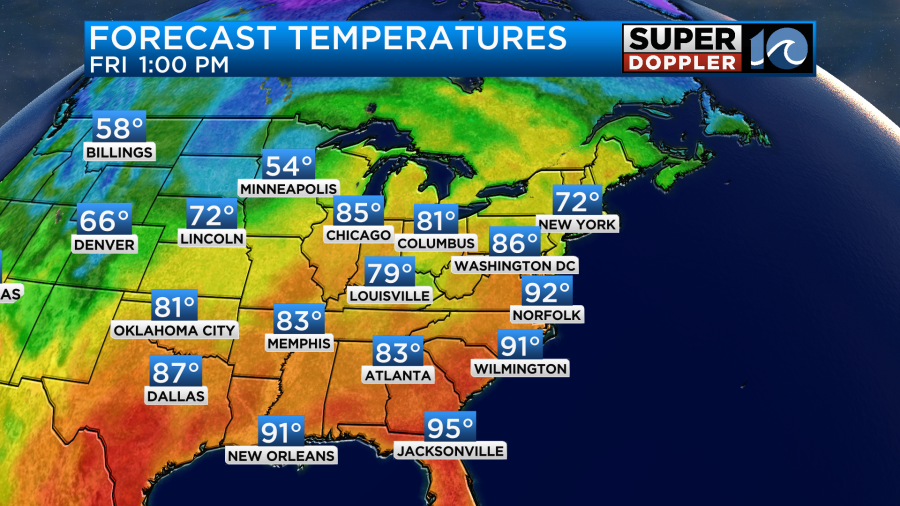
Today we’ll be partly cloudy for a long stretch. We’ll have a west wind at 10-15mph. This will allow temps to heat up into the low 90s.
The heat index will be in the mid 90s. This will be fuel for any storms that do form later today. When I got in this morning our Future Trak model had a large cluster of showers and storms arriving by the mid-afternoon. The next update (6Z) it had them more towards the 5-7pm hours.
The HRRR model also had the focus more towards the early evening. The latest update has it closer to 8pm.
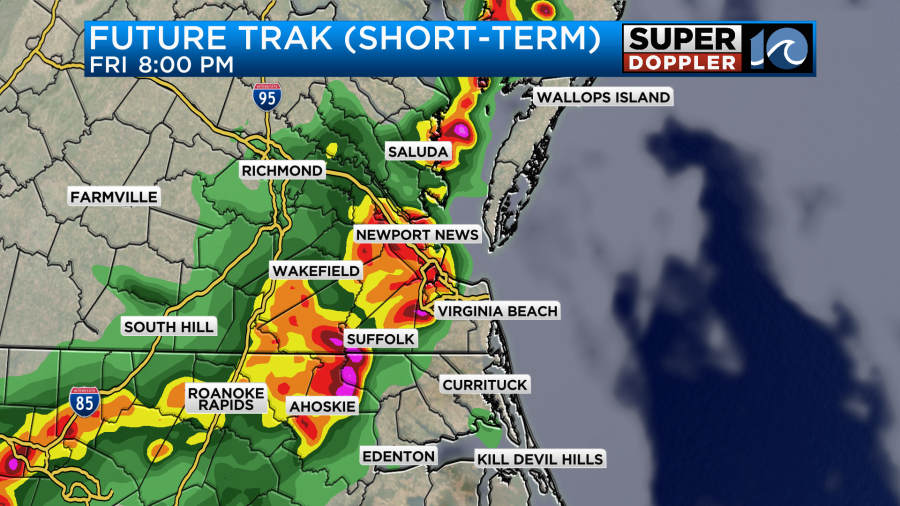
Keep in mind that the hi-res NAM, NAM, and GFS had have very little rain for the entire day and evening. So it’s a tricky forecast to say the least. Either way the Storm Prediction Center has a slight risk for severe weather for southeast Virginia and a marginal risk for severe weather for Northeast North Carolina.
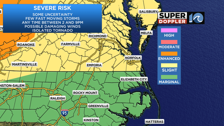
The main risk would be strong damaging winds. The storms would probably move too fast to produce much too much hail or flooding. My thinking is that they (COULD) move faster than the instability will allow them to grow too tall. However, some brief heavy rain could happen. Also, an isolated tornado can’t be ruled out, but the chance for that is very low. After the evening we’ll only have some isolated showers overnight.
Tomorrow we’ll have quieter weather overall. We’ll be partly cloudy with some isolated showers or storms. That’s good news for a lot of the outdoor events that we have going on, and there are many. However, you do need to stay hydrated. High temps will aim for the low 90s again. The heat index will be in the mid 90s.

At least there will be a good breeze out of the west through the day. Gusts may be up to 25mph.
The cool front will slide through Saturday evening. There may be an isolated shower or two with it, but there shouldn’t be much. Then we’ll dry out on Sunday.
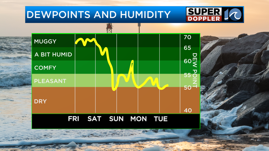
Temps will drop to the low 80s.
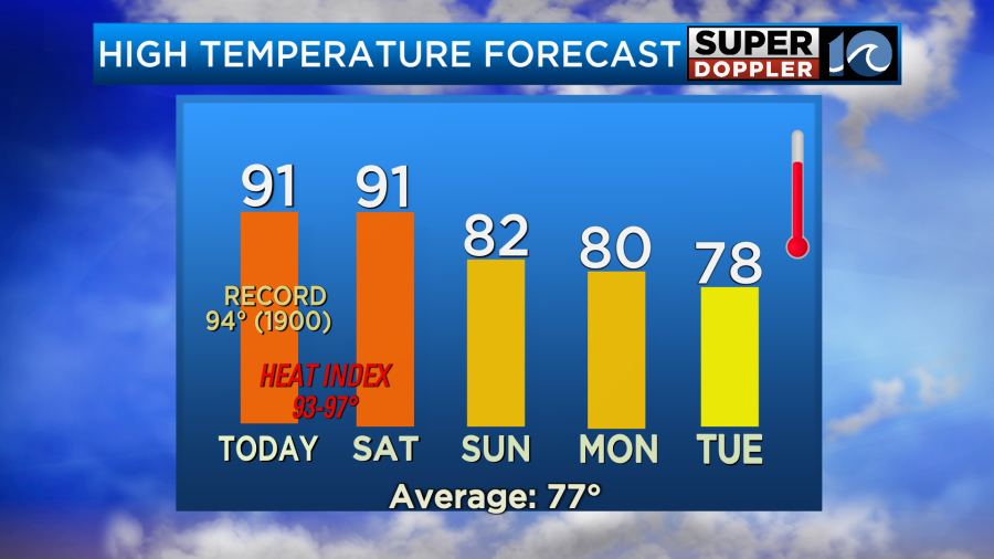
It should be pretty nice out on Sunday. We’ll have fair skies. It will be even nicer Monday and Tuesday. High temps will be in the upper 70s to near 80 degrees. We’ll have some more rain showers on Wednesday.
Meteorologist: Jeremy Wheeler


