Yesterday afternoon strong storms moved through the area causing torrential rainfall and gusty winds for a period of time. Additionally, some locations experienced some pretty decent sized hail up to the size of a dime!

Luckily as we start Mother’s Day weekend, conditions have quickly improved and high pressure behind yesterdays cold front is allowing for dry and refreshing air to fill in.
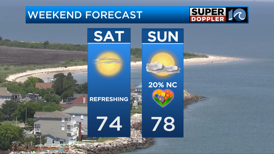
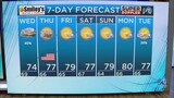
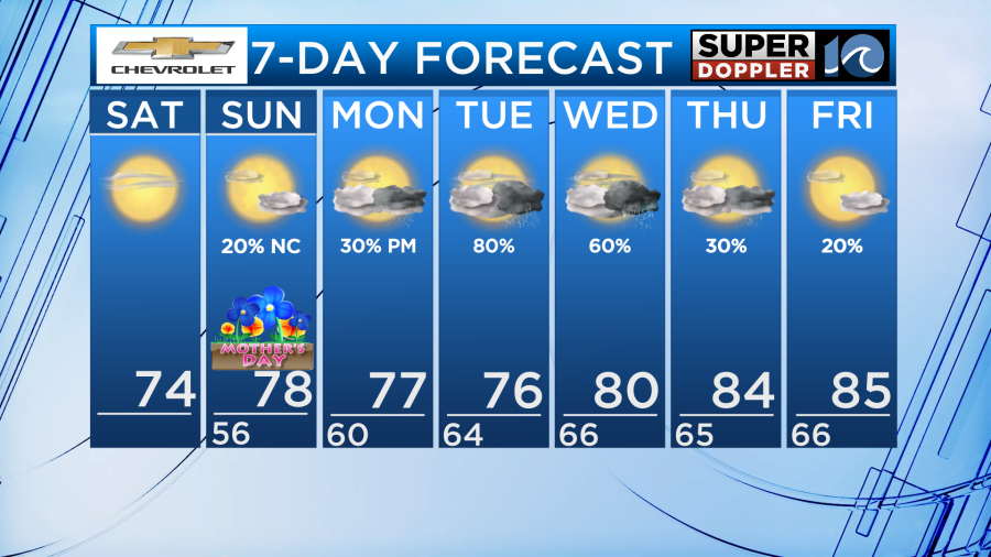
Besides from a few thin high clouds, our Saturday will feature lots of sunshine and a light northwest breeze at around 5-15mph. Temperatures will be a tad cooler than average with highs in the lower and middle 70s. Low dew points will make it feel nice as well.
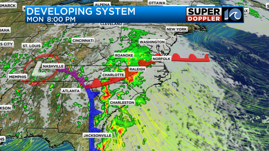
Overnight tonight, clouds will build ahead of our next storm system which is currently developing in the northern gulf. The southeast United States is currently dealing with widespread heavy rain and it is possible we get heavy rain locally but not until later on in the week.
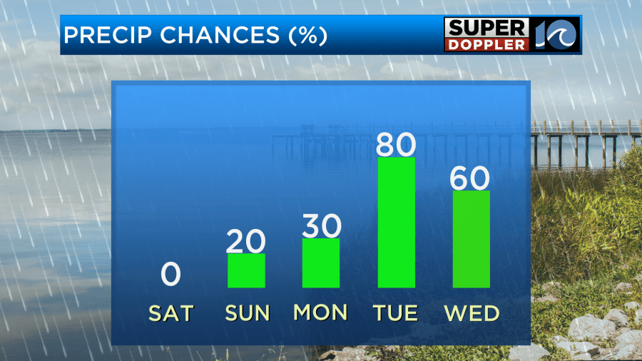
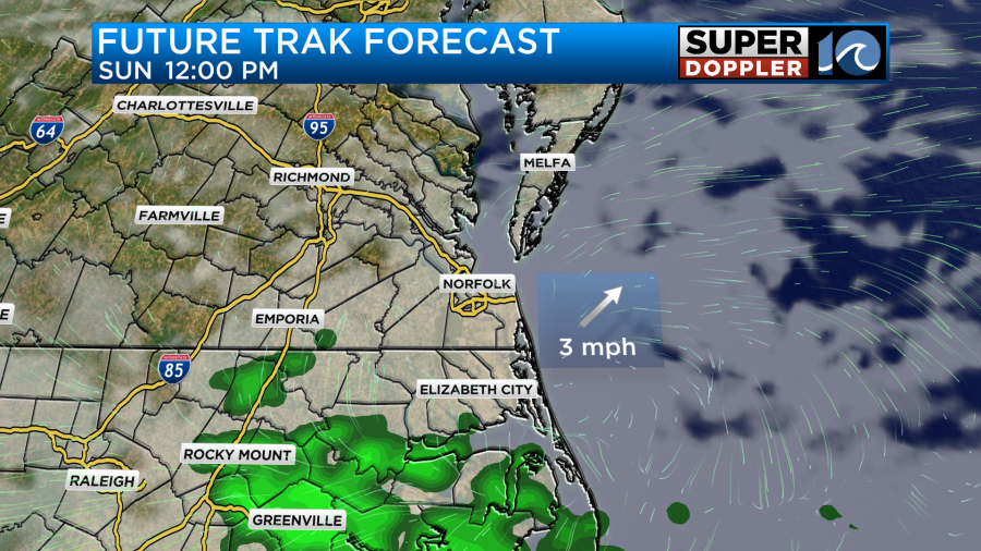
As for Mother’s Day, we will stay mostly dry with a few more clouds overhead as the storm moves closer. Winds will switch out of the southeast allowing for temperatures to get to near 80 degrees. Dew points will still be on the lower side so it shouldn’t feel to muggy. There is the chance for a shower or two but mainly in northeast North Carolina. Any rain that falls will be light and coverage will be limited so no need to worry about outdoor Mother’s Day plans.
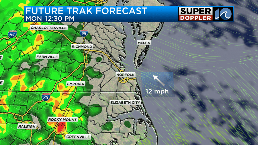
Eventually, as an area of low pressure slowly moves north, rain will become more widespread across the region. For the day on Monday most of the rain should be closer to I-95 where some downpours are possible from time to time. Otherwise, shower coverage will be spotty for areas closer to the coast on Monday.
Widespread rain and scattered downpours will likely fill in throughout the day on Tuesday and continue for the day Wednesday. Some areas may see upwards of 2 inches of rain over the next few days.
-Meteorologist Brian Michigan 🤙