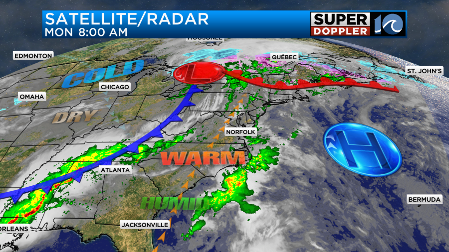
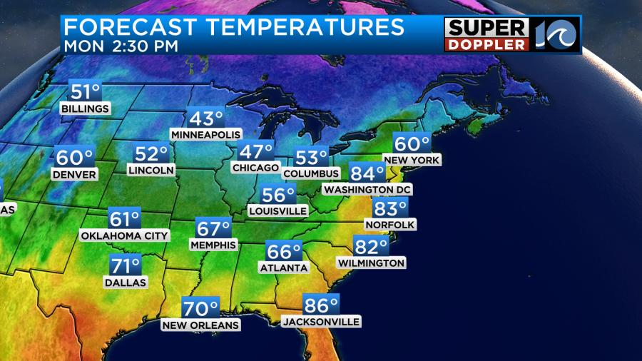
Over the weekend we enjoyed some nice weather. It was a bit warm at times, but the air was still fairly dry. Plus, the breeze made it feel nice. It was a bit too-warm too-soon for my tastes, but I’m sure many people loved it. Highs were in the 80s both days. We are going to have one more warm day today before the bottom drops out. While we enjoyed nice weather here there were severe storms over the central U.S. that caused damage and even at least a couple of deaths.
This was near and ahead of a large/strong cold front. Today that front is still to our west with a warm front to the north.
There will be more severe storms across the southeast during the daytime.
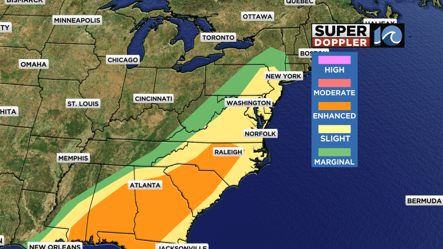
There is an enhanced risk (level 3) down to our southwest. However, we are in a slight risk (level 2) here. Most of our storms are expected tonight.
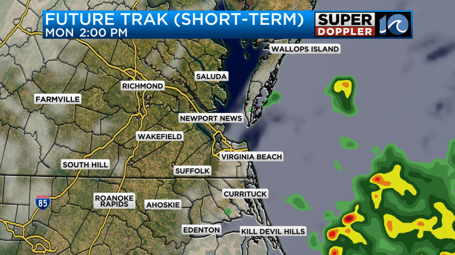
I don’t think we’ll see much during the day here. We did have a small batch of scattered showers this morning.
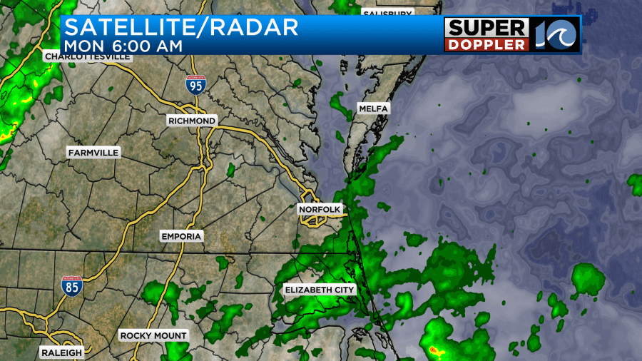
Those showers were in the process of moving out as I was writing this blog. For the rest of the day the models really don’t have much rain. They show a mix of sun and clouds with only some isolated showers or storms.
The surface winds will be gusting up to 25mph for a while.
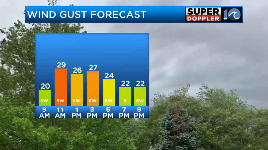
They may briefly gust up to 30mph for a time. This will push our high temperatures up to the low 80s, and there may even be some mid 80s out there.
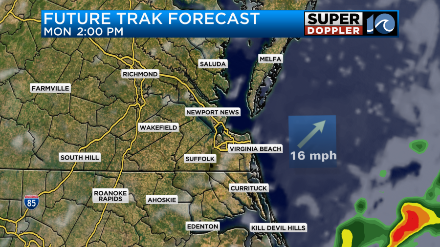
The record for today is 85 degrees set back in 1938. We could flirt with that record if we get a little more clearing than expected. By tonight the front will move into the region. We’ll have a cluster of showers and storms develop ahead of it.
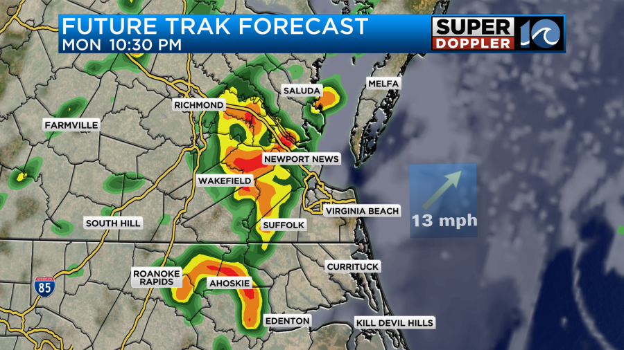
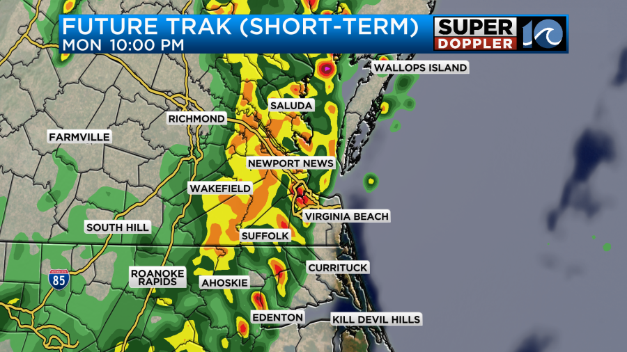
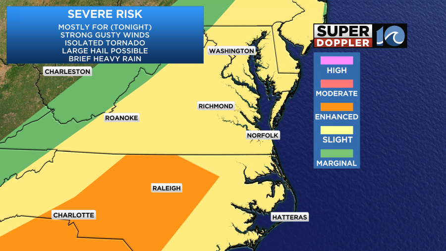
The chance for storms will be from about 8pm until 1am (give or take). During that time there will be some strong gusty winds but only inside of the storms. The general wind will probably decrease. There is a low chance at seeing an isolated tornado and/or some large hail. After that we’ll have mostly cloudy skies with only some isolated showers or sprinkles until 7-8am. Then we’ll have clearing skies through the morning. After dropping a bit during the overnight the winds will pick up again in the morning out of the north. They will gust up to 25mph for a time. However, they will decrease as go through Tuesday. This will push temps down. Highs will only be in the upper 50s.
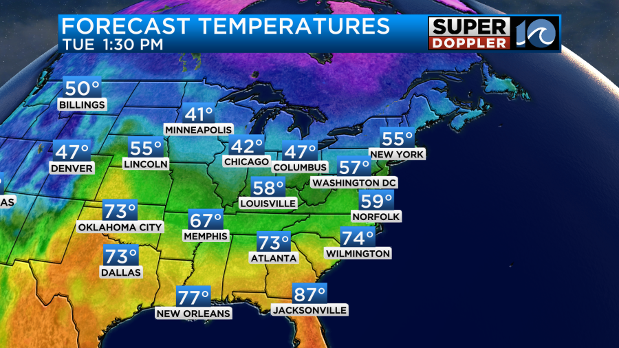
We’ll have a chilly morning Wednesday with lows in the 40s. However, the afternoon should be nice with high temps in the 60s and partly cloudy skies.
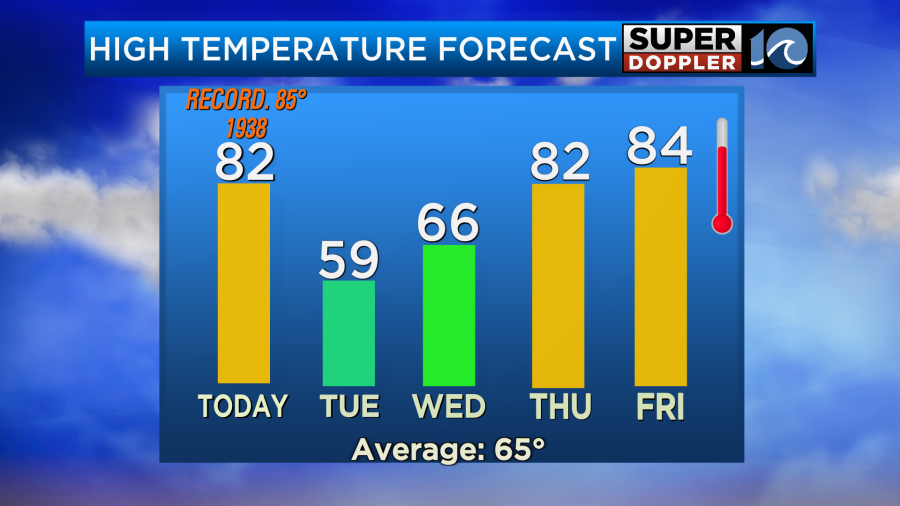
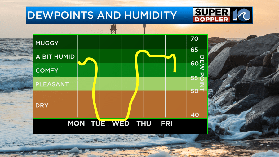
As you can see temps will bounce back up on Thursday. High temps will return to the 80s. That’s not the only thing that will bounce back. Humidity will also rise again.
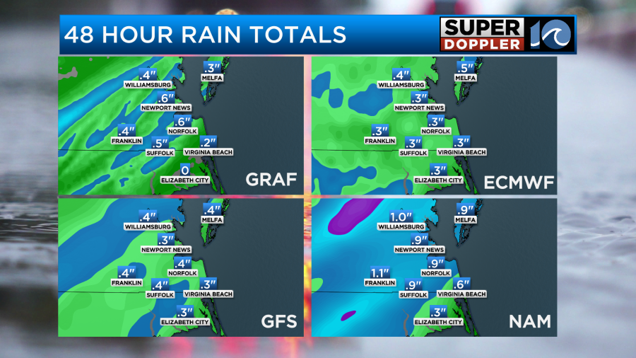
As far as rainfall goes… I think a lot of the region will get a half an inch of rain. There may be some small strips of 1″ as well.
There may be some more rain by next weekend, but it doesn’t look like much. I’ll have more details on that in tomorrow’s weather blog.
Meteorologist: Jeremy Wheeler


