
Over the last 2 weeks we have definitely had a few warm days.
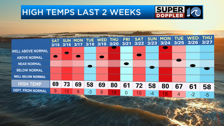
We had a cool shot during the last 2 days, but it was a brief stint. Today we will start to warm things up, and we are going to be unseasonably warm this weekend.
High pressure has pushed offshore. A warm front is trying to stretch into our region.
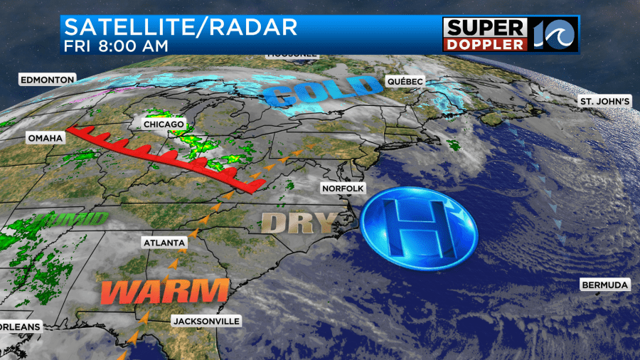
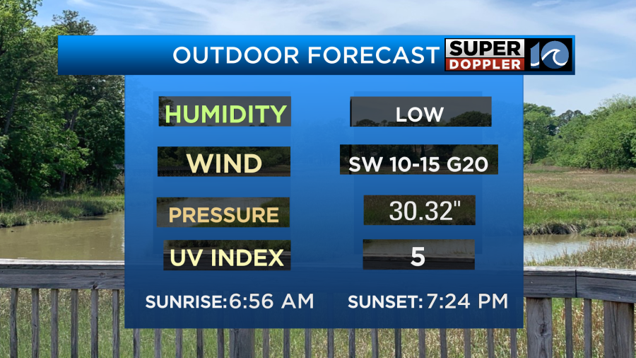
We’ll have partly cloudy skies today. The warm front may create a stray shower north of the metro, but most areas will miss out on that. We’ll have a southwest wind running at 10-15mph with gusts to 20mph.
This will push our high temperatures up into the mid-upper 70s.
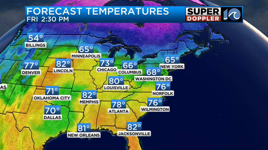
It will be cooler on the Eastern Shore. Luckily, we’ll stay dry today. The dew points will rise to the low 50s later this afternoon, and they will stay at those levels for Saturday and Sunday.
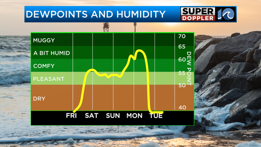
That’s good because temperatures are going to launch into the 80s both days.
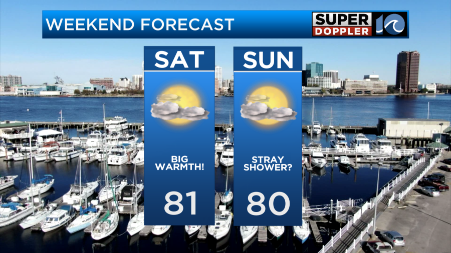
We’ll have a mix of sun and clouds tomorrow with no rain expected. The wind will blow out of the southwest at 10-15mph with gusts to 25mph. We’ll hold on to a light southwest breeze on Sunday. We’ll be partly to mostly cloudy with a stray shower possible.
Things will change on Monday. The moisture will increase quite a bit. We’ll have a lot of clouds through the day. There will be some scattered rain showers during the afternoon with a better chance for rain and storms during the evening.
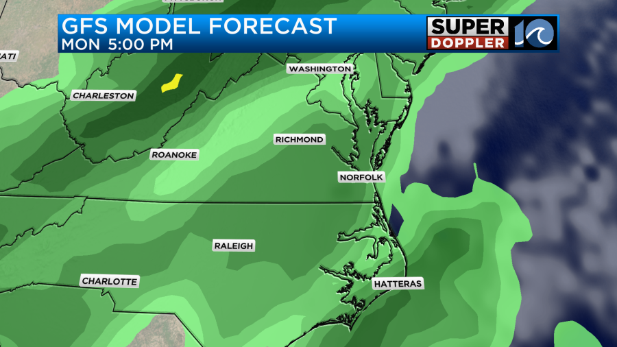
This will be ahead of a strong cold front. Temps will still make it to near 80 on Monday despite the clouds and rain chances.
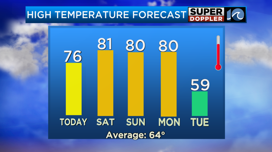
However, temps will crash on Tuesday. They’ll drop to the upper 50s.
There may be a few strong storms late Monday ahead of the front. It’s still early for details, but we’ll update you on that over the weekend.
Meanwhile another thing that we are tracking is wildfire smoke. The wildfires over the western Carolinas are still burning. Thousands have been affected. It is now the highest priority wildfire in the country. We may get a little haze from it later today, but that should be elevated. It shouldn’t make it to the ground.
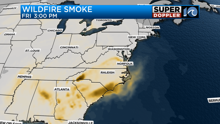
It may create some thin haziness up in the sky. However, tomorrow our forecast model shows a thicker band of smoke over our region.
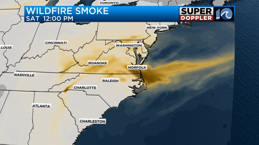
This may actually make it down to the ground. Some folks may smell some smokiness in the air. Viewers that have asthma or COPD should definitely check the forecast. They may want to stay inside tomorrow if the smoke gets to them. Check back for updates!
In other U.S. News…Severe flooding has hit the Rio Grande Valley in south Texas. Some of the region has had over 10-15inches of rainfall. There have been multiple water rescues. Here’s the article with more information: South Texas Flooding.
One last thing. There will be a partial solar eclipse tomorrow morning, but our area will outside of the possible viewing zone.
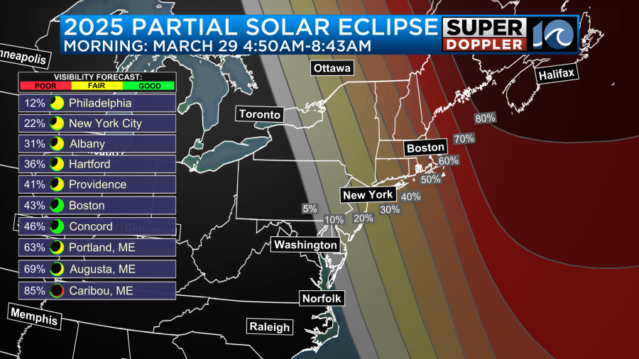
If you want to travel to view it, then that’s fine. Keep in mind that is will be early in the morning. Also, remember that you will need the special “eclipse glasses” or welders goggles to safely view it.
Meteorologist: Jeremy Wheeler


