
I have to say…The storms yesterday behaved pretty much as expected. By midday a line of storms formed near the I-95 corridor. It crossed the interstate and then pushed into the western parts of the viewing area.
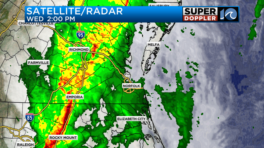
There were a few showers and some drizzle ahead of the main line. Winds were already very strong. The line then moved through Hampton Roads between 3 and 5pm.
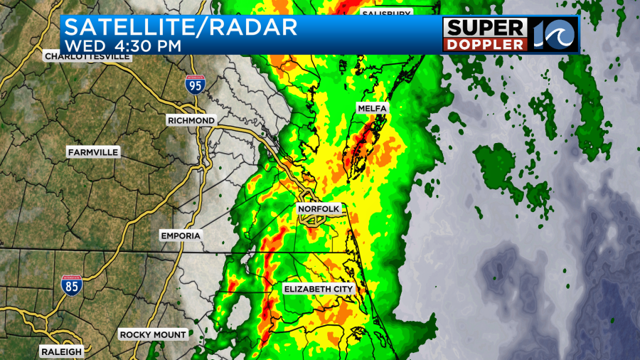
The storms then moved out to sea during the evening. In its wake the storm system did leave many reports of storm damage.
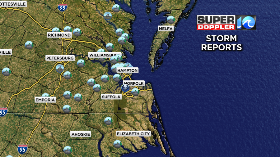
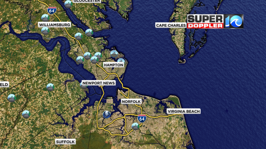
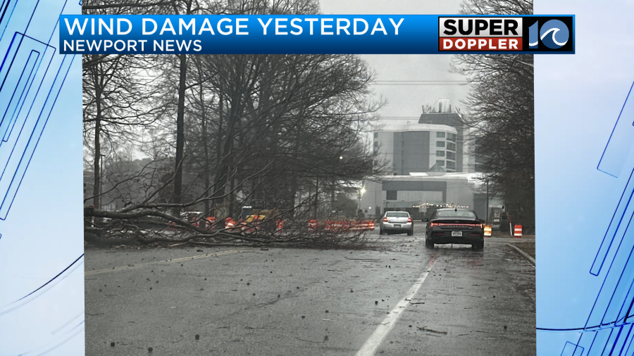
Most of the reports were trees down or limbs down. The one zig-zag over Portsmouth was a report of a lightning strike that hit a home. Here is one example of a tree that fell in Newport News.
Here is another photo of some of the damage. This one came in from the Cobbs Creek area of Matthews county.

We were actually lucky in 2 ways yesterday. First, there was some drizzle and clouds before the storms hit. So that kept the instability down a bit. Also, most trees don’t have leaves on them yet. So the wind was able to blow through most branches with less opposition. There was also less weight on the trees without the leaves. So that probably helped as well. Having said that… There were some very strong gusts over the region.
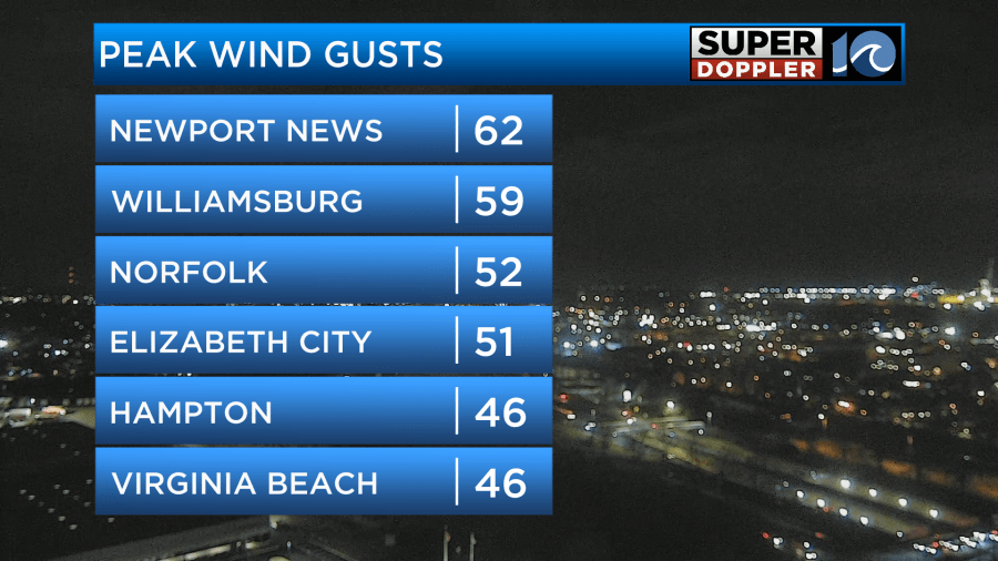
There was a wild report of a 94mph wind gust down around Avon Pier over the Outer Banks. To be fair it was noted that the height of that sensor is 39 ft.
We had varying amounts of rainfall, but the bulk of the area had about a half inch to an inch.
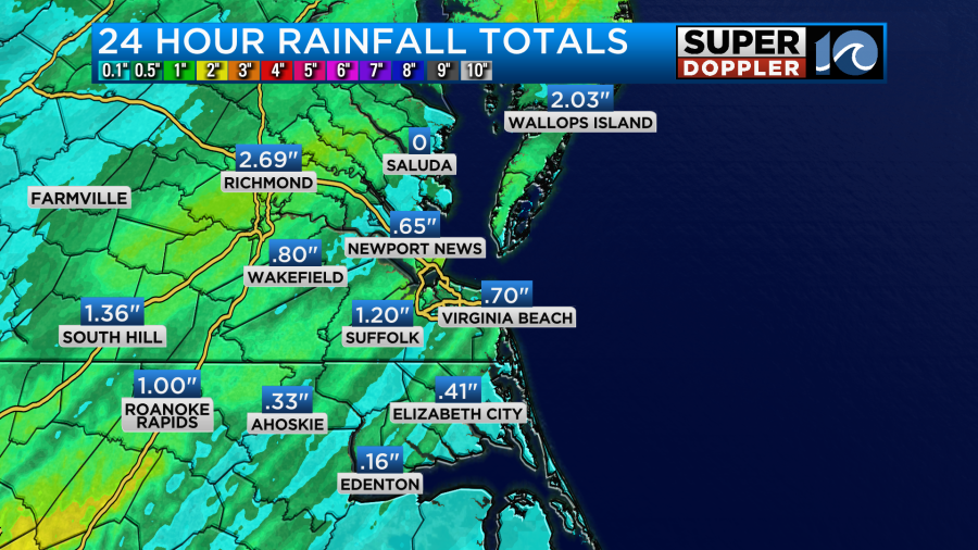
There was over 2 inches up around Wallops Island. There were a few reports of flooding over the region, but the water has gone down since.
Since yesterday the storms have pushed offshore. A cold front has also slid offshore as well.
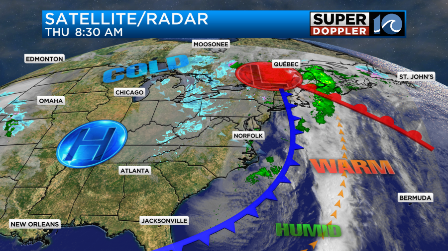
The strong area of low pressure is now up in the Great Lakes region. It caused a lot of snow with blizzard warnings across the Midwest yesterday. Today some of that snow will continue across the Great Lakes and Northeast.
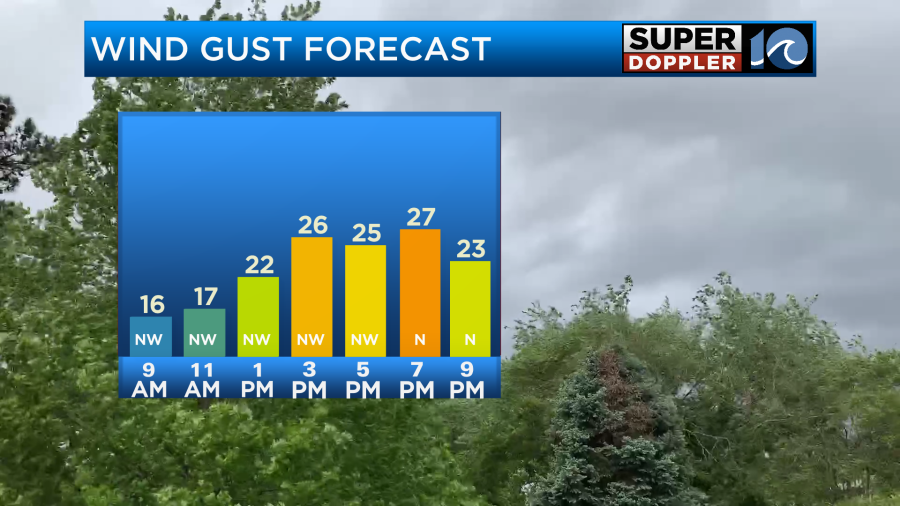
Around here it will be a calmer day overall, but it will still be breezy. Also there will be some isolated showers this morning. These are from a weak upper-level disturbance. Luckily, most of the rain will move out by midday. Then we’ll have a mix of sun and clouds. I can’t rule out a sprinkle or two. The breeze will still be up today, but it won’t be nearly as bad as yesterday. Winds will gust up to 25mph out of the northwest at times.
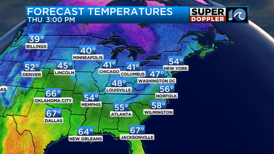
High temps will be in the mid-upper 50s.
Tonight we’ll have clearing skies. The breeze will die down over most area, but the wind may increase over the eastern shore for a time.
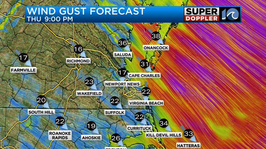
It will also be strong over the Outer Banks.
Tomorrow we’ll have much nicer weather. High pressure will build back into the region. We’ll have mostly sunny skies. High temps will be in the upper 50s.
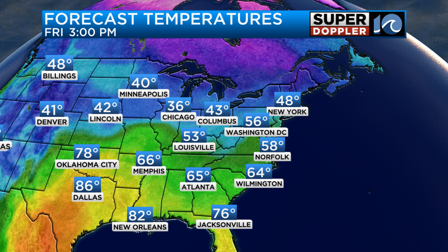
There will be a light breeze mainly out of the west.
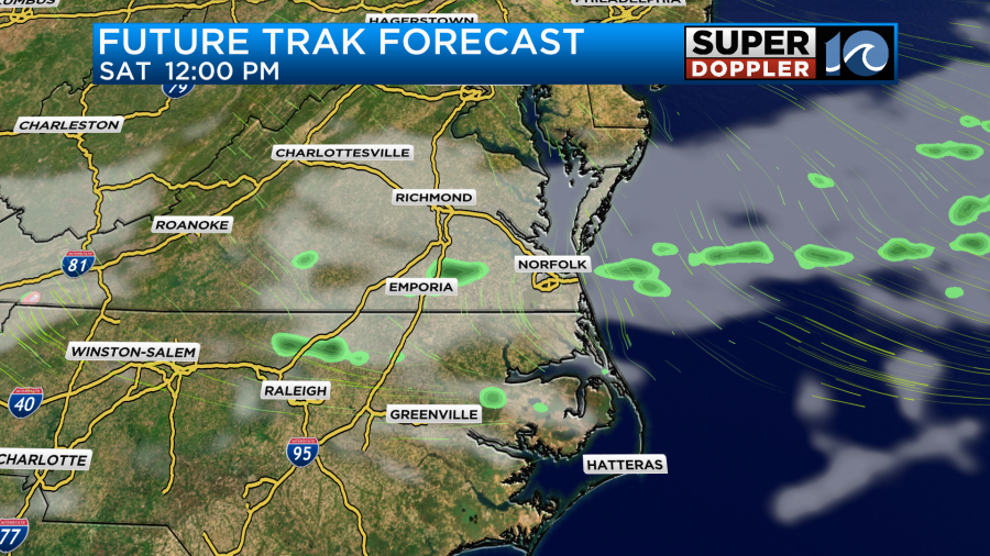
On Saturday we’ll have a mix of sun and clouds. There will be a weak cold front moving into the region. This will create some isolated showers again.
Highs will be in the low 60s on Saturday. Then we’ll drop to near 50 on Sunday. An area of low pressure will pass to our south on Sunday. It may create a few rain showers, but it doesn’t look like much. Stay tuned for updates.
Meteorologist: Jeremy Wheeler


