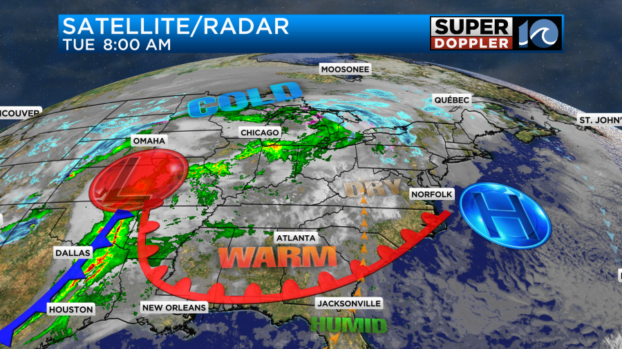
Today is going to be the calm before the storm. Literally! We currently have a large area of high pressure that is sliding offshore with a warm front coming up from the south.
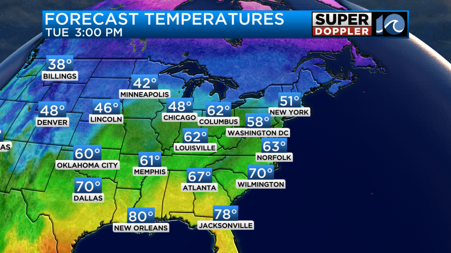
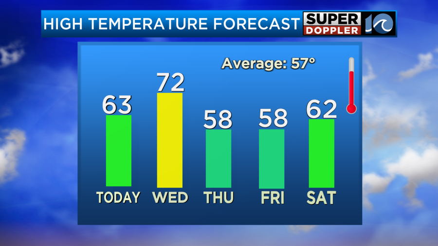
This will produce a nice day here with partly cloudy skies and high temps in the 60s.
We’ll have a light southwest wind. Get out and enjoy the weather while you can! Meanwhile, you can see the developing area of low pressure centered over Missouri (surface map above). There is a large trough (dip in the jet stream) over the central U.S. with some warm/humid air bubbling up from the south at the surface.
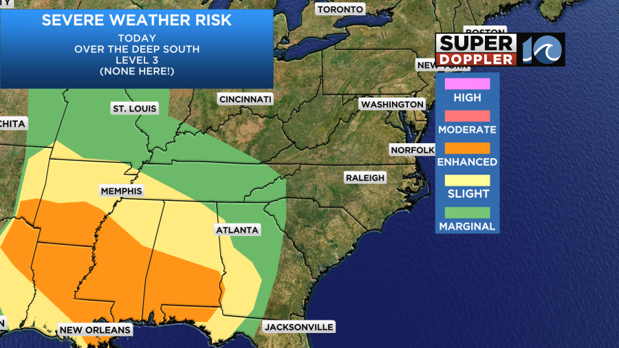
The storms will get pretty bad across the Deep South this today. There is an enhanced risk for severe weather there through this evening.
Tomorrow high pressure will slide far offshore with the warm front lifting to our north. The surface low won’t roll through here. It will actually move up into the Midwest. However, it will become very large and strong. So it will have some influence on our weather. A cold front, however, will have more of an impact on our region.
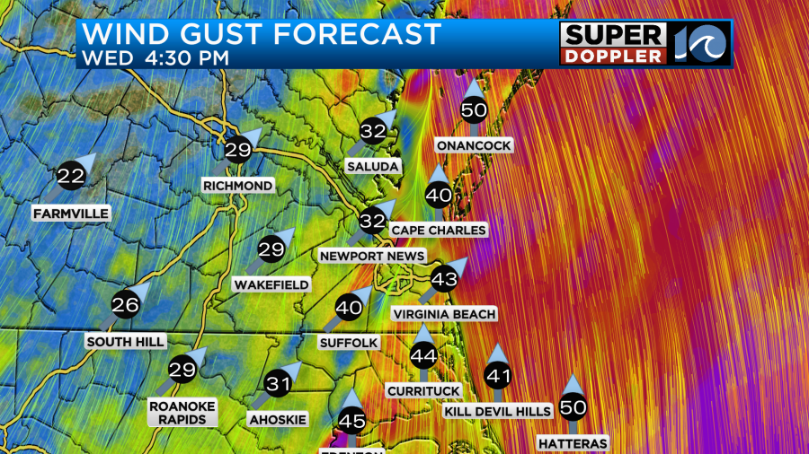
As we go through tomorrow we will develop some strong winds out of the south. Winds will gust to around 40mph for many, and there may be a few higher gusts.
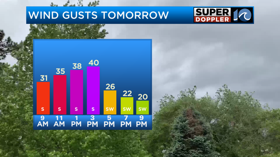
Winds will increase during the afternoon. Some of the gusts could be enhanced as the storms move through.
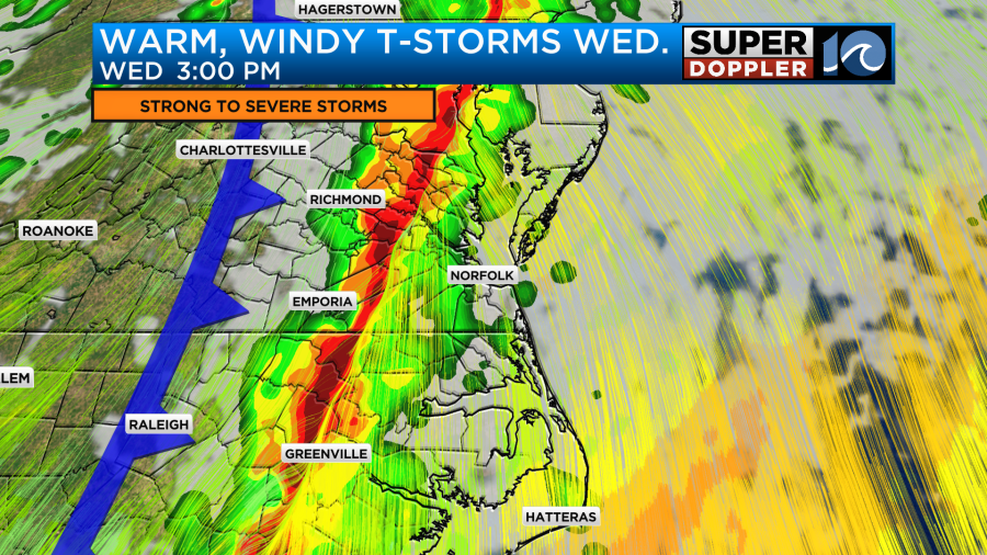
We’ll be dry for the first half of Wednesday. However, by the mid afternoon that line of storms will cross I-95.
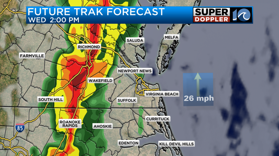
The storms will cross the metro area some time between 4 and 7pm.
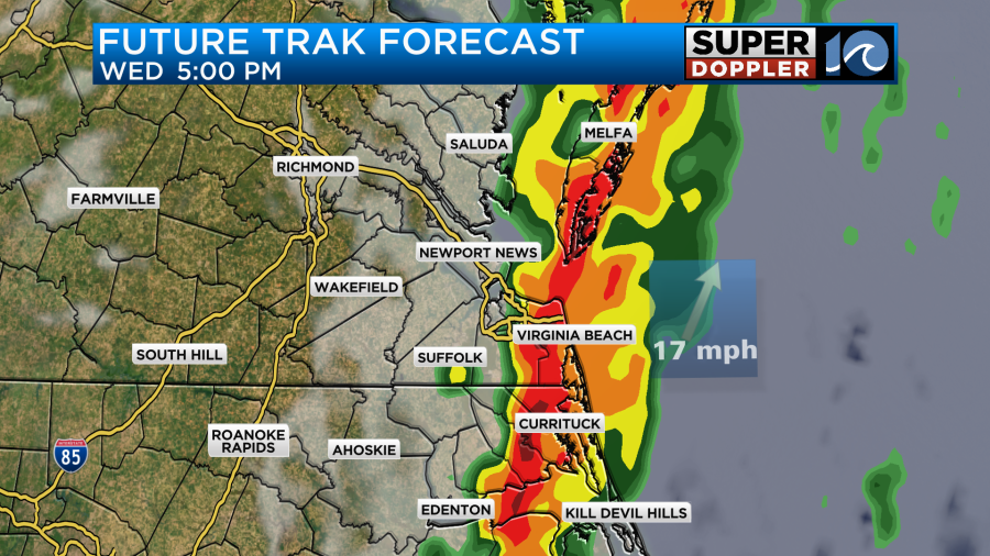
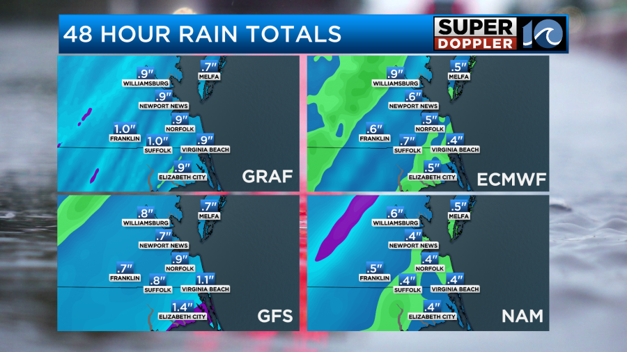
They should move through fairly quickly according to Future Trak. So I don’t think we’ll have large areas of flooding despite some brief heavy rain. There may be some brief standing water, but it should go down pretty quickly. We may pick up a half an inch of rain, and some isolated areas could get up to an inch.
We do have a risk for severe weather here. As of today our area is split between a slight risk (level 2) and an enhanced risk (level 3).
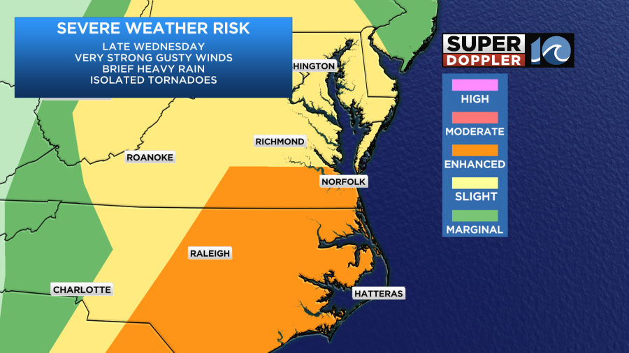
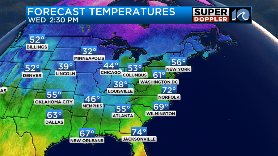
There will definitely be a lot of wind shear. A strong low-level jet will contribute to those strong/warm wind gusts over the region. This is why the main threat will be strong/damaging winds. There will be some broad spin in the atmosphere. So an isolated tornado will be possible. However, it’s hard tell how much instability (potential for rising air) there will be. We will have a lot of clouds, but I still think high temps will be able to reach the low 70s.
Humidity will be marginal. Dew points will probably aim for the mid 50s. If they make it to near 60, then that could increase the instability. We’ll have updates on this later today and tomorrow morning. The biggest thing is that the timing could change.
Regardless, the cold front will pass to our southeast on Thursday high temps will drop to the 50s.
We will dry out, but a few sprinkles or an insolated shower may be possible Thursday morning.
We’ll be dry on Friday and Saturday with highs in the upper 50s to low 60s.
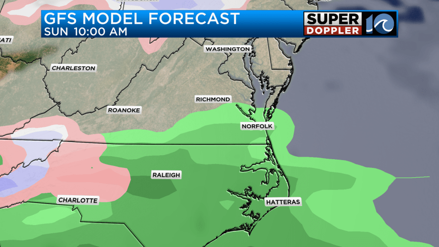
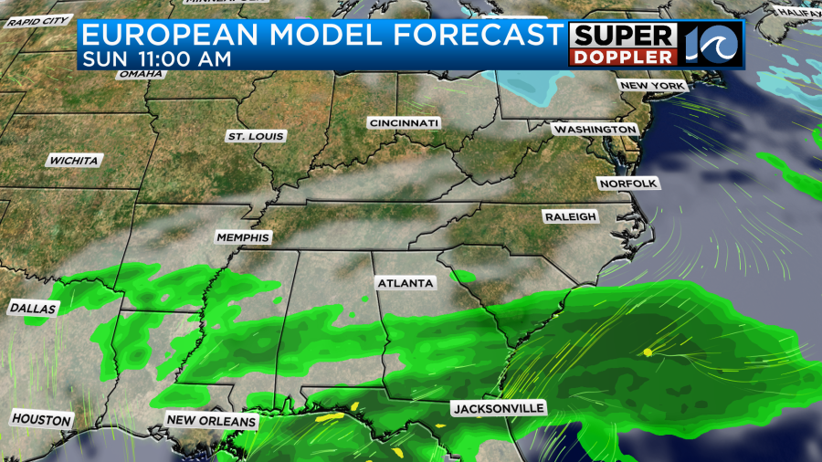
Sunday could be interesting. As of this morning the GFS model has a quick moving area of low pressure passing just to our south. If this were to happen, then we could see some scattered rain showers and possibly even a brief wintry mix in the morning. However, the European model hardly has anything on Sunday.
Let’s get past tomorrow. Then I can focus on that possibility. The models should have a little better agreement by then as well.
Meteorologist: Jeremy Wheeler


