
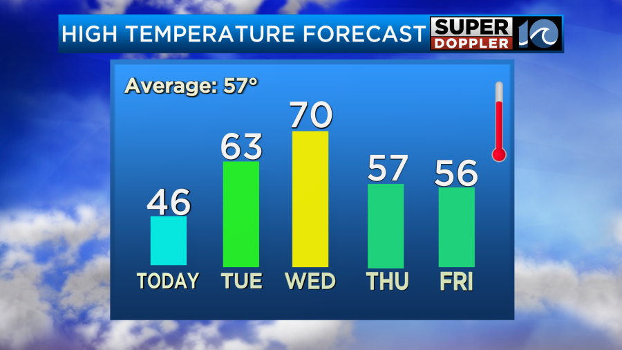
The temperatures over the last 2 weeks have been dramatic. We had a cold streak 2 weeks ago that lasted for several days. That’s when we had the snow on the ground. Then we had a nice warm streak all last week. However, the warm streak came to a screeching halt over the weekend. We managed to hit the low-mid 70s on Saturday. Then high temps were only in the low 40s yesterday.
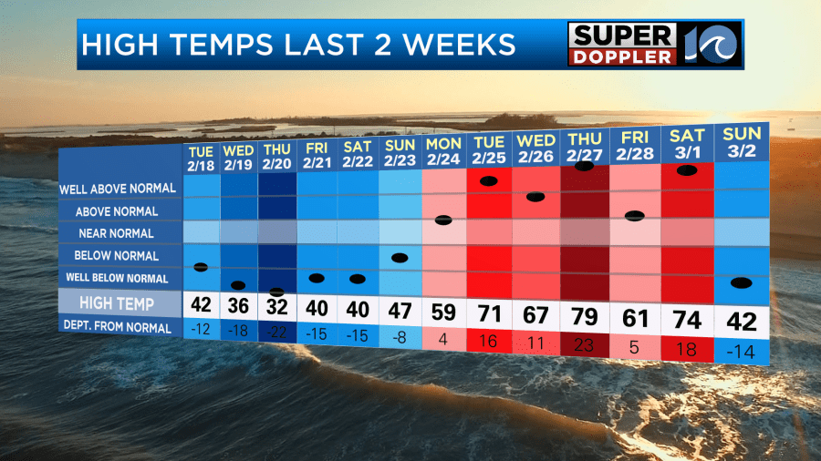
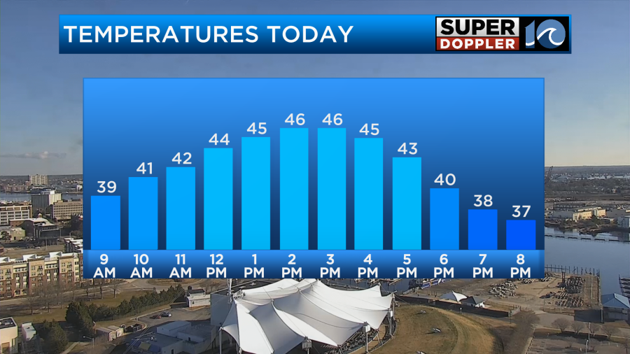
It wasn’t just cold yesterday. It was breezy most of the day. So wind chills were in the 20s and 30s. Today we will still be chilly, but we’ll have lots of sun and less wind. High temps will rise a bit into the mid-upper 40s.
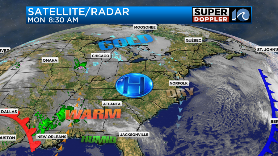
High pressure is building into the region.
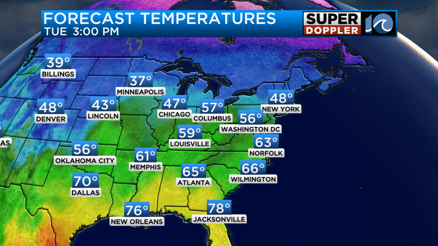
Tomorrow we’ll have high pressure overhead with a strong area of low pressure rolling across the Deep South. High temps will rise to the low-mid 60s in our region with partly cloudy skies.
There will be some severe storms tomorrow down across the south/central U.S.
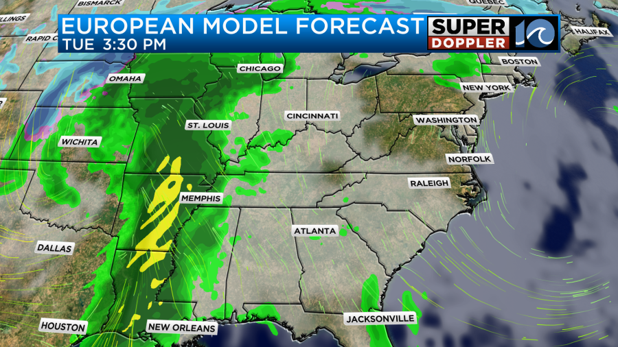
The storms are forecast to be so strong that they are going to postpone and cancel some Mardi Gras events around New Orleans tomorrow.
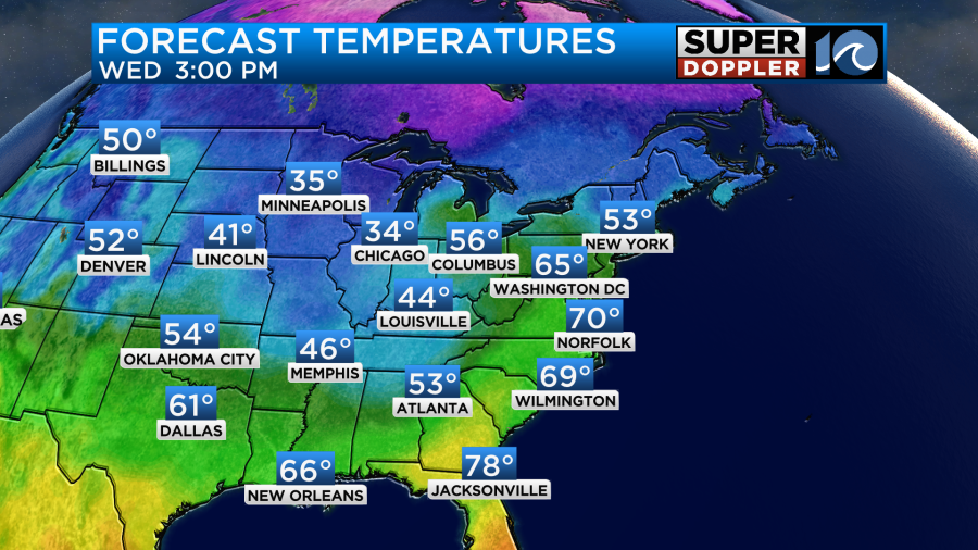
Some warmer and much more humid air will push up into that region with a strong area of low pressure over the central U.S. The low isn’t forecast to move through here on Wednesday. It will actually move up into the Midwest. However, a strong warm front will push through our area. We’ll have winds gusting out of the south to at least 30mph. There will probably be some higher gusts. These will push high temperatures up to near 70 degrees.
We’ll start off with a mix of sun and clouds, but then we’ll have increasing clouds during the afternoon. There will be a few showers and storms later in the afternoon with much more development closer to I-95.
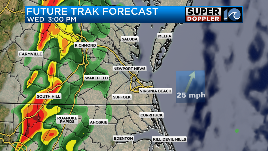
However, a line of showers and storms will form ahead of a cold front by the evening. It should push through our region fairly quickly.
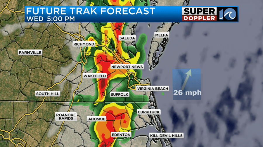
We could see some severe weather during that time. It’s still early for the finer details, but we’ll have a lot of those details for you over the next 48 hours. Either way it looks like we’ll dry out and cool down on Thursday and Friday.
Stay tuned for updates.
Meteorologist: Jeremy Wheeler


