
Finally, we woke up this morning to lots of sunshine. It feels like it has been a long time.
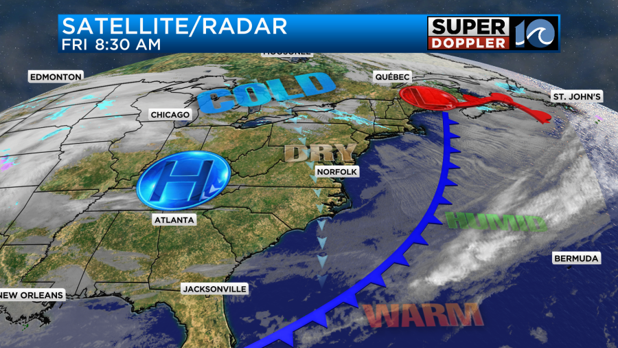
A cold front has passed far to our south now with high pressure building in from the west.
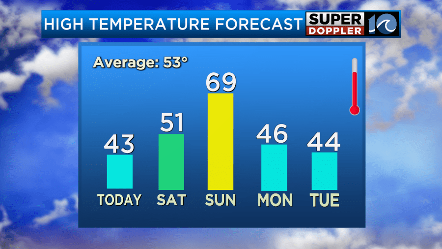
We’ll have a lot of sunshine through the day. However, it will be chilly on this Valentine’s Day. Winds will run out of the north at 10-15mph with some gusts up to 20mph. So high temps will only be in the low-mid 40s this afternoon.
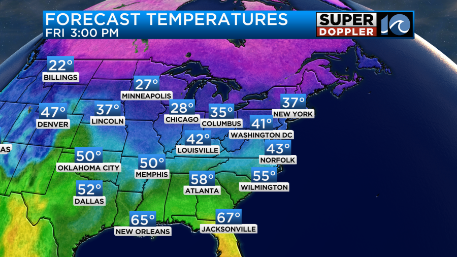
If you’re headed out this evening for Valentine’s Day dinner, then bundle up. Temps will already be in the upper 30s by 5-6pm.

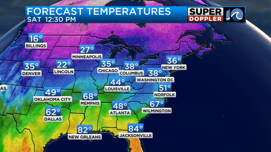
Tomorrow we’ll start off dry. However, clouds will be increasing. Clouds will continue to thicken up through the day as high pressure slides offshore, and moisture comes up from the south. By the afternoon the deeper moisture will push into the area, and we’ll go back to that overunning pattern that we’ve had lately. So rain will become nearly widespread by Saturday afternoon.
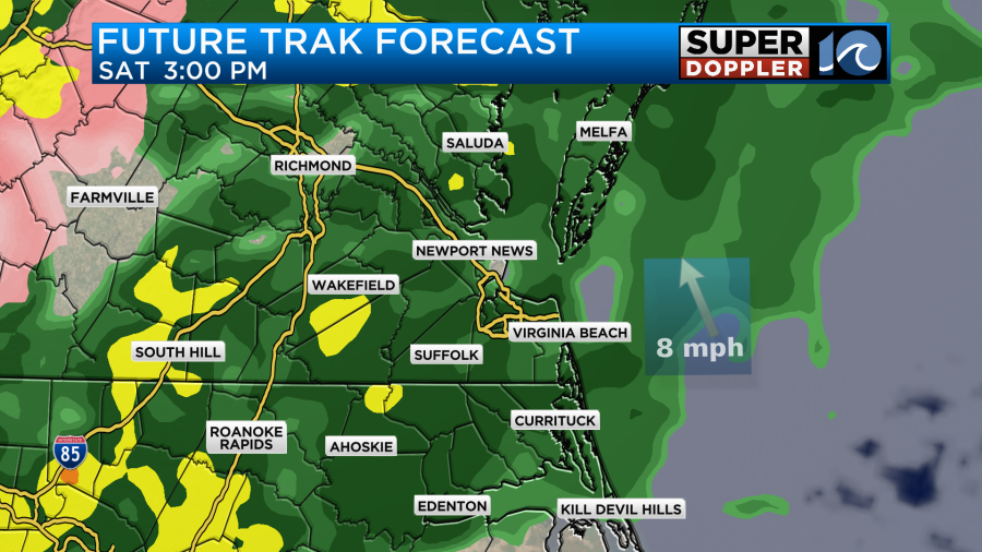
There may even be a few heavy showers by the evening. High temps during the day will be able to warm up a bit. Despite the rain we’ll have a light southeast wind. So high temps will aim for the low 50s.
By Sunday we’ll have a warm front rise up from the south with a strong cold front coming in from the west.
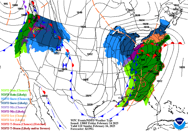
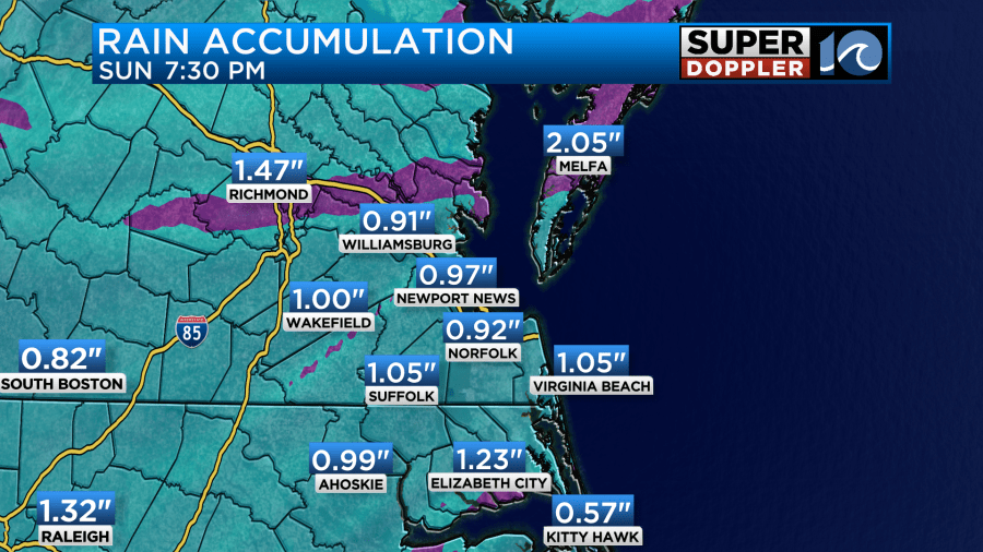
We’ll probably have some scattered rain showers (with heavy rain possible) Sunday morning.
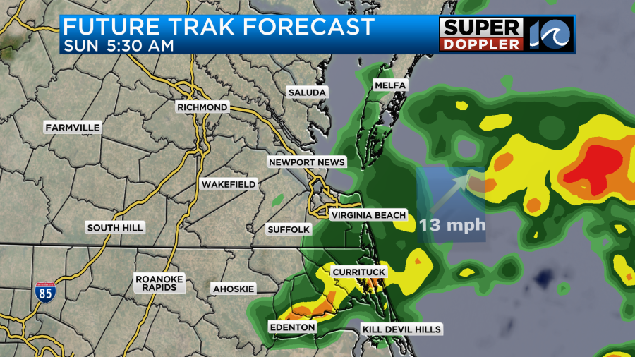
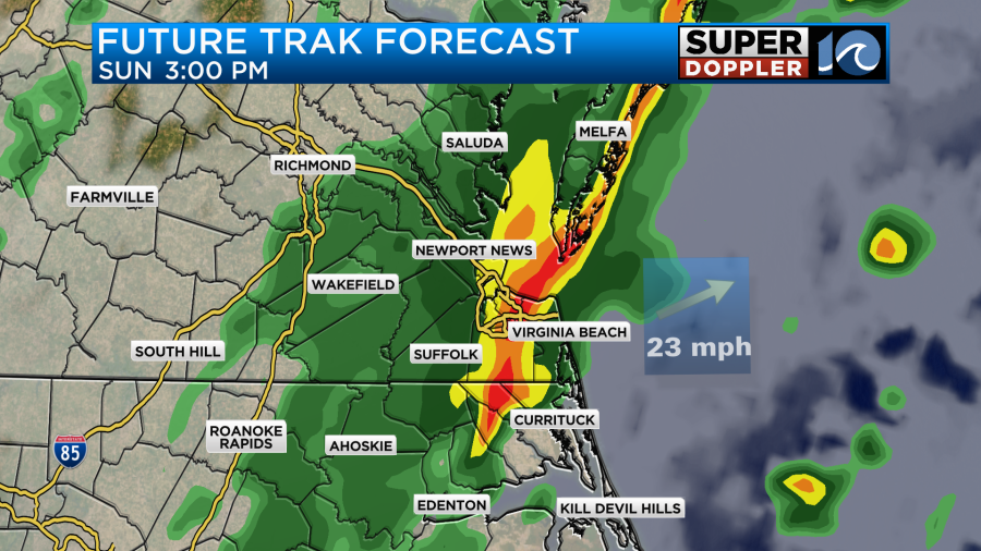
This will be as the warm front enters the area. The rain may break for a while around midday. However, heavy rain and a few thunderstorms will be possible later Sunday as the cold front races in from the west.
We will warm up quite a bit before the front arrives. Some models suggest we’ll make it to 70 degrees during the afternoon. I’m going with upper 60s to near 70 for now.
Winds will become gusty out of the west/northwest for a time. Temps may even drop a little Sunday afternoon. Before the rain ends Sunday evening we could pick up another 1-2 inches of rainfall.
As we go into Monday and Tuesday next week the strong cold front will drop well to our south. We’ll be dry and chilly with highs in the 40s. Then things get interesting Wednesday into Thursday…
The theme is that a strong area of low pressure will form along the Gulf coast. Then it will run up along the coast and push up to just south of our region. It will have plenty of cold air to work with. So snow will be possible. Before the low moves up this way we’ll probably have another overunning situation on Wednesday.
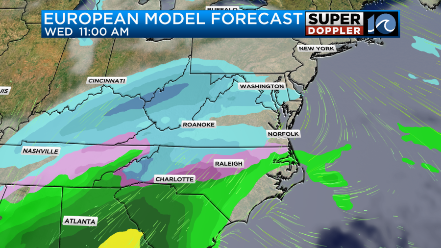
At a minimum the Hampton Roads area will probably see a wintry mix with some brief snow for a time. On the high end there is a potential for some big snow. The big snow potential right now is (just) north of the metro up into northern Virginia and Maryland. Keep in mind that this is still far out in time, and the models have been bouncing around quite a bit. For now I’m going to show you the Wednesday forecast on the Euro and GFS models.
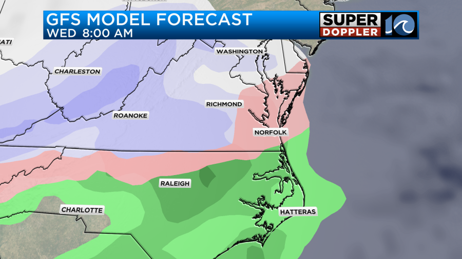
Yesterday, the Euro didn’t have much for Wednesday. The GFS has a wintry mix in the morning, and then it changed over to rain and a mix with some snow to the north. Now the GFS has a mix in the morning with a gradual change over to rain. It does keep some snow to the north in the afternoon.
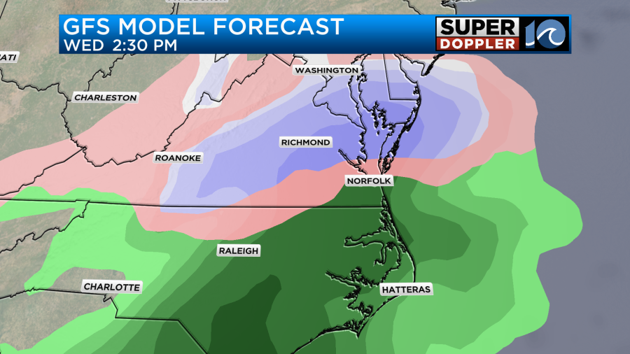
It does have that northern area change over to a mix at night though with cold rain in the metro.
The Euro doesn’t have much until the late morning, and that is mainly a mix. However, it changes over to snow for much of Virginia during the afternoon with a mix zone closer to the state line.
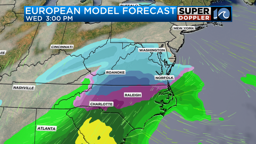
So already there is some uncertainty in the forecast, and that’s just for Wednesday. Both models do have a swath of snow with a mix for some on Thursday. However, for me that’s just too far out to show. Let’s just say that there is a potential for some heavy snow for a time if the models hold their tune. My best advice is don’t camp out on any forecast totals that you see on the internet right now. It’s just too early. The details could change dramatically over the next few days. We have plenty of times for updates. So check back over the weekend.
Meteorologist: Jeremy Wheeler


