
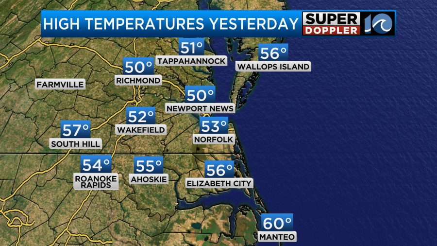
Yesterday was a bit frustrating for me. There was a warm front that had moved up from the south, but it had stalled for a brief time. There was some heavy rain for a time yesterday, and that part was expected, but it lingered just a bit longer than forecast. Then we had some clearing, but that didn’t happen until later in the day. The bottom line is that we didn’t warm up as much as I’d hoped. Highs were mainly in the low-mid 50s.
The warm front rose to our northeast last night. However, an area of low pressure moved along the boundary. This created some heavy showers in the overnight along with an upper-level disturbance.
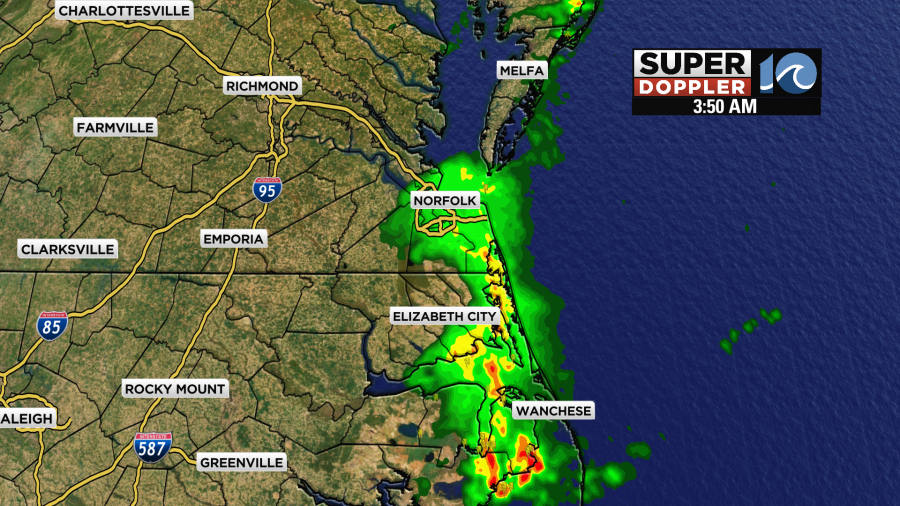
There were also some scattered thunderstorms as some “elevated” instability was briefly created. One of our cameras over the Outer Banks captured a lightning strike early in the morning.
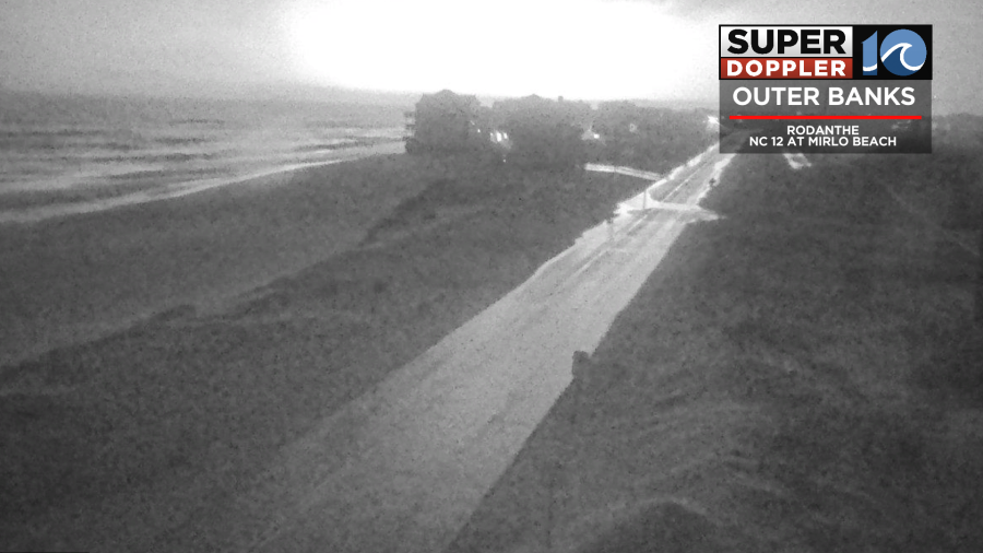
Just for comparison…This is what the camera normally looks like during the overnight hours.

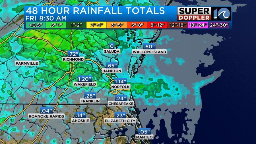
The rain quickly moved in, and it quickly moved out. So by 5am it was already gone. Before it all ended, we ended up with varying amounts of rainfall. Some locations had over an inch. Other areas had about a quarter to a half an inch.
Going through the day today a cold front (that is trailing out of the low) will slowly sink to our south.
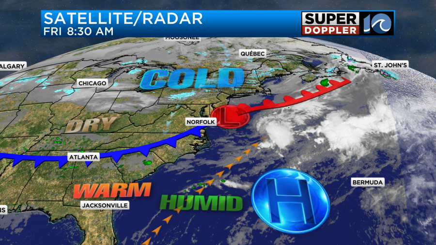
Since it’s a slow mover I don’t think temps will drop much. They will probably hold steady in the 50s for most.
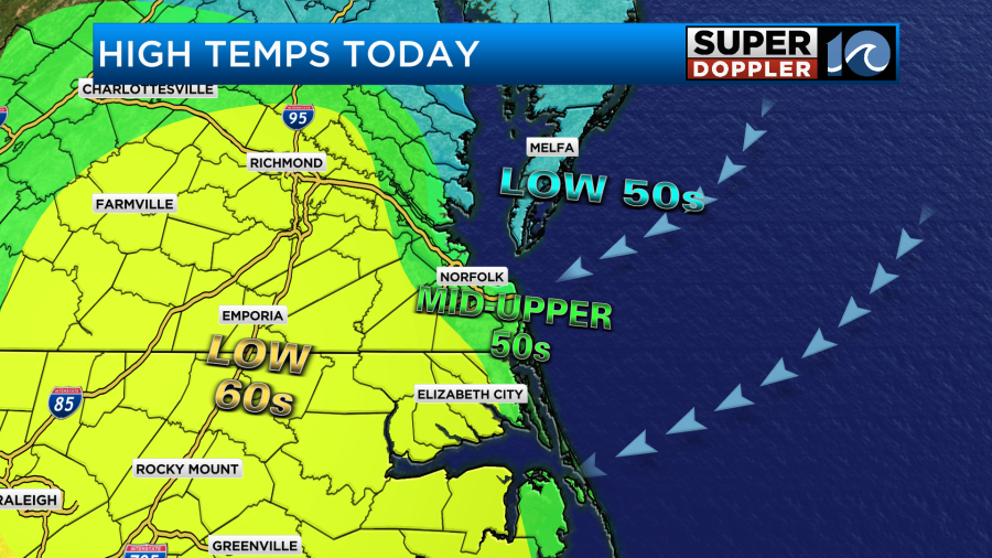
We will have fair skies all day, but there will be a northeast breeze running at 8-12mph. So it will be cooler near the shore. It will probably reach the low 60s inland away from the water.
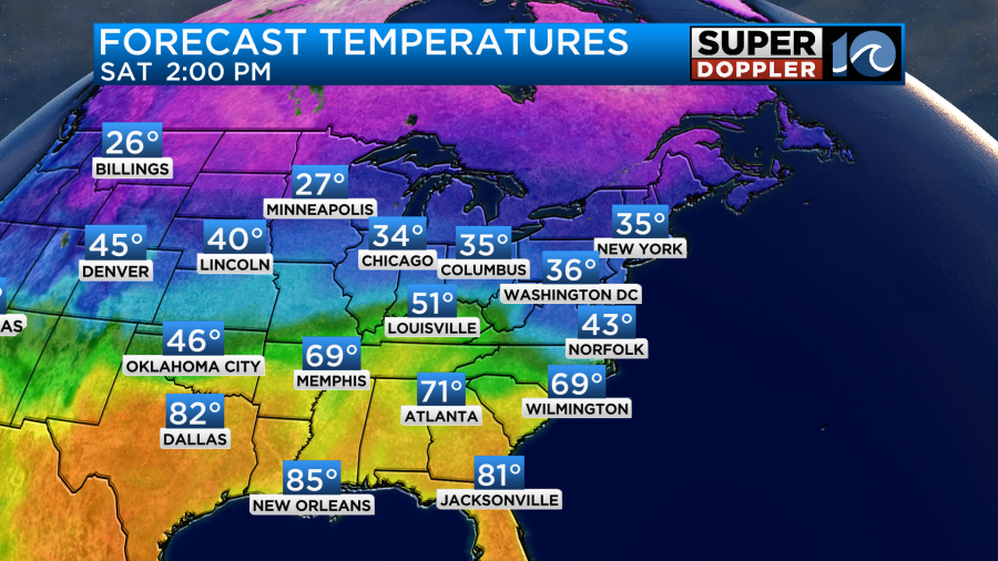
Tomorrow the cold front will sink a little more to the south. We will be chilly all day. We’ll start in the upper 30s in the morning. We’ll only rise to the low 40s in the afternoon.
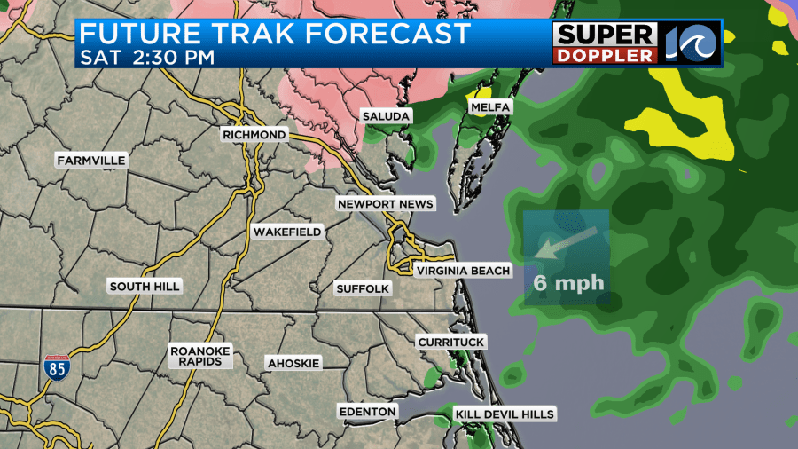
Warmer/more humid air aloft will push up over the cooler airmass. This has been happening a lot lately. It’s called overrunning. This will produce some scattered rain showers tomorrow morning. Temps will be cold enough for a wintry mix to form in spots.
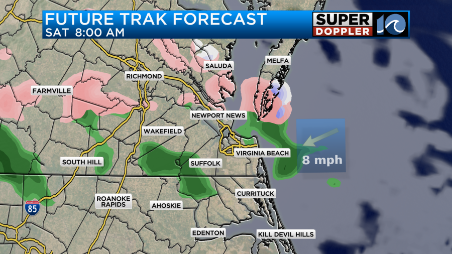
However, temps will be above freezing. So most of the sleet and wet snowflakes should melt. Even if they don’t melt at first they should melt later in the day as temps warm to the 40s. There will be scattered rain showers continuing into the mid-afternoon with a mix to our north.
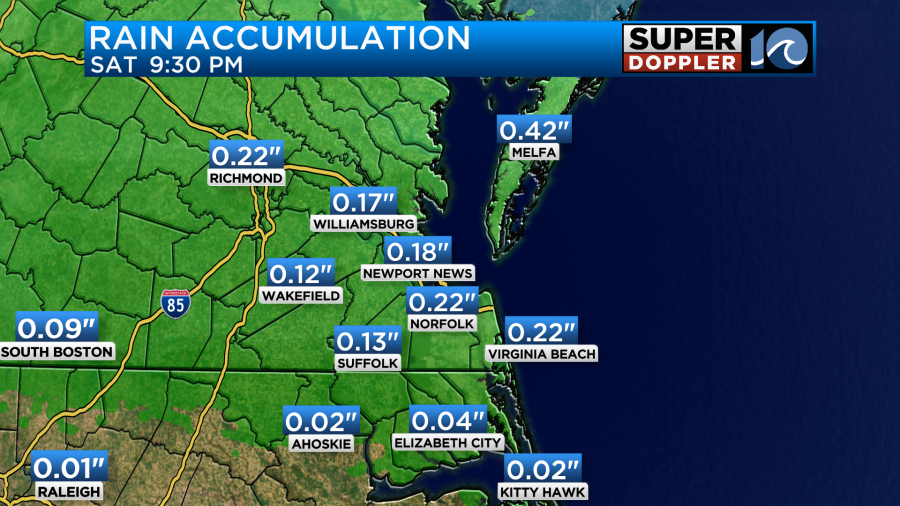
Rain should taper off by the evening. We could see another quarter to a half an inch of rainfall.
A warm front will lift through the area Saturday night into Sunday. Then a cold front will slip through the region. This may create some isolated showers or sprinkles, but there shouldn’t be much rain overall. High temps will rise to the 50s.
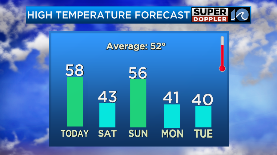
The front shouldn’t sink too far to the south on Sunday. So I think temps will mainly hold in the 50s. I’m optimistic about Sunday evening for travel for the big game. Any Super Bowl parties should be dry, but I can’t completely rule out a stray sprinkle or shower.
On Monday a cold front will stall out to our south. Between Monday and Tuesday 2 areas of low pressure (MAY) develop and move along the front. The GFS model has this happening, and so it has a wintry mix and snow developing Monday morning into Monday afternoon.
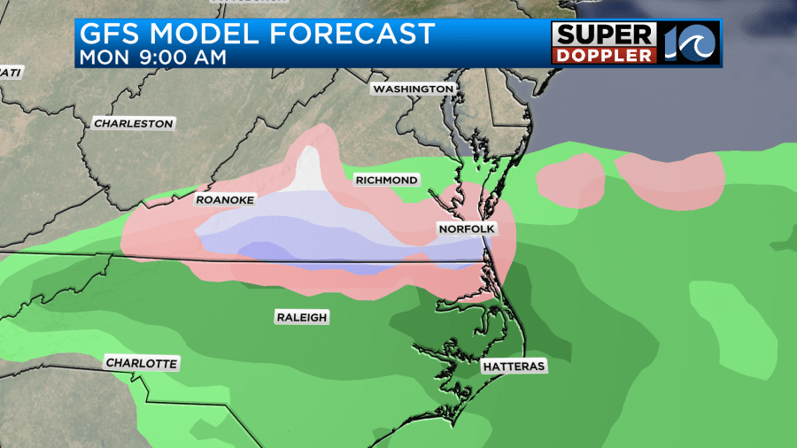
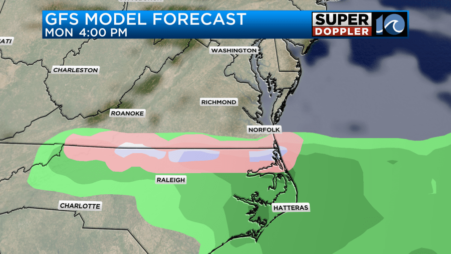
It looks odd to me that it shows a mix on the south AND north side of the snow. So I’m a little leery about its snow potential Monday. Regardless, the European model and the NAM do not have any mix nor snow Monday morning.
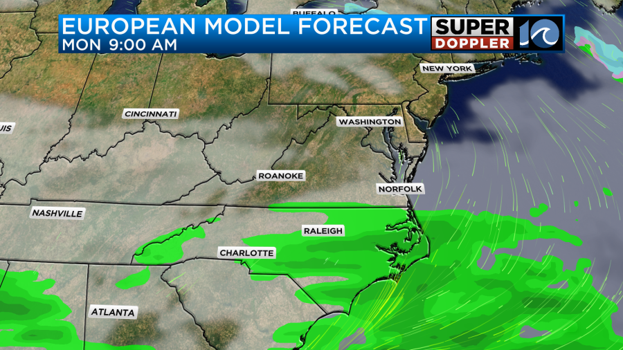
It has the front a bit more south, and it does not develop the low at that time.
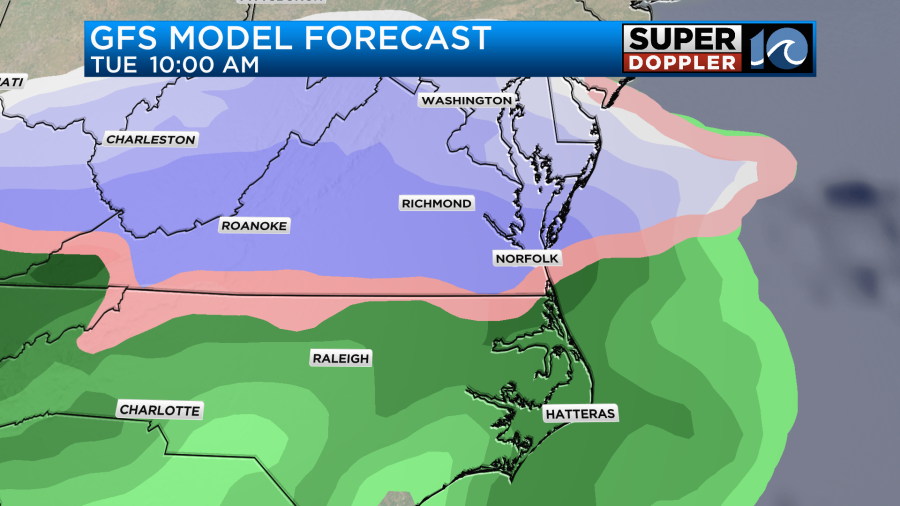
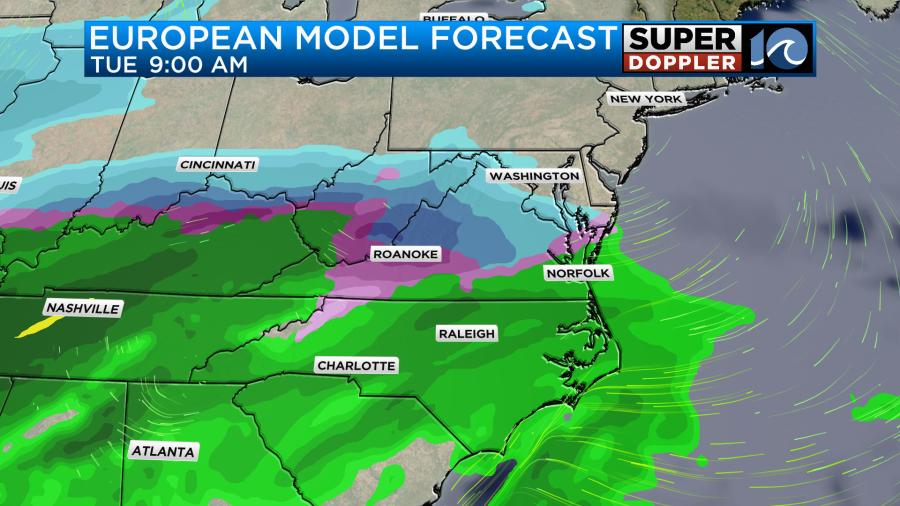
So for now the GFS is not favored, but it is something we need to watch. Both the GFS and Euro have a mix and some snow again Tuesday morning, but the Euro is farther north with the rain/snow line.
That is too far out for the NAM. IF the GFS is right, then there could be some big snow in the region. If the Euro is right, then we’ll have some cold rain with a mix and snow north. I’m going to show this next graphic to you, but don’t camp out on it. It WILL LIKELY CHANGE. It’s the GFS and Euro snow forecast for the next 5 days.
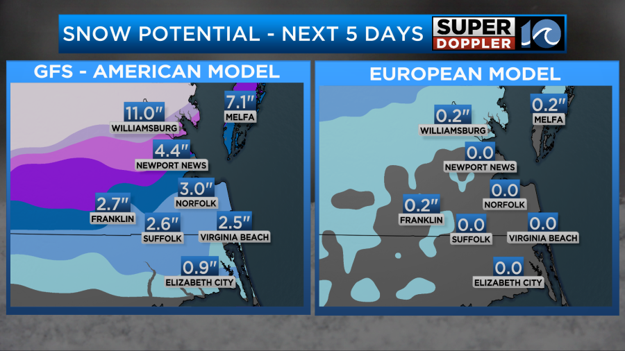
Also keep in mind that some of the Monday snow on the GFS would likely melt. However, any light snow on Monday still wouldn’t account for the high totals from Williamsburg north. That would be mostly on Tuesday.
I imagine the models will gravitate towards a trend in the next 12-24 hours. So please check back for updates over the weekend.
Meteorologist: Jeremy Wheeler


