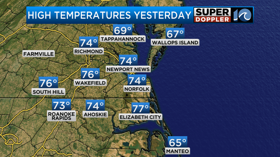
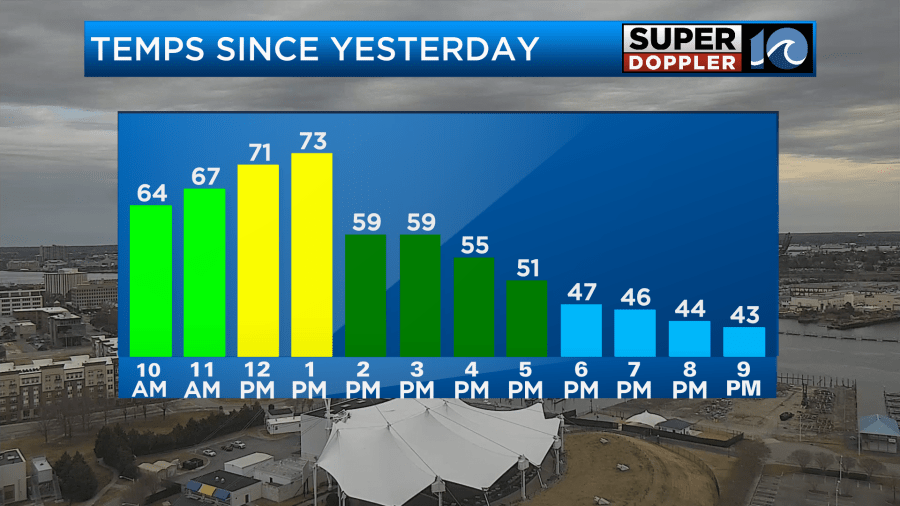
Yesterday, we ended up much warmer than I predicted. We were expected to warm up through noon. I had forecast highs in the low-mid 60s with upper 60s south. A cold front was then forecast to come in and drop the temps through the afternoon. While that did happen. It happened just an hour or two later than predicted. Hence:
We did drop down into the 50s after the front passed. Then it was in the upper 40s by 4 to 5pm.
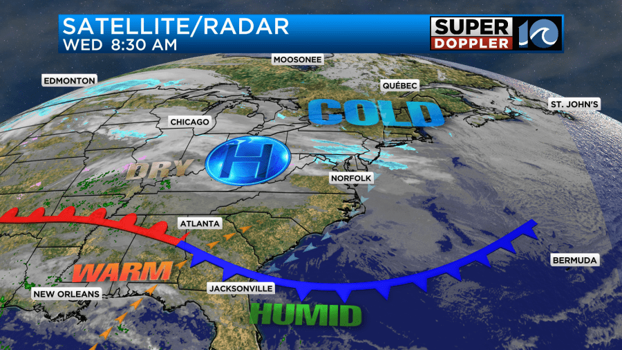
Today will be a world of difference. It will be much colder this afternoon. The cold front is stalling out to our south.
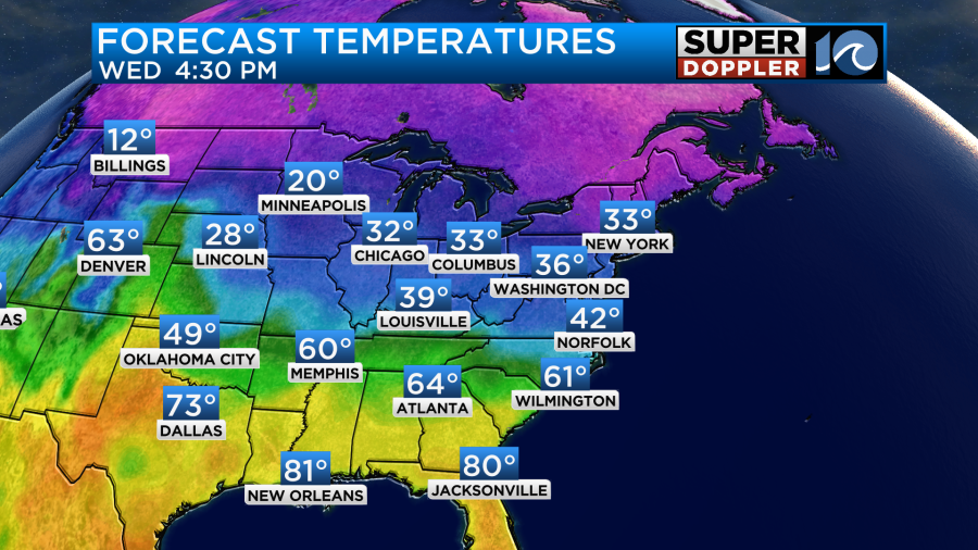
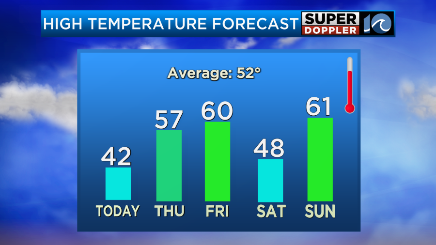
We’ll have a northeast breeze through the day. It will run at 5-15mph. Along with ample clouds temps will basically hold in place. High temps will only be in the low-mid 40s in the afternoon.
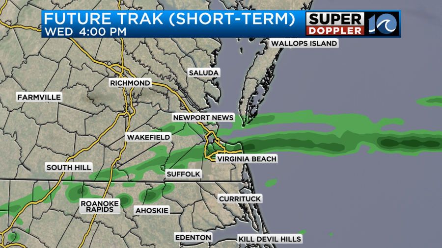
We will be dry at the surface, but warmer/more humid air is pushing up from the southwest. This is creating an overunning situation. This effect basically forces the air to squeeze out the moisture in the form of clouds and rain showers. So we’ll have lots of clouds today with a few showers possible by the late afternoon and early evening.
During the evening there may be a few sleet pellets in some areas, but temps will stay above freezing. There may be some freezing rain between Richmond and Washington D.C. for a time.
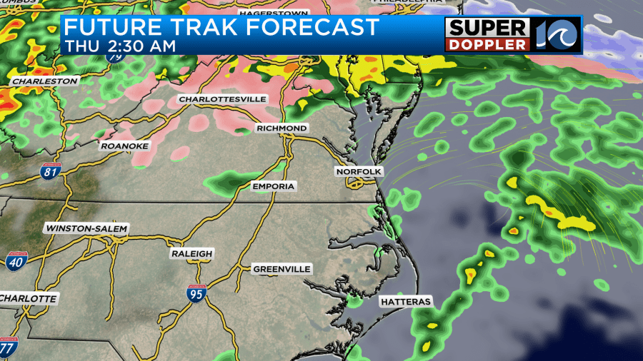
This could pose some problems if you are headed up that way tomorrow morning.
We’ll still have some scattered showers here tomorrow morning. A couple of sleet pellets could fall, but that shouldn’t pose any problems. We’ll have a wave of rain in the morning as the front returns north as a warm front.
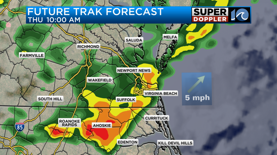
We’ll have scattered showers tomorrow morning, but we should have drier weather by the afternoon as the warm front rises to our north. We’ll develop a light southwest wind. Temps should be able to reach the 50s in the afternoon.
For now it looks like Friday will be a nice day. High temps will be around 60 degrees.
We’ll have a mix of sun and clouds. Winds should be light.
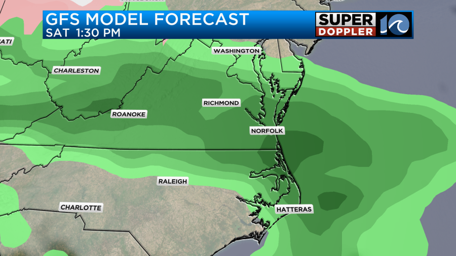
Another cold front will sink to our south on Saturday. We’ll have scattered rain showers with high temps only in the upper 40s.
Now the forecast shows warming for Sunday. I’ve got high temps aiming for the low 60s. Also, the rain chances dropped a bit. So I only have some isolated showers for late Sunday into early Sunday evening. This is good news for folks that will travel to view the big game. However, late Sunday night into Monday morning there may be some rain or a wintry mix for a time.
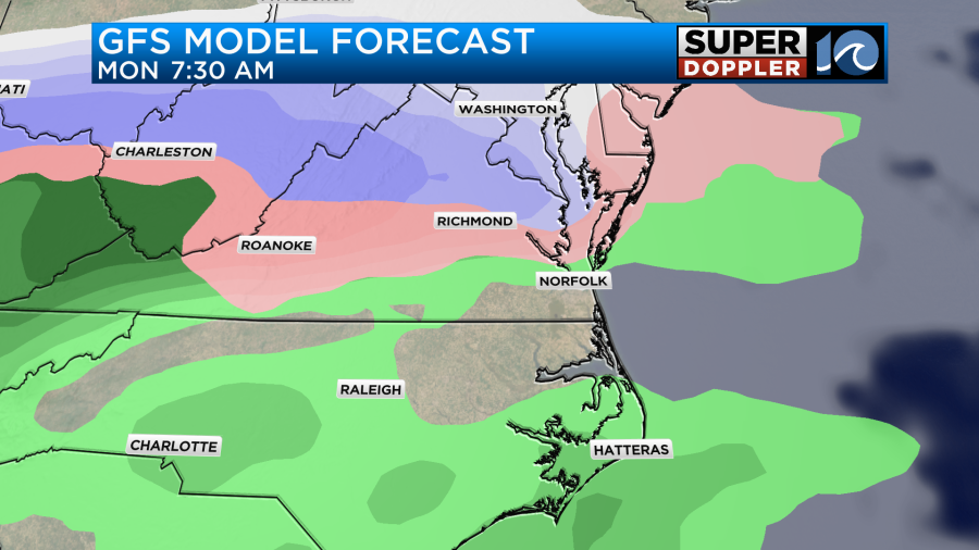
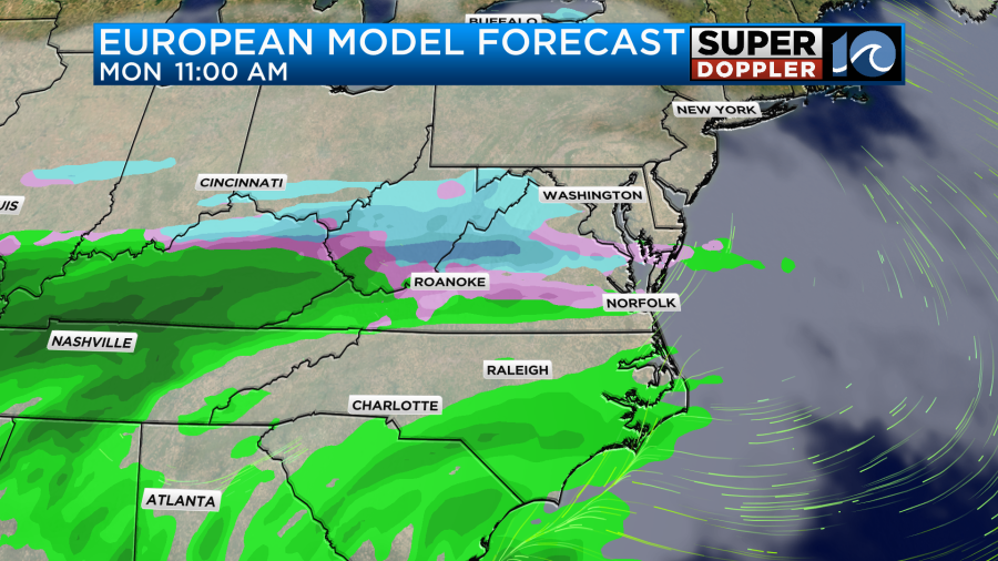
That would likely turn into scattered rain showers through the day, but some models do show a mix or some snow continuing for a while well north of Hampton Roads. That is still pretty far out, but it’s something that we’ll be watching. Especially since some models are showing a lot of potential snow up into northern Virginia. We’ll see. Stay tuned.
Meteorologist: Jeremy Wheeler


