
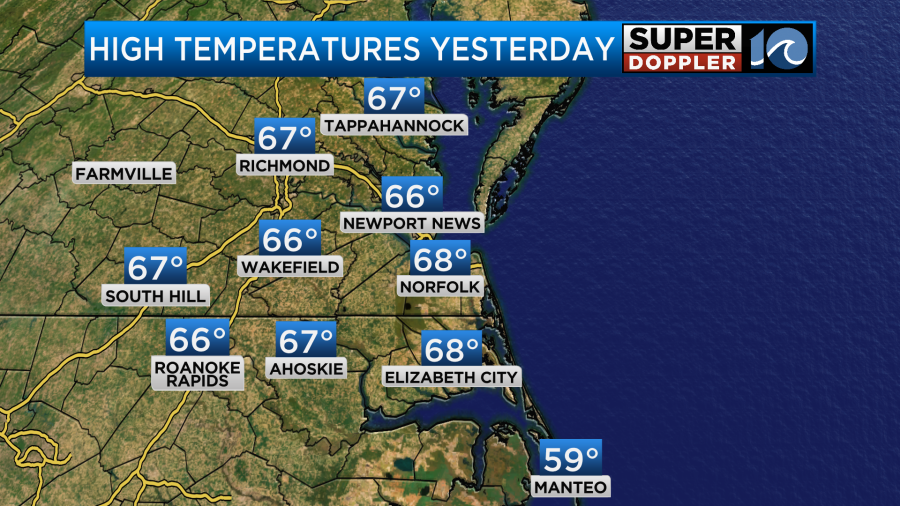
Yesterday’s weather was very nice. If it wasn’t for the wind, it would have been perfect. High temps made it into the mid-upper 60s.
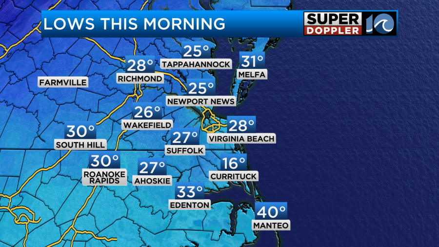
I took advantage of the mild temps and washed my car. I also did a little yard work. Today the winds have settled, but colder air has pushed into the region. Last night a cold front dropped to our south. Temps bottomed out in the 20s and 30s this morning.
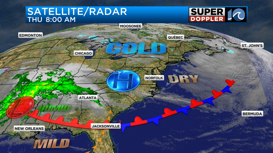
Today is definitely going to be much cooler. A cold front is sinking to our south. It is already stalling out down there.
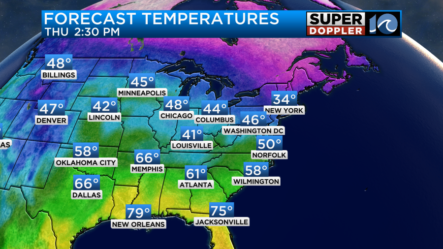
We’ll start out with a light northeast wind. Eventually it will turn our of the south. However, it will be too late to warm us back up again. High temps will aim for the upper 40s to low 50s.
Skies will be mostly sunny for a while. Then clouds will increase a bit this afternoon. They’ll increase even more by the evening. By tonight the front will lift back north as a warm front. It will pull up some moisture with it. So there will be some scattered rain showers overnight.
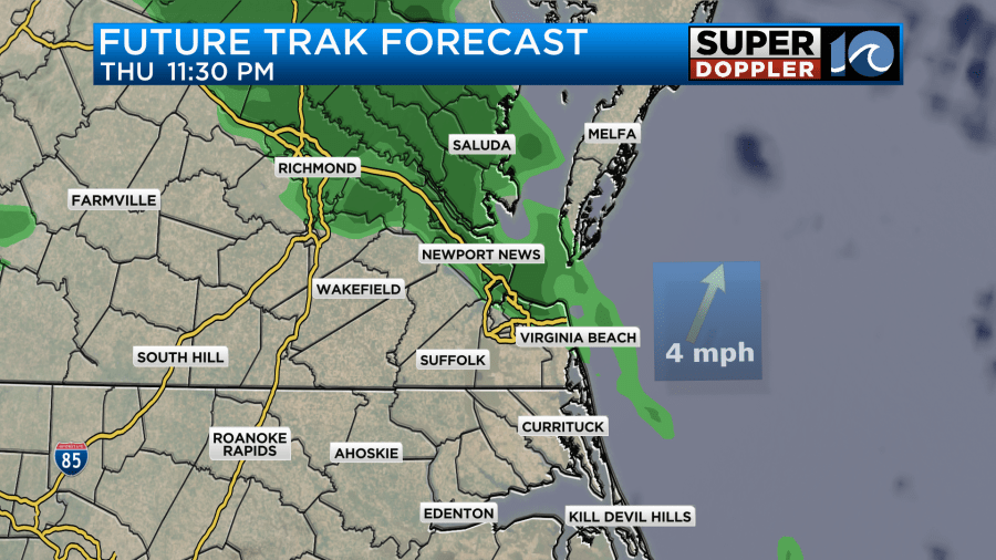
The rain will continue tomorrow morning for about half of the region.
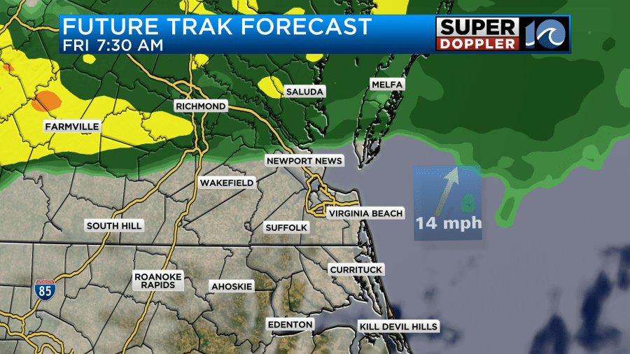
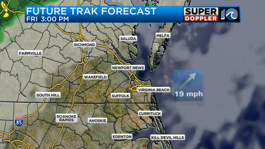
I think this will be due to the front stalling for a bit before resuming its northward trek. The good news is that the models are starting to agree more on the solution of the front (and therefore rain) heading to our north through the day. This might mean that we’ll have a decent stretch of partly cloudy skies.
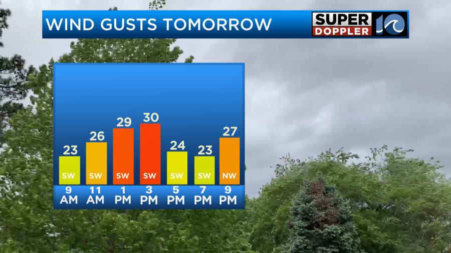
Along with that feature the winds are going to be very strong out of the southwest. Gusts will be up to 30mph.
This will push temperatures up to near 70 or possibly even to the low 70s.
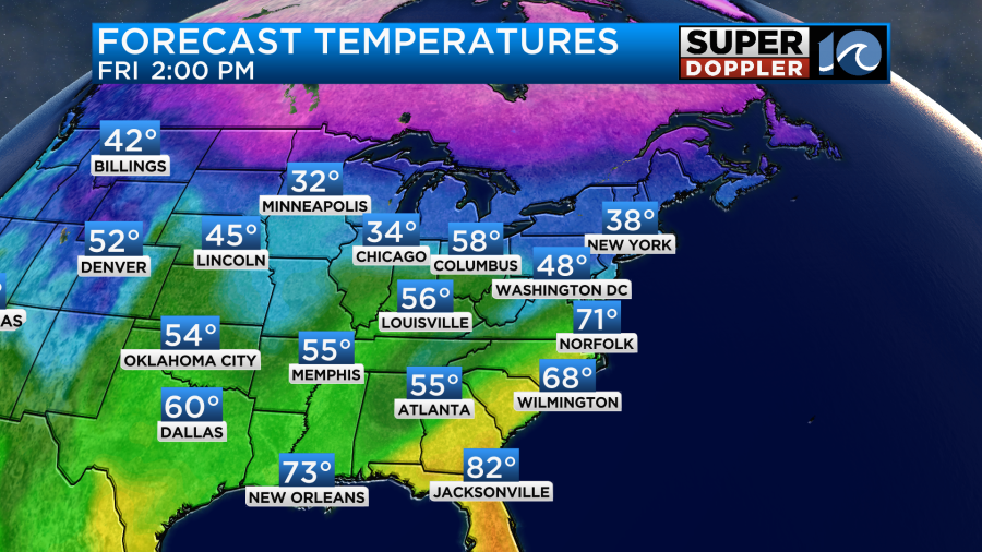
It will likely be cooler on the Eastern Shore and Outer banks due to the wind blowing over the cold water.
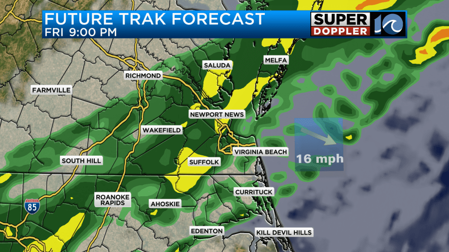
As we head into Friday evening the rain will pick up again as a cold front approaches from the west. We are still expecting a line of showers to form. There may even be a few thunderstorms.
The cold front should drop to our south by Saturday morning. The rain should also push to our south. So we’ll have clearing skies Saturday with winds picking up out of the north. High temps will only be in the upper 40s.
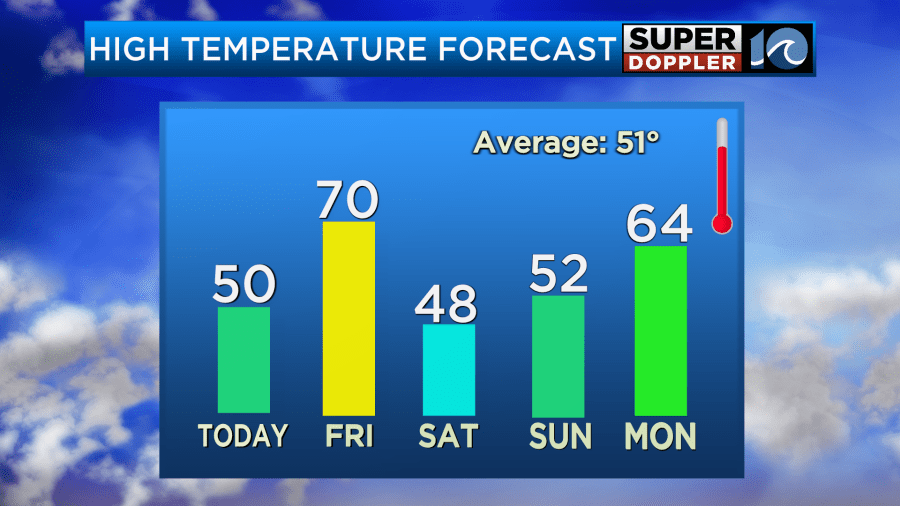
We’ll be dry on Sunday with high temps in the 50s. We’ll aim for the 60s on Monday with partly cloudy skies. Wow!
While the temps will be bouncing around quite a bit in the short term, I figure eventually we’ll get another longer shot of cold air down the road. Snow? We’ll see. It’s definitely possible.
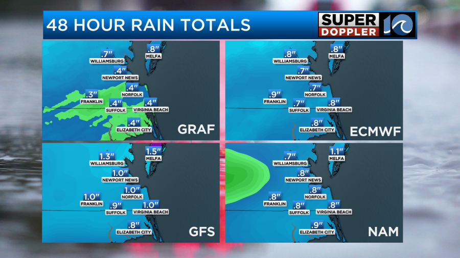
For rainfall in the region, I think the bulk of the area will get a quarter to three quarters of an inch between tonight and Saturday morning.
This will be good to wash all the salt off the roads and clean whatever vehicles don’t get washed before then.
Meteorologist: Jeremy Wheeler


