
So far the first half of this January has been cold. We started the month with about 3-4 days of mild days, but it has been pretty cold since then.
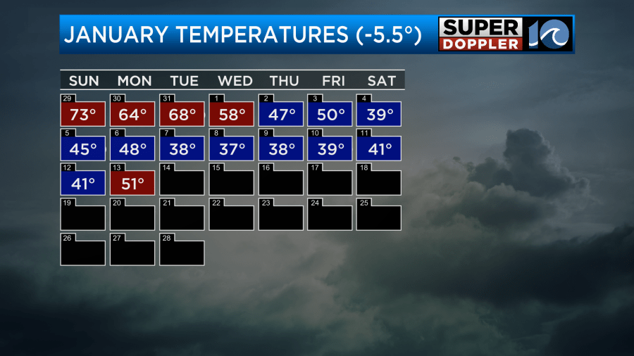
Wow! We are running a chilly 5.5 degrees below average. It’s one of the colder Januarys that we’ve had in a while. We’ll see where the rest of the month takes us, but I feel we’ll be chilly for most of the next 7 to 10 days. Yesterday, there was a brief pause in the cool streak. We hit 51 degrees in Norfolk and had highs near 50 over most of the area.
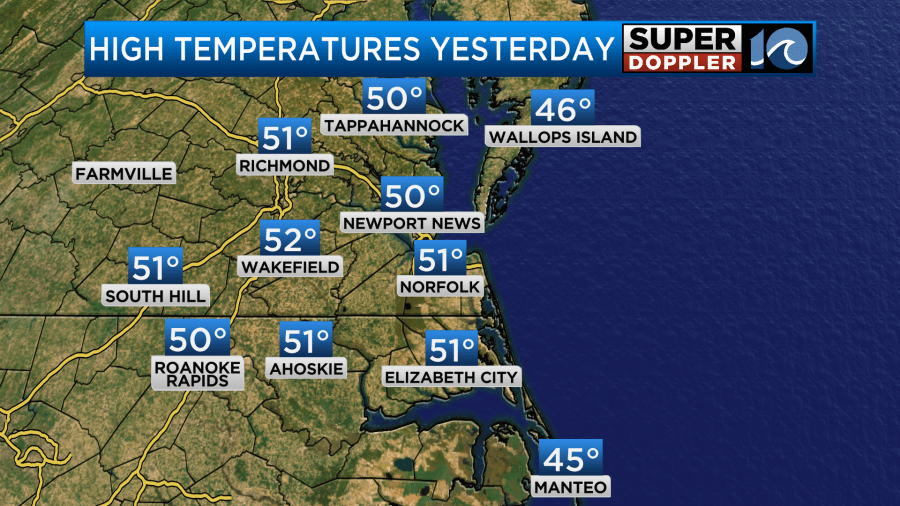
I will say that it didn’t feel that warm though as there was a light breeze at times. Since then a cold front has moved through the region, and it is now to our south.
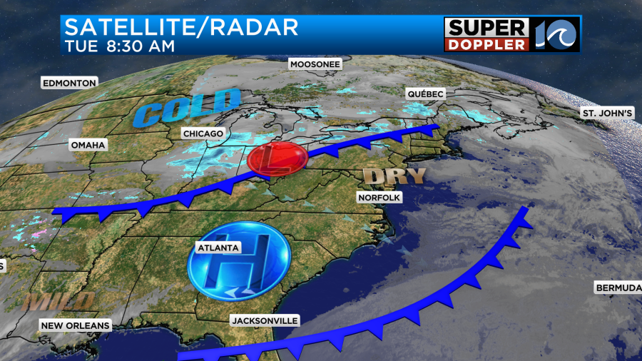
We’ll be about 10 degrees cooler today as the winds run out of the north/northwest at 10-15mph.
We’ll be dry with lots of sunshine. By tonight a second/stronger cold front will drop in from the north. As it comes in late in the evening there may be enough moisture for a few flurries and some isolated snow showers.
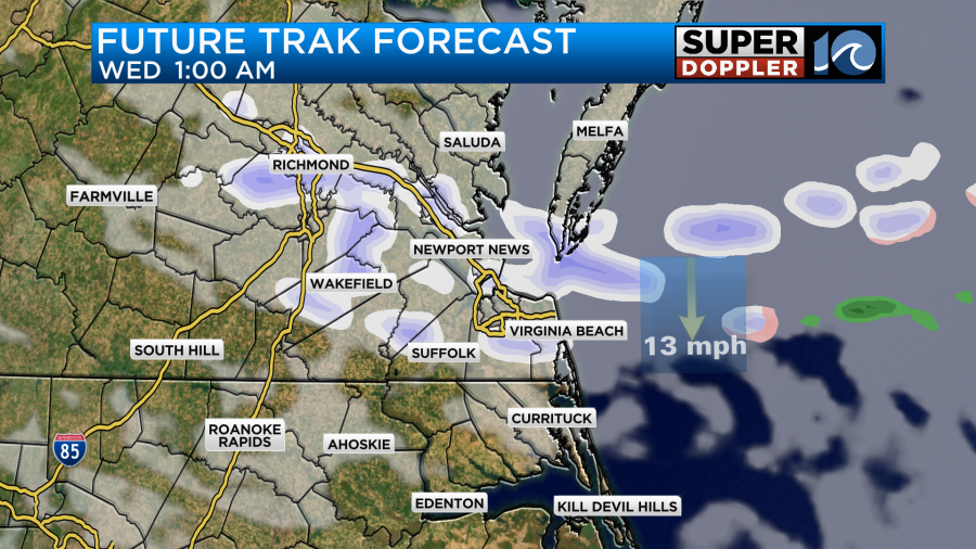
This could last until about 1-2am. After that we’ll quickly dry out as the front sinks to the south. Our Future Trak model does have some VERY minor snowfall scattered about.
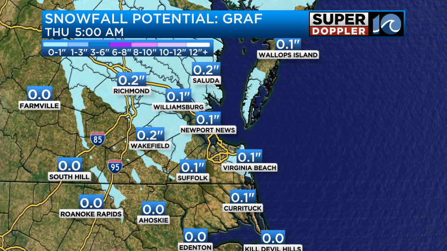
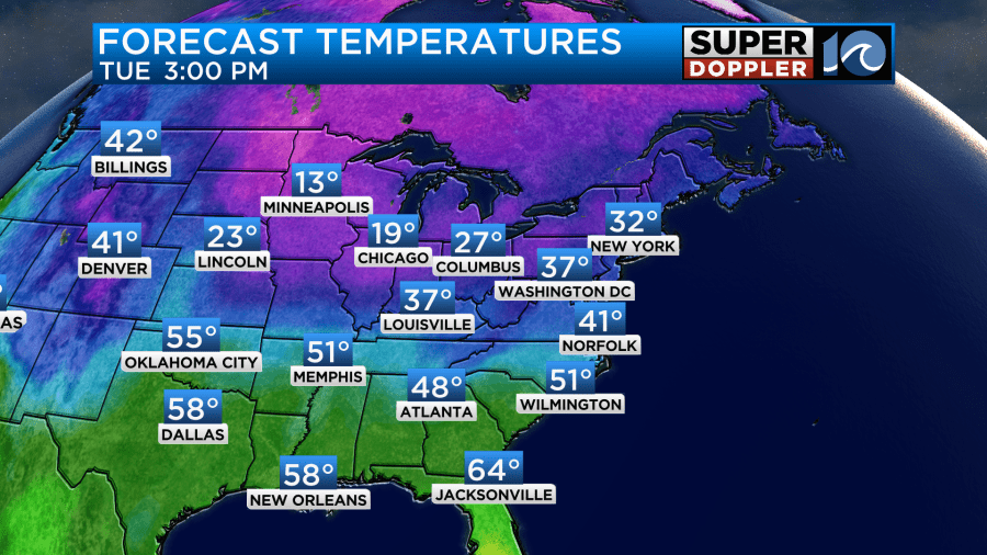
At the most we’ll have a dusting on some decks and grassy surfaces. At the least we’ll have zilcho…That’s a word. Not really, but you know what I mean. Anyway, many of us will wake up to no snow on the ground Wednesday morning. We’ll have lots of sunshine through the day. It will definitely be colder with high temps only in the mid 30s.
Winds will pick up out of the northwest. It will run at 10-15mph with gusts to 25mph. This will create wind chills in the teens and 20s in the morning with 20s during the afternoon. The good news is that we’ll warm up slightly on Thursday and Friday.
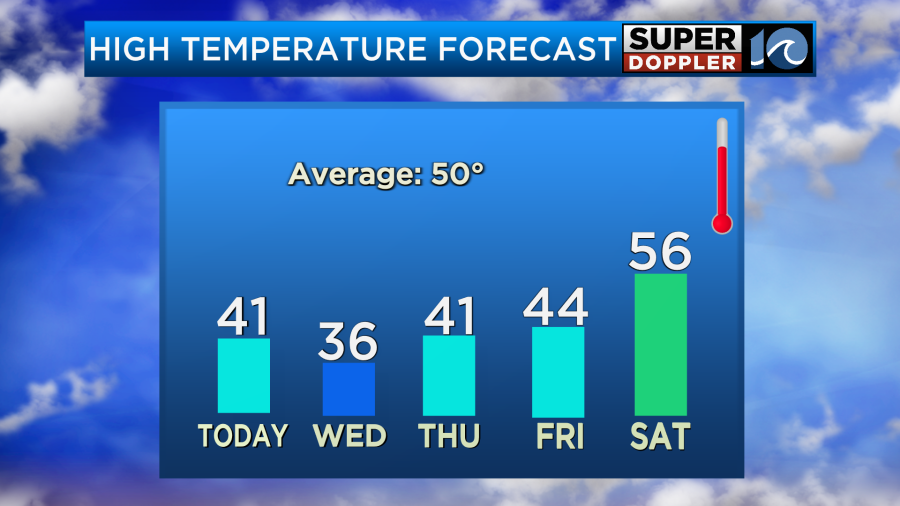
We’ll be dry on those days. Then the weekend forecast is getting tricky. On Saturday we’ll definitely have warmer & more humid air coming up from the south. There’s good confidence in that. High temps will rise to the 50s. However, the models are split as to when some rain will move in. The European model has one small wave of rain already by the late morning, but it doesn’t have as much during the afternoon. However, the GFS Model only has precip coming in later in the day.
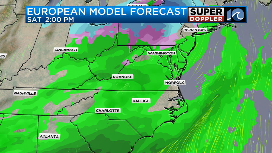
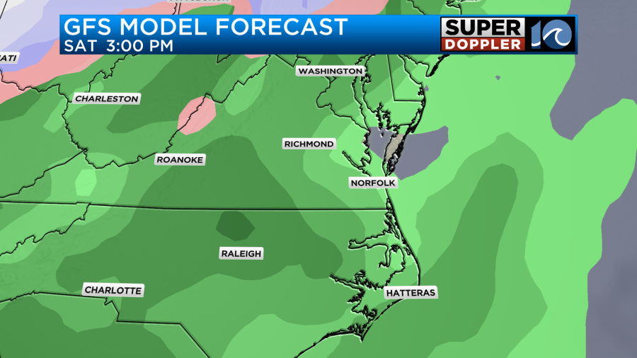
The GFS has a lot of rain between late Saturday afternoon into early Sunday morning. However, the Euro is dry through that time.
It’s tough to say which model has the better handle on things. It’s only Tuesday. So I’m not going to uber detail it for now. I’ll take a closer look at it in tomorrow’s weather blog.
Meteorologist: Jeremy Wheeler


