
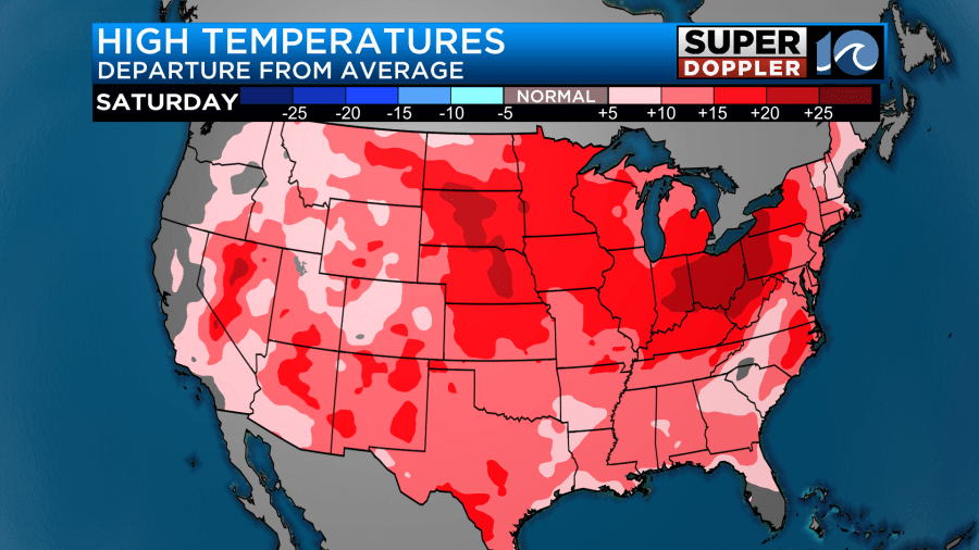
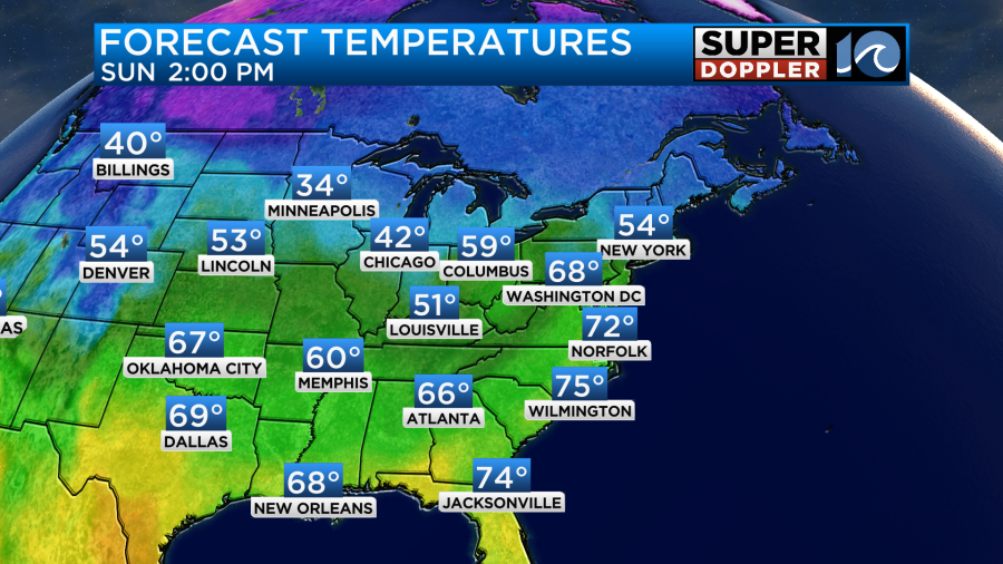
If you’ve been hoping for some warmer weather lately, then you are in luck. We are going to have an unseasonably warm weekend, and the mild temps will continue into the end of the year. First off, we are not alone. Take a look at how warm the entire U.S. mainland is today.
Temps over a lot of the eastern U.S. will be running well above average. Our local high temps will rise to the upper 60s.
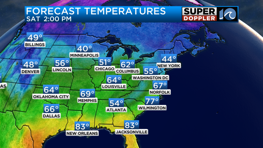
Temps in the region will be warmer, but the bigger warmth won’t make it up past Richmond today.
Part of the reason for that is that clouds and rain showers will limit the heating over there. However, a warm front is the main driver for the warming, and that likely won’t make it north of Williamsburg today.
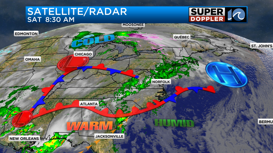
Meanwhile very strong storms are expected across the deep south today closer to a surface low. It could even turn into a tornado outbreak down between east Texas and Mississippi.
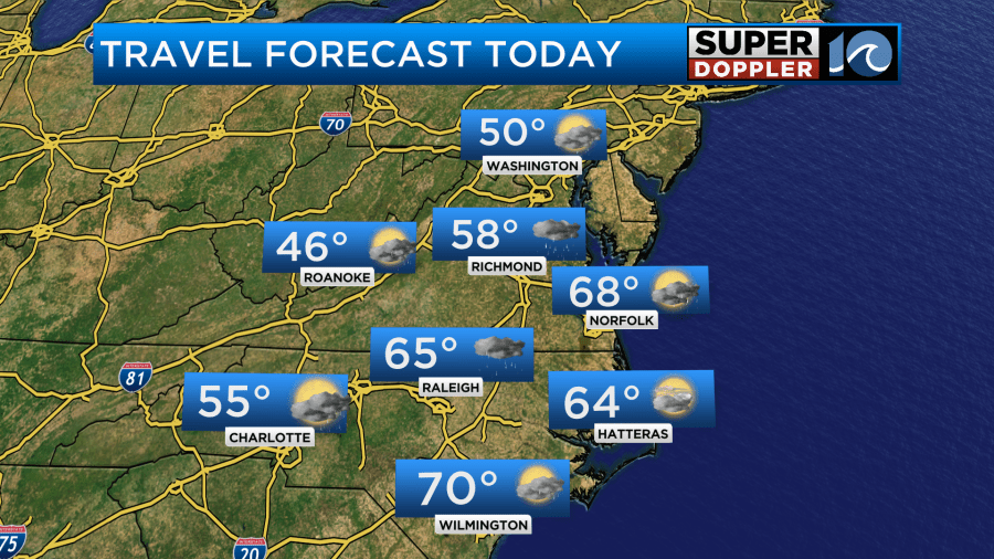
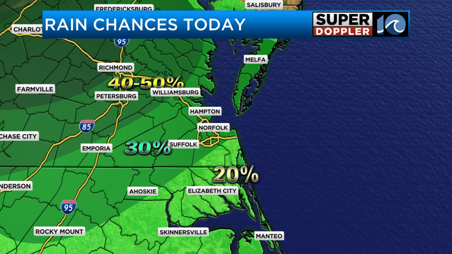
It won’t be like that here. Locally, we will have increasing moisture through the day with light winds out of the south. There will be a few spotty showers in the region with higher rain chances to the north and west.
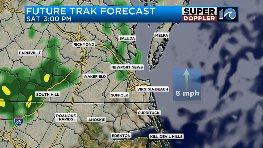
Skies will be mostly cloudy with a little more sun to the east and southeast.
Tomorrow we are going to warm up even more. We’ll be partly cloudy for a long stretch with winds increasing out of the south. Gusts will be up to 25mph. This will push our high temps up to the low 70s in the afternoon.
The record highs are in the mid 70s. So we may not be far off from that. There will be storms to our west during the day.
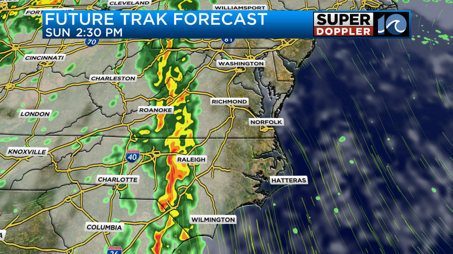
We may pop some isolated showers or storms during the day. However, the models are now in better agreement at keeping things quiet until the end of the day. They are all bringing in a line of showers and storms in the evening.
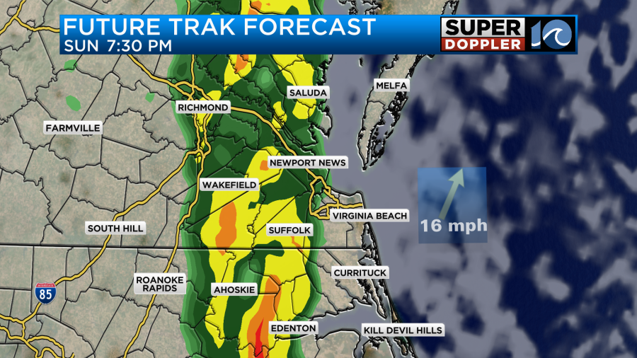
There will already be some strong wind gusts to 25mph. So some strong/damaging winds will be possible with the line. Especially to our west/southwest.
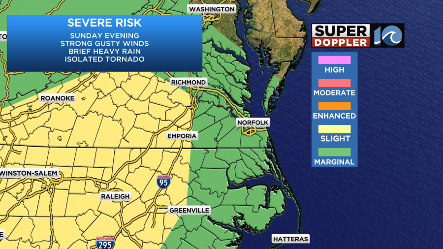
The timing of the rain will determine our severe potential. If the line doesn’t arrive until 8-10mph, then we may cool down slightly before it gets here. The line should move out after midnight, but some spotty showers may continue into Monday morning. We’ll cool down Monday into Tuesday, but high temps will still be in the 60s.
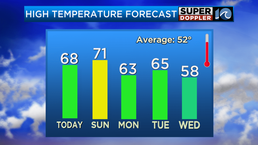
We will definitely be mild to start the new year. Temps will cool down some more on Wednesday, but they won’t really cool down until later next week. We should be in the 40s again by Thursday.
Stay tuned for updates!
Meteorologist: Jeremy Wheeler


