Yesterday’s dog walk was a bit rough. I was out there for a brief stroll in the late morning, and it was about as cold as I thought it would be. I was prepared though with some nice warm clothing. Plus, I tend to favor colder weather now that I’m older. Still…high temps only made it into the 30s.
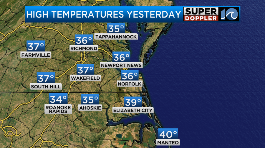
These were some of the coldest afternoon high temps since last January, but no records were broken.
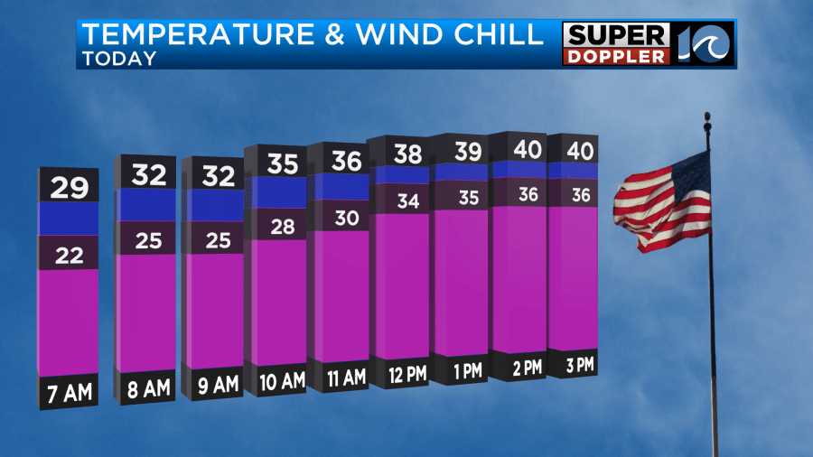
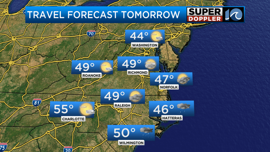
Today won’t be quite as cold, but it won’t be much better as temps warm slightly. We’ll have a lot of sunshine today as high pressure controls the weather.
However, High temps will only make it into the low 40s today. Wind chills will be in the 20s and 30s.
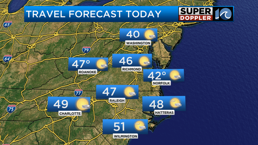
We’ll have a northeast wind at 8-12mph with some higher gusts near the shore. The weather should be fine for travel in the region.
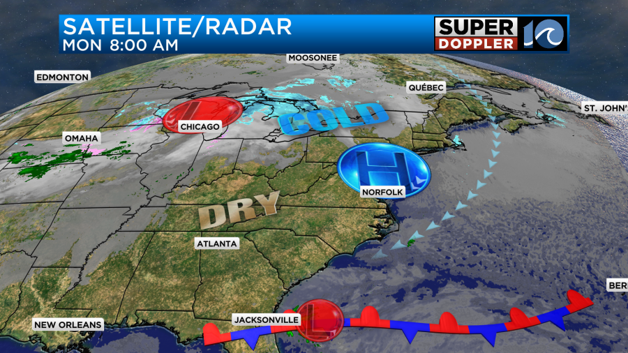
A lot of the country will be dry today. However, there will be some snow showers in the Great Lakes and over parts of the Rockies.
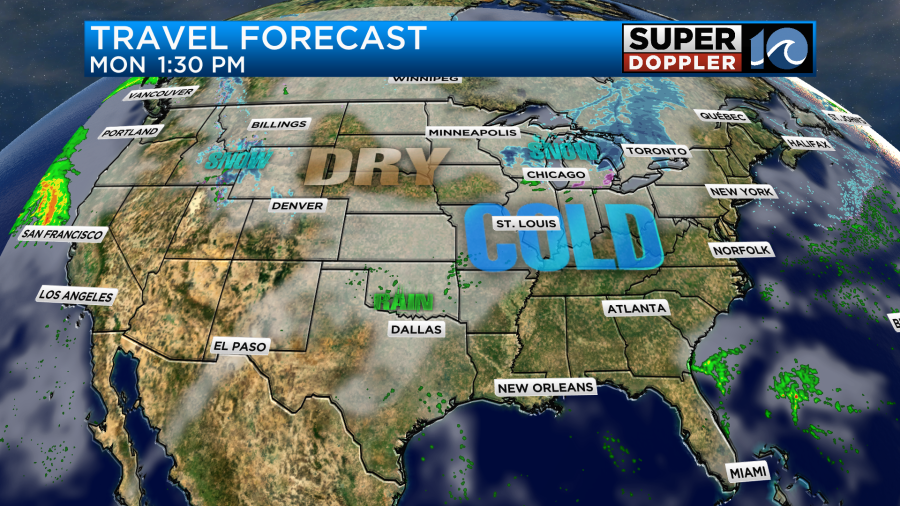
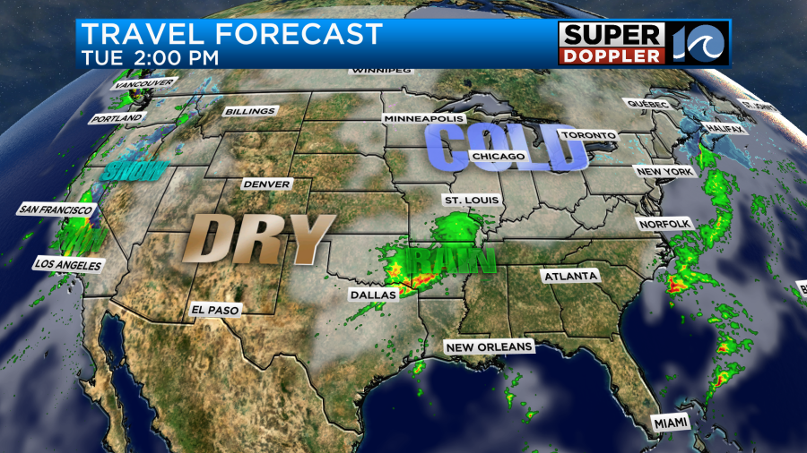
There will be a few showers over the central U.S. Tomorrow the problem areas will shift east. There will be snow showers in the Northeast. There will be wet weather over a section of the central U.S. Also there will be more precip over the western states.
Locally, we’ll have some scattered rain showers starting up late tonight and continuing into tomorrow morning.
Some of the rain showers will continue until the early afternoon. The problem is that the showers in the morning will be during some cold air. The moisture will be pushing up from the south, but it will still be pretty dry at the surface. This could lead to some virga (precip that dries up as it falls from the cloud). However, if the moisture is thick enough, then it’s possible that we’ll have some brief freezing rain in some inland locations. Future Trak and a couple of other models (like the hi-res NAM) are showing this scenario.
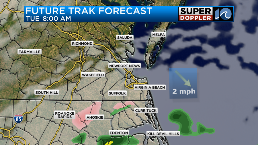
The window for any freezing rain to happen is very small. This would be between about 7am and 10am. After that point there will just be a few rain showers. Temps should warm up by the mid-morning to above freezing. The scattered/light rain showers should end by the mid afternoon. Most models are barely showing any rainfall.
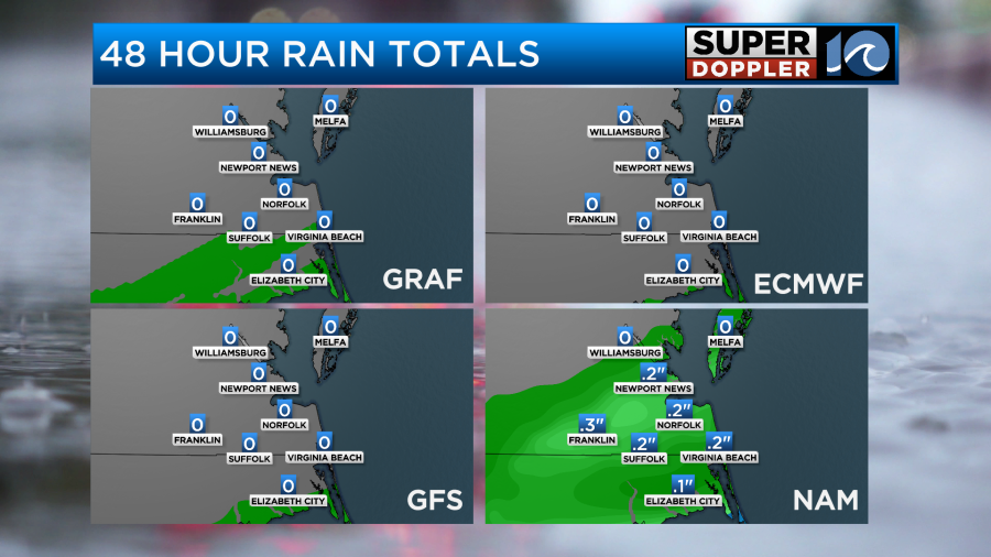
The NAM model is the outlier, but it has the precip starting and ending a bit later. So it doesn’t really have the freezing rain. Our FutureTrak model does not have any accumulating ice.
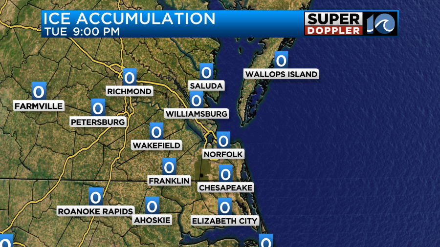
However, it could be underdoing the moisture a bit. Either way I don’t think we’ll have any big problems. I believe if freezing rain happens that it will only be in several spots. There could be a couple of wet snowflakes, but they would likely melt as temps warm. Whatever happens, we will watch things carefully until that time.
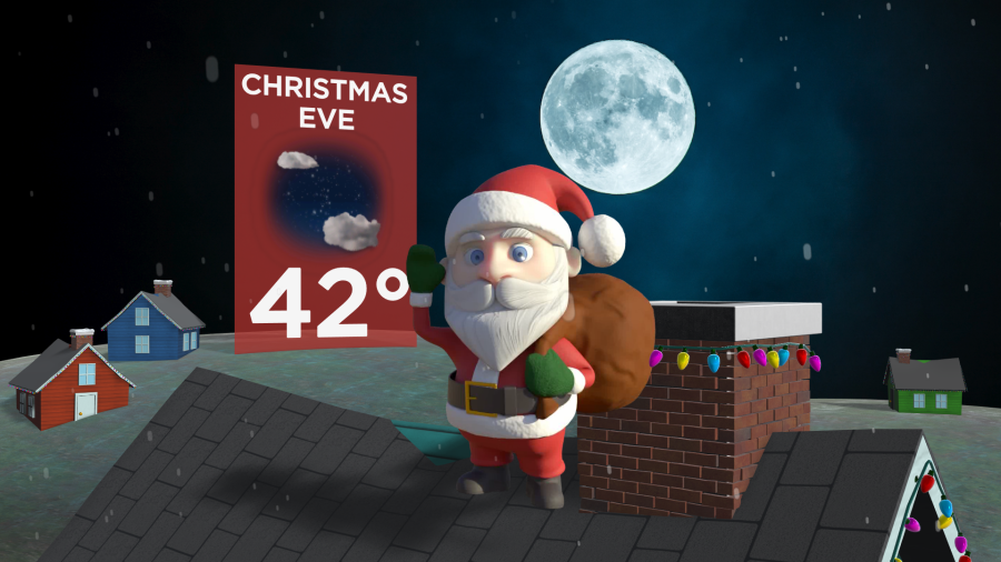
Either way it looks like we’ll dry things out by later tomorrow into the evening. So we’ll have dry/chilly conditions for Christmas Eve.
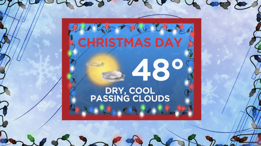
The dry weather will continue for Christmas Day, but the temperature forecast for Christmas looks colder now. I currently have our forecast high temps only in the 40s.
We’ll be dry on Thursday and Friday with high temps closer to 50 degrees. Then we’ll be dry next weekend. Stay tuned for updates.
Meteorologist: Jeremy Wheeler


