
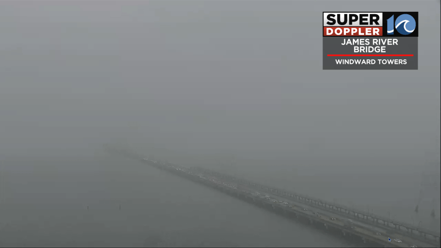
It was a rough Monday morning for many folks out there. The weather wasn’t terrible, but fog and scattered light rain showers combined to create numerous problems on the roads.
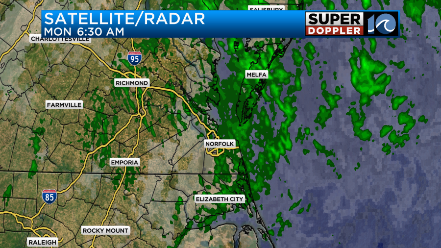
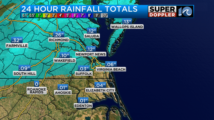
There was a little light rain since last night. However, we haven’t picked up much rainfall over the last 24 hours. It’s only been about a tenth of an inch with less to the south.
The fog and precip had formed just north of a warm front.
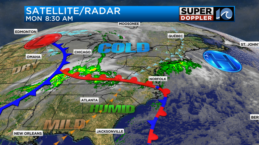
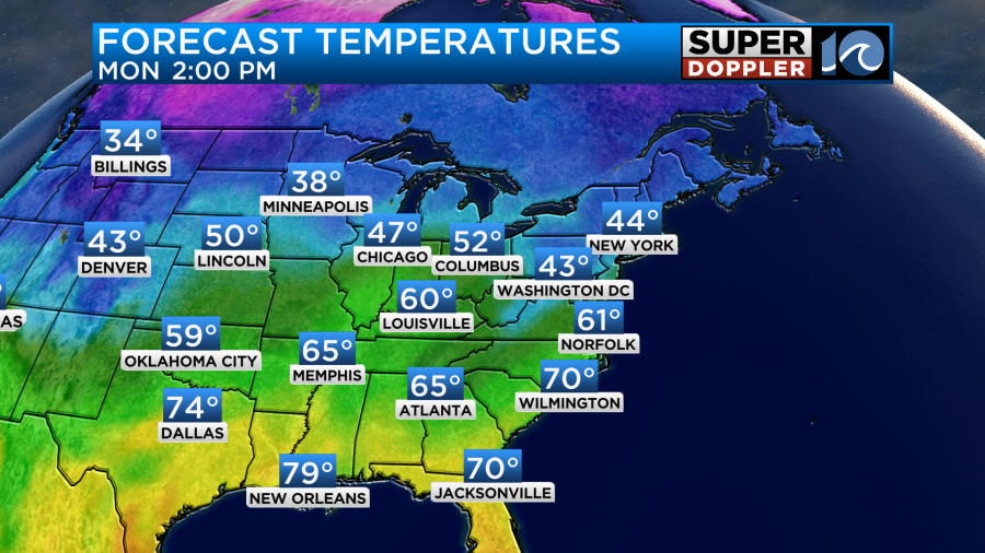
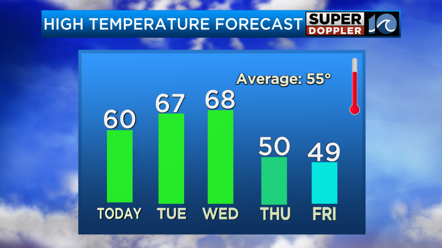
That front will lift north through the day. We’ll be on the warm side of it. So high temps will rise to near 60 degrees this afternoon.
The showers and sprinkles should wrap up by the mid-late morning. Then we’ll be mostly cloudy for a while. There will probably be a little clearing in the afternoon, but it probably won’t last too long. We’ll have variable winds at 5-10mph.
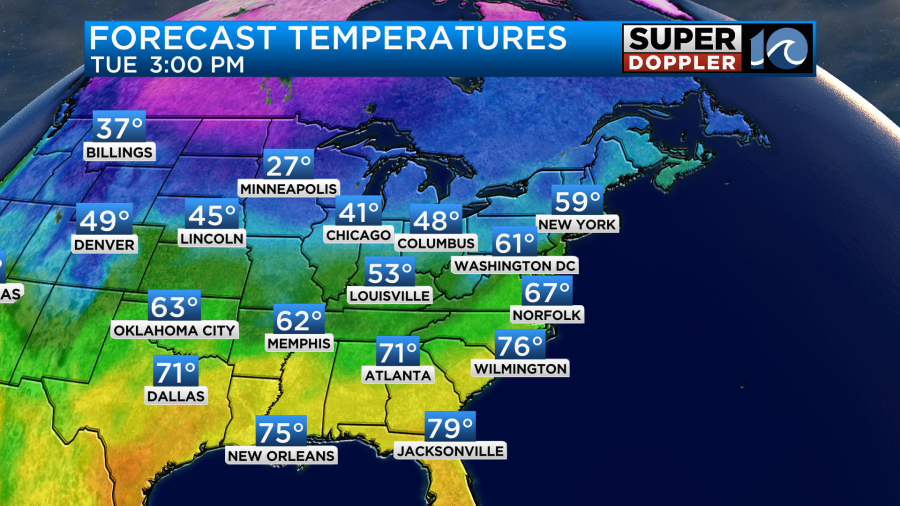
Tomorrow we’ll have similar weather. We’ll be mostly cloudy with some brief clearing for a bit. There will be a lot of moisture. That may create some isolated showers, but I think the bulk of the day (and area) will be rain-free. The one difference is that the wind will be a little more consistently out of the southwest. That will allow temps to warm up more into the mid-upper 60s.
We’ll have almost a repeat on Wednesday with high temps in the upper 60s. However, temps will fall Thursday into Friday as the cold front slides south of the region.
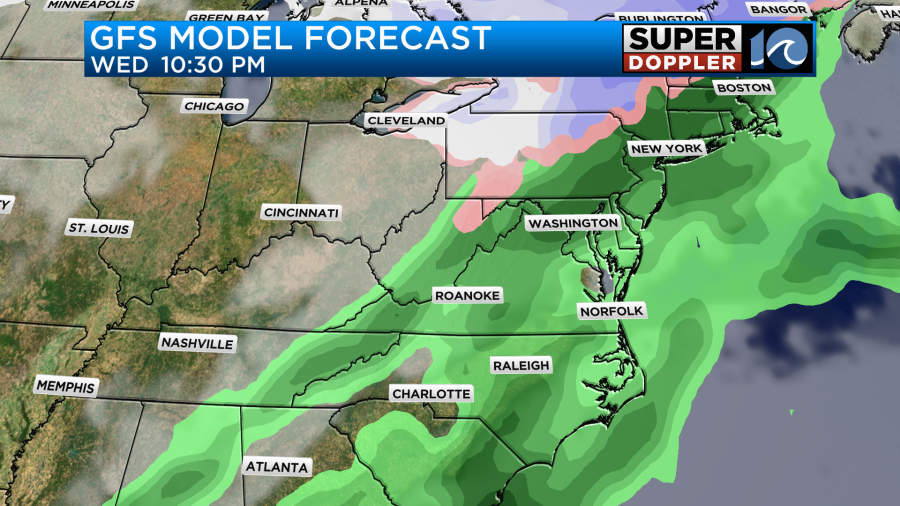
The biggest chance for rain will be Wednesday night as the front arrives.
I’ll talk more about the weather going into next weekend in tomorrow’s weather blog.
Meteorologist: Jeremy Wheeler


