Yesterday we got the much-needed rainfall over the region that we asked for. Rain started up Tuesday night and continued through Wednesday evening.
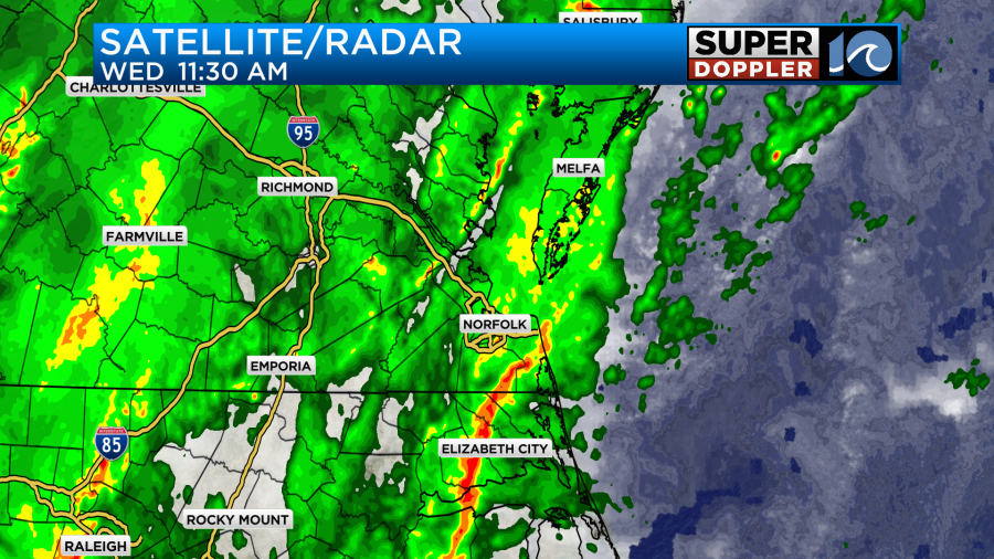
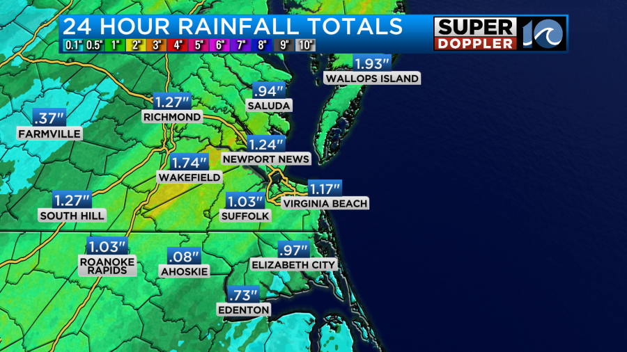
Rain was heavy at times. Plus, it lasted for a long time. So the 24 hour rainfall totals were good.
The 48 hour totals were even better.
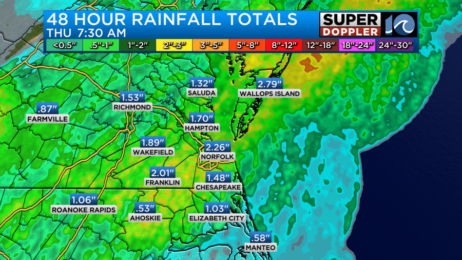
We got over 2 inches in Norfolk. Much of the region netted 1-2 inches. We’ve cleaned out the atmosphere, and got rid of all the dust that’s been lingering in the air. This came as a strong cold front moved into the region.
Over the last couple of weeks we had one big cool streak and then a few days of milder temperatures.
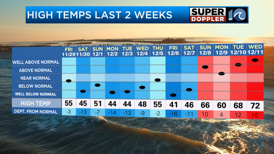
We topped off in the low 70s yesterday with some 60s north of the metro. Then the cold front swept in and started dropping temperatures quickly. This morning temps dropped down to the freezing mark in several locations.
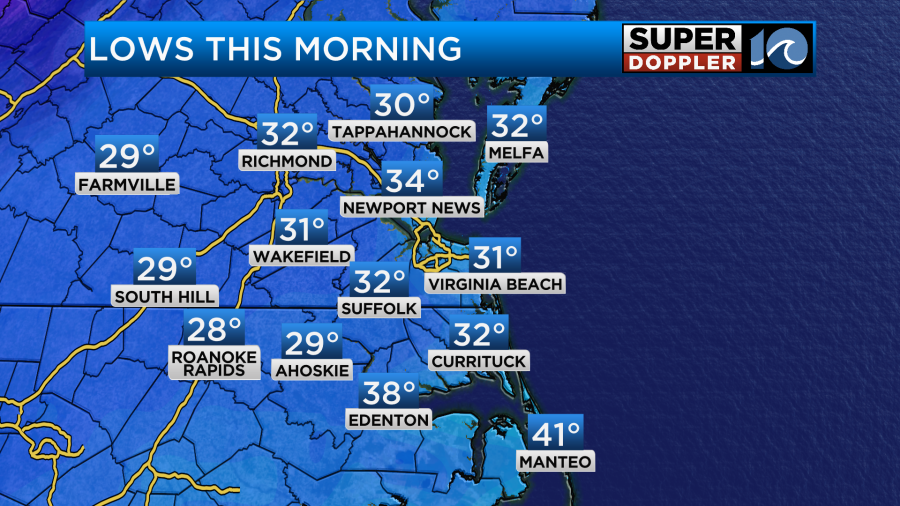
There was some patchy ice in some inland locations.
The cold front is now far offshore. High pressure is building in from the west.
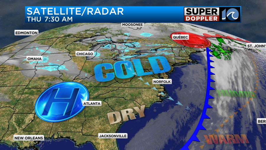
We’ll be dry and chilly today with lots of bright sunshine.
However, high temps will only rise to the upper 40s to near 50.
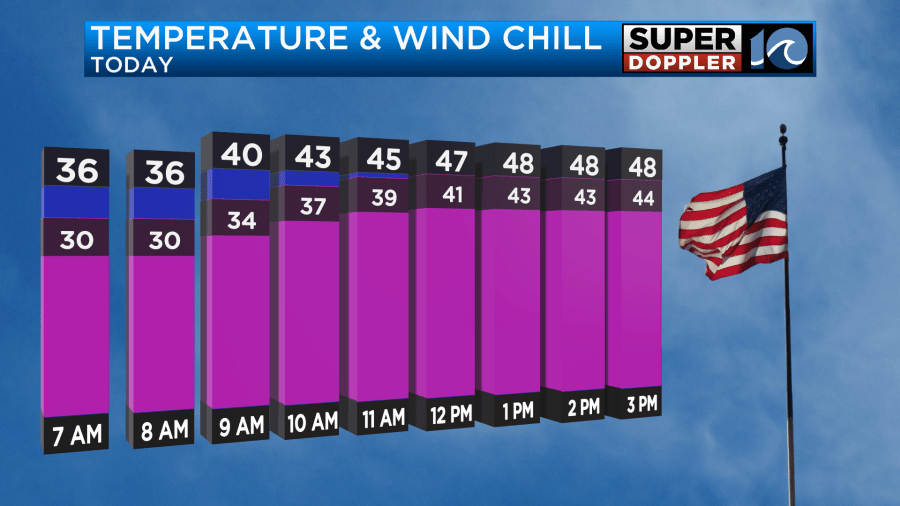
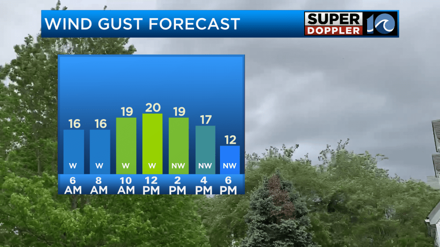
Wind chills will be in the low 40s this afternoon. Winds won’t be too strong, but they will gust up to 20mph out of the west at times.
Tonight we’ll have clear skies and light winds. The air will be super dry as dew points drop down from the 20s to the teens in some places. So low temps tonight will be in the 20s with a few low 30s near the shore.
Tomorrow we’ll start off cold, and we’ll end chilly. High temps will be in the upper 40s to near 50 again.
We’ll have fair skies with a few more clouds later in the day.
We’ll be dry on Saturday with high temps rising into the low 50s.
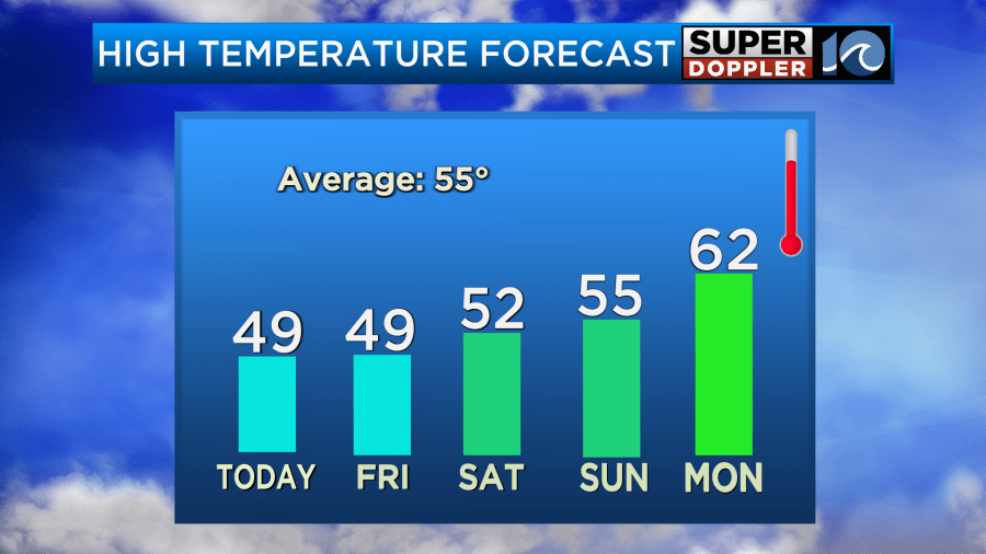
The wind should be light on Saturday. So it should be a pretty nice day. The forecast for Sunday has dried up. So now I have a mix of sun and clouds with high temps in the mid 50s. The rain got pushed back. Now it looks like we’ll have a few showers between Monday and Tuesday. Highs will be in the 60s.
Meteorologist: Jeremy Wheeler


