
We are in-between active weather systems today. The nor’easter that has raked the northeast recently is finally moving out to sea. High pressure is overhead with a developing area of low pressure off to the west.
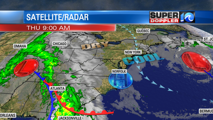
Today we’ll have a mix of sun and clouds. I was optimistic earlier, but now I’m thinking there will be more clouds than sun over most of the region. While I can’t rule out a couple of sprinkles, I think most of the day should be dry. Some isolated showers could develop by the end of the day into the evening. The big difference today is the wind speed. Winds will be much lighter out of the northeast. They will only run at 5-10mph.
Tomorrow the area of low pressure to the west will strengthen quite a bit. It won’t move into our region, but it will get a little closer. Meanwhile high pressure will slowly push offshore.
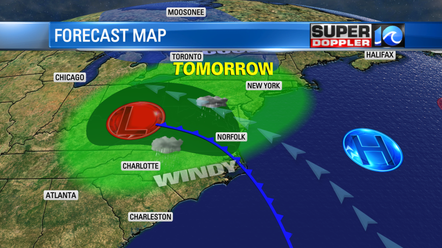
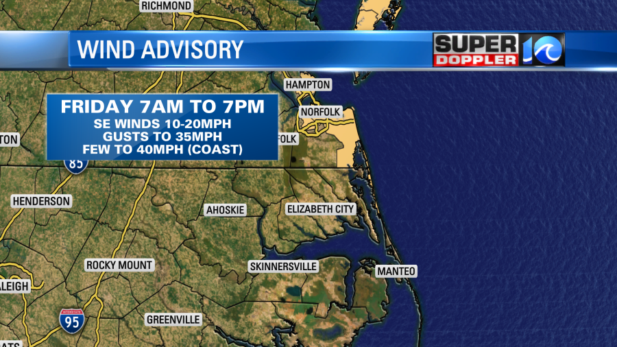
The difference in pressure between the two systems will rev up our local winds. By the morning they will be out of the southeast at 10-20mph with gusts up to 35mph. There may even be a few gusts to 40mph near the shore.
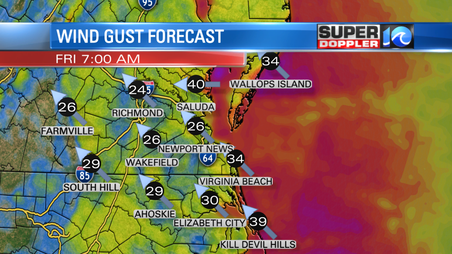
There is a Wind Advisory for areas along the coast tomorrow.
Rain will also be widespread during that time.
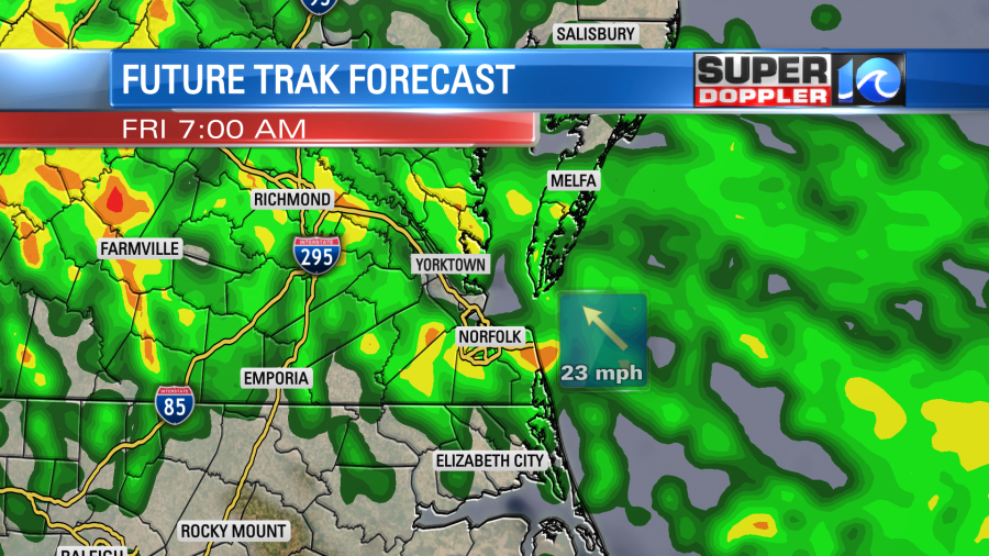
This spells out a very messy morning commute. There could be a lot of slow downs if not accidents. So plan accordingly for tomorrow morning. Rain will be pretty widespread through the late morning. Then showers will become more scattered as the cold front moves in from the southwest.
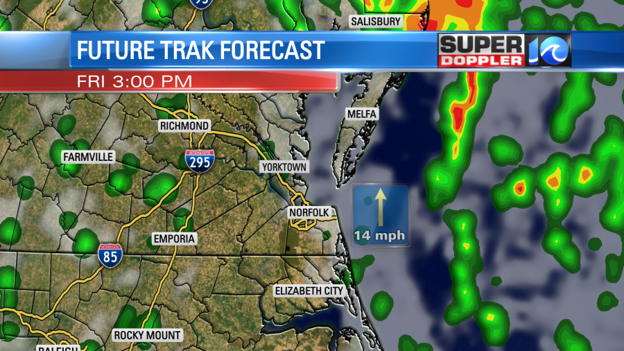
Winds should decrease after the front passes. They will turn more out of the southwest in the afternoon with gusts dropping down to 15-25mph. Dry air will actually blow in from the southwest during the day. This should dry us out by the evening. The low will move northward, and high pressure will actually settle back into the region.
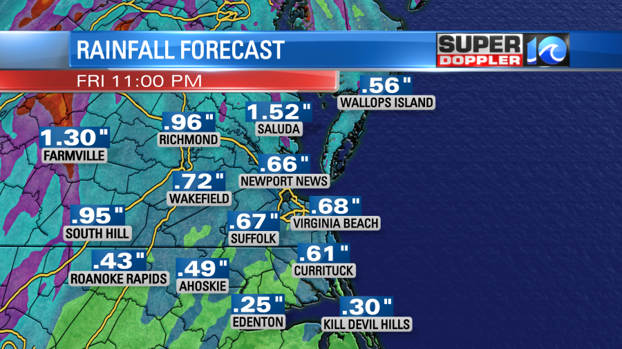
We could see about a half inch up to an inch of rain before it wraps up tomorrow night.
So we’ll have a fairly cool and dry weekend, but an isolated shower could linger into Saturday morning. We’ll be partly cloudy Saturday and Sunday. High temps will be in the upper 60s to low 70s.
There will be some minor tidal flooding today. Again, it’s mainly due to the churned up waters off the coast. Today’s high tide will be up to minor levels. However, the tide will be a bit higher tomorrow afternoon.
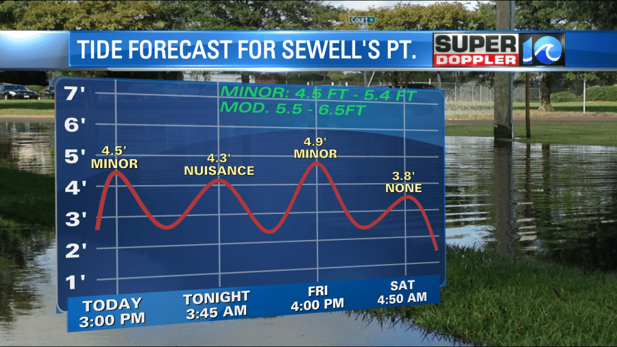
There may be some minor to moderate tidal flooding tomorrow afternoon between the Eastern Shore and Middle Peninsula. The highest tide will be up on the north end of the Chesapeake Bay.
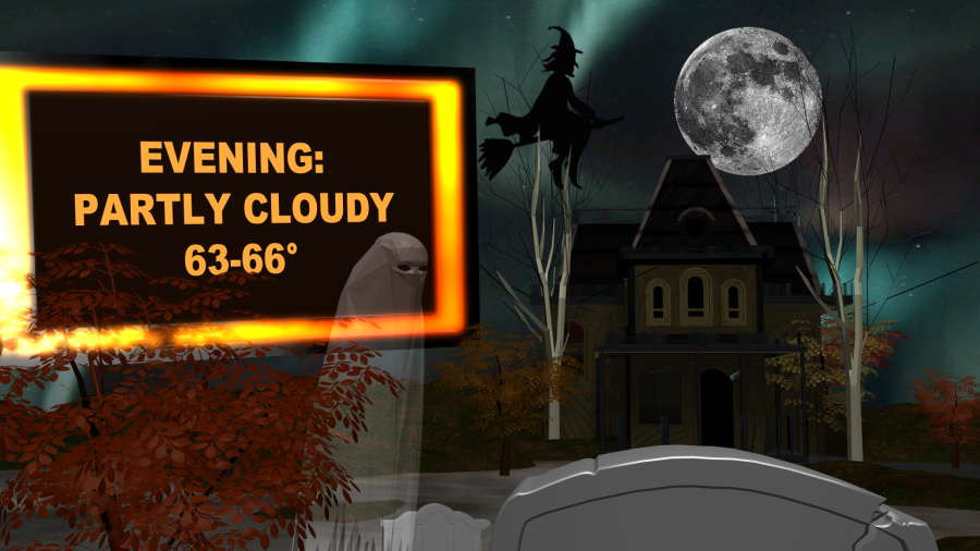
The Halloween forecast is looking good. For now I have partly cloudy skies. Temps will likely be in the low-mid 60s during trick-or-treat hours.
The forecast also looking cool and dry early next week.
Meteorologist: Jeremy Wheeler


